Home > The Magical World of Illustration > Nastasic Images & Illustrations
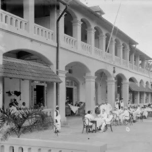
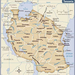
Dar es Salaam, Tanzania

![]()
Wall Art and Photo Gifts from Fine Art Storehouse
Dar es Salaam, Tanzania
Antique illustration of a Dar es Salaam, Tanzania
Nastasic
Media ID 13590943
© This content is subject to copyright
Central Africa Country Geographic Area Democratic Republic Of The Congo East Globe Navigational Equipment Indian Ocean Kenya Malawi Mozambique Mt Kilimanjaro Serbia Serengeti National Park Square Tanzania Uganda Vector World Map Zambia Zanzibar
FEATURES IN THESE COLLECTIONS
> The Magical World of Illustration
> Nastasic Images & Illustrations
> Map
> Historical Maps
> Map
MADE IN THE UK
Safe Shipping with 30 Day Money Back Guarantee
FREE PERSONALISATION*
We are proud to offer a range of customisation features including Personalised Captions, Color Filters and Picture Zoom Tools
SECURE PAYMENTS
We happily accept a wide range of payment options so you can pay for the things you need in the way that is most convenient for you
* Options may vary by product and licensing agreement. Zoomed Pictures can be adjusted in the Basket.