Home > Top Sellers - Art Prints
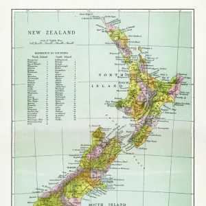
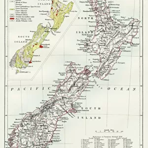
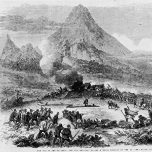
Antique map of New Zealand in the 19th Century, 1873

![]()
Wall Art and Photo Gifts from Fine Art Storehouse
Antique map of New Zealand in the 19th Century, 1873
Vintage engraving of a Antique map of New Zealand in the 19th Century, 1873
duncan1890
Media ID 14069921
© This content is subject to copyright
1870s Auckland Australasia Bad Condition Colour Colours Condition Damaged Dirty Equipment Faded Image Created 1870 1879 Navigational Equipment New Zealand North Island Oceania Retro South Island Stained Styles Supplies Victorian
FEATURES IN THESE COLLECTIONS
> Map
> Historical Maps
> Map
MADE IN THE UK
Safe Shipping with 30 Day Money Back Guarantee
FREE PERSONALISATION*
We are proud to offer a range of customisation features including Personalised Captions, Color Filters and Picture Zoom Tools
SECURE PAYMENTS
We happily accept a wide range of payment options so you can pay for the things you need in the way that is most convenient for you
* Options may vary by product and licensing agreement. Zoomed Pictures can be adjusted in the Basket.