Home > Map > Historical Maps
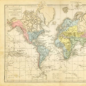
Jamaica Bahamas Trinidad map 1897

![]()
Wall Art and Photo Gifts from Fine Art Storehouse
Jamaica Bahamas Trinidad map 1897
The World-Wide Atlas of Modern Geography, Political and Physical W. & A.K. Johnston - London 1897
THEPALMER
Media ID 14757112
© Roberto A Sanchez
Atlas Backgrounds Bahamas Caribbean Sea Country Geographic Area Earth Greater Antilles Island Jamaica Journey Paper Patina Stained Textured Effect World Map
FEATURES IN THESE COLLECTIONS
> Map
> Historical Maps
> Map
MADE IN THE UK
Safe Shipping with 30 Day Money Back Guarantee
FREE PERSONALISATION*
We are proud to offer a range of customisation features including Personalised Captions, Color Filters and Picture Zoom Tools
SECURE PAYMENTS
We happily accept a wide range of payment options so you can pay for the things you need in the way that is most convenient for you
* Options may vary by product and licensing agreement. Zoomed Pictures can be adjusted in the Basket.