Home > Travel Imagery > Travel Destinations > patagonia
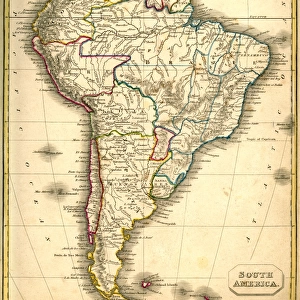
Map of South America (early 19th century steel engraving)
")
![]()
Wall Art and Photo Gifts from Fine Art Storehouse
Map of South America (early 19th century steel engraving)
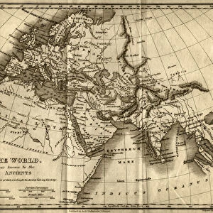
A steel engraving of a map from the early 19th century of Brazil and Paraguay in South America, from A System of Geography, Popular and Scientific, or A Physical, Political, and Statistical Account of the World and its Various Divisions. Volume VI, Part IIa by James Bell and published by A. Fullarton & Co. Glasgow, in 1838
whitemay
Media ID 13666941
© Linda Steward
1830s Style Amazon Region Amazon River Atlantic Ocean Bolivia Brazil Caribbean Sea Chile Colombia Document Education Equator Equator Line Exploration Falkland Islands Georgian Style Guyana Line Art Monochrome North Atlantic Ocean Pacific Ocean Paper Paraguay Past Patagonia Patagonia Argentina Patagonia Chile Peru Sepia Toned Social History South America South Pacific Ocean Stained Steel Engraving Topography Traditional Culture Vignette
FEATURES IN THESE COLLECTIONS
> Map
> Historical Maps
> Map
> Travel Imagery
> Travel Destinations
> patagonia
MADE IN THE UK
Safe Shipping with 30 Day Money Back Guarantee
FREE PERSONALISATION*
We are proud to offer a range of customisation features including Personalised Captions, Color Filters and Picture Zoom Tools
SECURE PAYMENTS
We happily accept a wide range of payment options so you can pay for the things you need in the way that is most convenient for you
* Options may vary by product and licensing agreement. Zoomed Pictures can be adjusted in the Basket.