
Home > Map > Map Illustrations
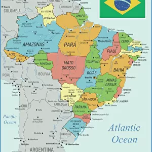
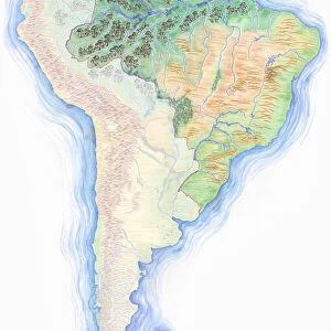
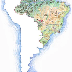
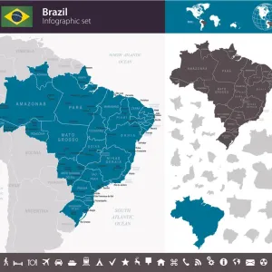
Brazil Vector Map

Brazil Vector Map


Photo Prints
Jigsaw Puzzles
Poster Prints
Cards
Home Decor
Mounted Prints
Canvas Prints
Fine Art Prints
Metal Prints


We accept all major credit cards

Wall Art and Photo Gifts from Fine Art Storehouse

Brazil Vector Map

Ultra detailed vector map of Brazil with administrative divisions. Including main rivers and lakes. Each state is grouped separately. You can zoom in well in the vector file. Theres more detail visible than you can see in the preview window, because theres a limit of 6000 pixels. You may open the.eps-file in Photoshop at even higher resolutions. Great for super-size usage like trade fair walls. File was created on February 18, 2013. The colors in the.eps-file are ready for print (CMYK). Included files: EPS (v8) and Hi-Res JPG (6000aua6000 px)

Media ID 14833443


MADE IN THE UK
Safe Shipping with 30 Day Money Back Guarantee

FREE PERSONALISATION*
We are proud to offer a range of customisation features including Personalised Captions, Color Filters and Picture Zoom Tools

SECURE PAYMENTS
We happily accept a wide range of payment options so you can pay for the things you need in the way that is most convenient for you

* Options may vary by product and licensing agreement. Zoomed Pictures can be adjusted in the Basket.


redeem
Beautiful Photo Prints and Gifts
image
Professionally Printed
inventory
Photo Prints are in stock
thumb_up
Professional quality finish
diamond
Made with high-grade materials
inventory_2
Carefully packed to aid safe arrival


Related Images


Brazil Map with Rivers and National Flag
Brazil country map
Brazil country map
political map of south america in vector format
Bayeux Tapestry Scene -Edward the Confessor (c. 1003 - 1066) dies and the crown passes to King Harold II (c. 1022 - 1066)
Highly detailed hand-drawn map of Brazil within the outline of South America with a compass rose and the equator
View from Diamond Hill, Connemara National Park, County Galway, Republic of Ireland, Europe
Antique damaged map of South America in the 19th Century
Brazil - Infographic map - illustration
Ballybunion Beach
Ballybunion Beach
Portugal country map
Kosovo country map
Kosovo country map

+

Shipping

+

Choices

+

Guaranteed