Home > Map > Italian Maps
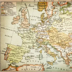
Antique Map of Europe, 1785

![]()
Wall Art and Photo Gifts from Fine Art Storehouse
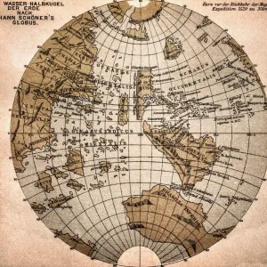
Antique Map of Europe, 1785
An accurate map of Europe from the best authorities. London: C. Dilly & G. Robinson: 1785. Original size: 35.7 x 37.4 cm. Coloured, Inset: Spitsbergen, East and West Greenland, and Iceland. Engraved for William Guthrie
BernardAllum
Media ID 13597639
© Bernard Allum
Backgrounds Baltic Countries Black Sea Continent Denmark Direction Document European Culture Finland Grunge Grunge Image Technique Hungary Latitude Longitude Manuscript Ornate Paper Past Pattern Sepia Toned Social History Square Stained Textured Effect Topography Torn Travel Backgrounds Travel Locations Turkey Turkey Middle East Vector World Map
FEATURES IN THESE COLLECTIONS
> Map
> Denmark Maps
> Map
> Historical Maps
> Map
> Italian Maps
> Map
MADE IN THE UK
Safe Shipping with 30 Day Money Back Guarantee
FREE PERSONALISATION*
We are proud to offer a range of customisation features including Personalised Captions, Color Filters and Picture Zoom Tools
SECURE PAYMENTS
We happily accept a wide range of payment options so you can pay for the things you need in the way that is most convenient for you
* Options may vary by product and licensing agreement. Zoomed Pictures can be adjusted in the Basket.