Home > Map > Italian Maps
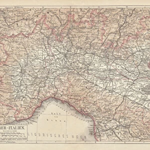
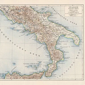
Map of Northern Italy illustrating the campaigns of 1796-1797

![]()
Wall Art and Photo Gifts from Fine Art Storehouse
Map of Northern Italy illustrating the campaigns of 1796-1797
Vintage engraving of a Map of Northern Italy illustrating the campaigns of 1796-1797 during the French Revolutionary Wars
duncan1890
Media ID 13667083
© duncan1890
18th Century 18th Century Style 78272 94456 French Revolution Historical War Event Image Created 18th Century Military Military Invasion Navigational Equipment Northern Italy Revolution Southern Europe Styles
FEATURES IN THESE COLLECTIONS
> Map
> Historical Maps
> Map
> Italian Maps
> Map
MADE IN THE UK
Safe Shipping with 30 Day Money Back Guarantee
FREE PERSONALISATION*
We are proud to offer a range of customisation features including Personalised Captions, Color Filters and Picture Zoom Tools
SECURE PAYMENTS
We happily accept a wide range of payment options so you can pay for the things you need in the way that is most convenient for you
* Options may vary by product and licensing agreement. Zoomed Pictures can be adjusted in the Basket.