Home > Map > Italian Maps
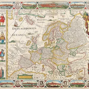
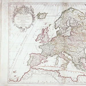
Antique Map of Europe 1744

![]()
Wall Art and Photo Gifts from Fine Art Storehouse
Antique Map of Europe 1744
An engraved map of Europe with ornamental cartouche and relief shown pictorially by Emanuel Bowen 1744, London, Geographer to His Majesty, being all new-drawn and engraved according to the latest discoveries and surveys of the period
BernardAllum
Media ID 13597641
© BernardAllum
Atlantic Ocean Cartouche Coat Of Arms Denmark Dirty Document Geographical Border Greece Grunge Grunge Image Technique Mediterranean Sea Nation National National Border Norway Paper Past Picture Frame Poland Retro Revival Russia Sweden Travel Backgrounds Travel Locations Turkey Turkey Middle East World Map
FEATURES IN THESE COLLECTIONS
> Map
> Denmark Maps
> Map
> Historical Maps
> Map
> Italian Maps
> Map
MADE IN THE UK
Safe Shipping with 30 Day Money Back Guarantee
FREE PERSONALISATION*
We are proud to offer a range of customisation features including Personalised Captions, Color Filters and Picture Zoom Tools
SECURE PAYMENTS
We happily accept a wide range of payment options so you can pay for the things you need in the way that is most convenient for you
* Options may vary by product and licensing agreement. Zoomed Pictures can be adjusted in the Basket.