Home > Map > Historical Maps
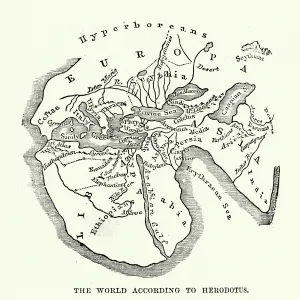
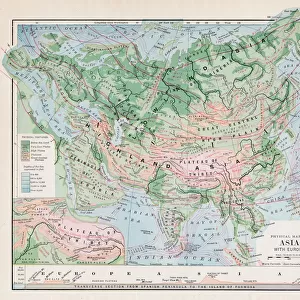
Map of the Ancient World according to Homer

![]()
Wall Art and Photo Gifts from Fine Art Storehouse
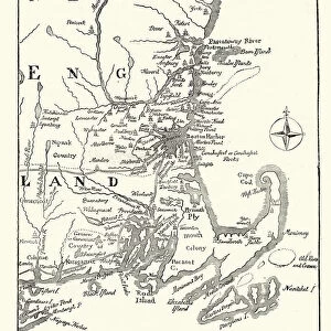
Map of the Ancient World according to Homer
Vintage engraving of a Map of the Ancient World according to Homer. Homer is best known as the author of the Iliad and the Odyssey. He was believed by the ancient Greeks to have been the first and greatest of the epic poets
duncan1890
Media ID 18305855
© duncan1890
Asia Pac Greco Roman Wrestling Middle East
FEATURES IN THESE COLLECTIONS
> Map
> Historical Maps
> Map
MADE IN THE UK
Safe Shipping with 30 Day Money Back Guarantee
FREE PERSONALISATION*
We are proud to offer a range of customisation features including Personalised Captions, Color Filters and Picture Zoom Tools
SECURE PAYMENTS
We happily accept a wide range of payment options so you can pay for the things you need in the way that is most convenient for you
* Options may vary by product and licensing agreement. Zoomed Pictures can be adjusted in the Basket.