Home > Map > Historical Maps
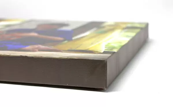
Canvas Print : Map of Hull


![]()
Canvas Prints from Fine Art Storehouse
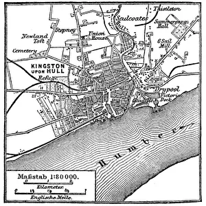
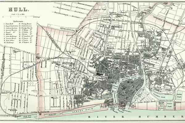
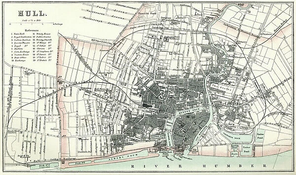
Map of Hull
Vintage map from 1880 of Hull in the East Riding of Yorkshire, England. The city of Hull has served as market town, military supply port, trading hub, fishing and whaling centre, and industrial metropolis
duncan1890
Media ID 13711447
© duncan1890
1880 1889 City Map Commercial Dock District District Type Equipment Human Settlement Image Created 1880 1889 Manufactured Object Navigational Equipment Northern Europe Objects Equipment Past Road Map Styles Thoroughfare Travel Locations Urban Road Urban Scene Yorkshire
21"x14" (53x35cm) Canvas Print
Ready to hang Premium Gloss Canvas Print. Our archival quality canvas prints are made from Polyester and Cotton mix and stretched over a 1.25" (32mm) kiln dried knot free wood stretcher bar. Packaged in a plastic bag and secured to a cardboard insert for transit.
Canvas Prints add colour, depth and texture to any space. Professionally Stretched Canvas over a hidden Wooden Box Frame and Ready to Hang
Estimated Product Size is 53.3cm x 35.6cm (21" x 14")
These are individually made so all sizes are approximate
Artwork printed orientated as per the preview above, with landscape (horizontal) orientation to match the source image.
FEATURES IN THESE COLLECTIONS
> Map
> Historical Maps
> Map
MADE IN THE UK
Safe Shipping with 30 Day Money Back Guarantee
FREE PERSONALISATION*
We are proud to offer a range of customisation features including Personalised Captions, Color Filters and Picture Zoom Tools
SECURE PAYMENTS
We happily accept a wide range of payment options so you can pay for the things you need in the way that is most convenient for you
* Options may vary by product and licensing agreement. Zoomed Pictures can be adjusted in the Cart.