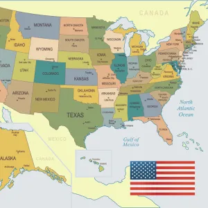
Home > Map > USA Maps
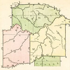
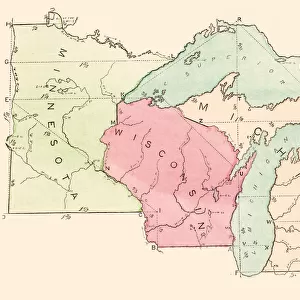
Map of usa north east states 1900

Photo Prints
Jigsaw Puzzles
Poster Prints
Cards
crop_landscape
Home Decor
Mounted Prints
Canvas Prints
Fine Art Prints
Metal Prints
![]()
Wall Art and Photo Gifts from Fine Art Storehouse
Map of usa north east states 1900
Meyers hand-Atlas Leipzig und Wien Verlag des Bibliographischen Instituts 1900
THEPALMER
Media ID 18106845
© 2014 Roberto Adrian Photography
FEATURES IN THESE COLLECTIONS
> Map
> Historical Maps
> Map
MADE IN THE UK
Safe Shipping with 30 Day Money Back Guarantee
FREE PERSONALISATION*
We are proud to offer a range of customisation features including Personalised Captions, Color Filters and Picture Zoom Tools
SECURE PAYMENTS
We happily accept a wide range of payment options so you can pay for the things you need in the way that is most convenient for you
* Options may vary by product and licensing agreement. Zoomed Pictures can be adjusted in the Basket.
Beautiful Photo Prints and Gifts
Professionally Printed
Photo Prints are in stock
Professional quality finish
Made with high-grade materials
Carefully packed to aid safe arrival
Related Images


+
Shipping
+
Choices
+