Home > Map > Italian Maps
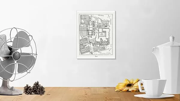
Photographic Print : Floor plan of Palatine Hill in Rome, published in 1878

![]()
Photo Prints from Fine Art Storehouse
Floor plan of Palatine Hill in Rome, published in 1878
Floor plan of the archaeological remains of the Palatine Hill in Rome. The Palatine Hill (Latin: Mons Palatinus, Italian: Monte Palatino) is one of the seven hills of Rome and is the oldest inhabited part of the city. Already in the 10th century BC were found on the Palatine human settlements. Wood engraving, published in 1878
Media ID 13666875
© ZU_09
Ancient History Ancient Rome Blueprint Italian Culture Palate Plan
10"x8" (25x20cm) Photo Print
Printed on archival quality paper for unrivalled stable artwork permanence and brilliant colour reproduction with accurate colour rendition and smooth tones. Printed on professional 234gsm Fujifilm Crystal Archive DP II paper. 10x8 for landscape images, 8x10 for portrait images.
Our Photo Prints are in a large range of sizes and are printed on Archival Quality Paper for excellent colour reproduction and longevity. They are ideal for framing (our Framed Prints use these) at a reasonable cost. Alternatives include cheaper Poster Prints and higher quality Fine Art Paper, the choice of which is largely dependant on your budget.
Estimated Product Size is 20.3cm x 25.4cm (8" x 10")
These are individually made so all sizes are approximate
Artwork printed orientated as per the preview above, with portrait (vertical) orientation to match the source image.
FEATURES IN THESE COLLECTIONS
> Map
> Historical Maps
> Map
> Italian Maps
> Map
MADE IN THE UK
Safe Shipping with 30 Day Money Back Guarantee
FREE PERSONALISATION*
We are proud to offer a range of customisation features including Personalised Captions, Color Filters and Picture Zoom Tools
SECURE PAYMENTS
We happily accept a wide range of payment options so you can pay for the things you need in the way that is most convenient for you
* Options may vary by product and licensing agreement. Zoomed Pictures can be adjusted in the Cart.