Home > Map > Historical Maps
Canvas Print : Map of Brazil and Paraguay (early 19th century steel engraving)
")
")

![]()
Canvas Prints from Fine Art Storehouse
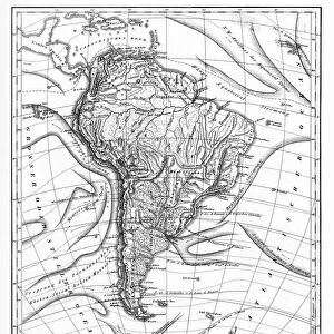
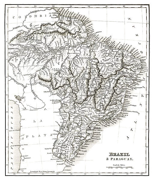
Map of Brazil and Paraguay (early 19th century steel engraving)
A steel engraving of a map from the early 19th century of Brazil and Paraguay in South America, from A System of Geography, Popular and Scientific, or A Physical, Political, and Statistical Account of the World and its Various Divisions. Volume VI, Part IIa by James Bell and published by A. Fullarton & Co. Glasgow, in 1838
whitemay
Media ID 13666943
© Linda Steward
1830s Style Atlantic Ocean Brazil Chile Colombia Education Exploration Georgian Style Guyana Line Art Monochrome Pacific Ocean Paraguay Past Peru Sepia Toned Social History South America Steel Engraving Topography Traditional Culture
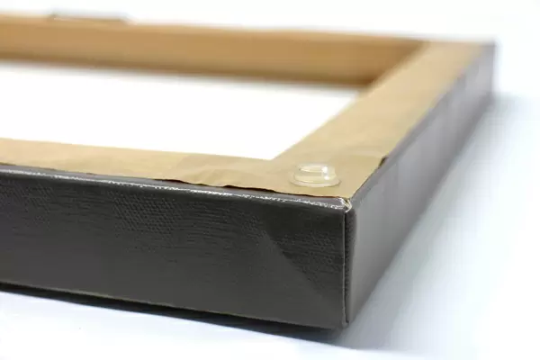
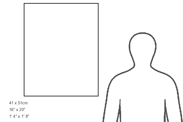
20"x16" (50x40cm) Canvas Print
Ready to hang Premium Gloss Canvas Print. Our archival quality canvas prints are made from Polyester and Cotton mix and stretched over a 1.25" (32mm) kiln dried knot free wood stretcher bar. Packaged in a plastic bag and secured to a cardboard insert for transit.
Canvas Prints add colour, depth and texture to any space. Professionally Stretched Canvas over a hidden Wooden Box Frame and Ready to Hang
Estimated Product Size is 40.6cm x 50.8cm (16" x 20")
These are individually made so all sizes are approximate
Artwork printed orientated as per the preview above, with portrait (vertical) orientation to match the source image.
FEATURES IN THESE COLLECTIONS
> Map
> Historical Maps
> Map
MADE IN THE UK
Safe Shipping with 30 Day Money Back Guarantee
FREE PERSONALISATION*
We are proud to offer a range of customisation features including Personalised Captions, Color Filters and Picture Zoom Tools
SECURE PAYMENTS
We happily accept a wide range of payment options so you can pay for the things you need in the way that is most convenient for you
* Options may vary by product and licensing agreement. Zoomed Pictures can be adjusted in the Cart.