Home > Map
Map of Saudi Arabia with Flag

![]()
Wall Art and Photo Gifts from Fine Art Storehouse
Map of Saudi Arabia with Flag
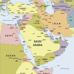
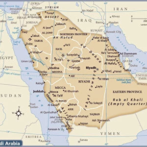
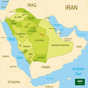
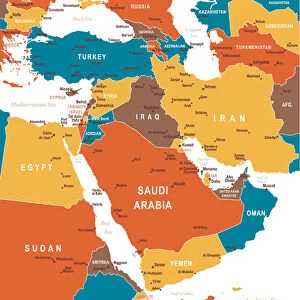
The map shows Saudi Arabia, officially the Kingdom of Saudi Arabia, a desert country in southwestern Asia (Middle East) that occupies most of the Arabian Peninsula.
The kingdom is bounded by the Gulf of Aqaba and the Red Sea in the west and the Persian Gulf in the east. Border countries are Iraq, Jordan, Kuwait, Oman, Qatar, United Arab Emirates, and Yemen. Saudi Arabia shares maritime boundaries with Bahrain, Egypt, Eritrea, Iran, and Sudan.
The country is the largest Arab state with a land area of more than two million km; compared, the sheikdom is about four times the size of France, or somewhat larger than one quarter the size of the contiguous United States
Media ID 20251051
MADE IN THE UK
Safe Shipping with 30 Day Money Back Guarantee
FREE PERSONALISATION*
We are proud to offer a range of customisation features including Personalised Captions, Color Filters and Picture Zoom Tools
SECURE PAYMENTS
We happily accept a wide range of payment options so you can pay for the things you need in the way that is most convenient for you
* Options may vary by product and licensing agreement. Zoomed Pictures can be adjusted in the Basket.