
Home > Photo Libraries > Dorling Kindersley Prints
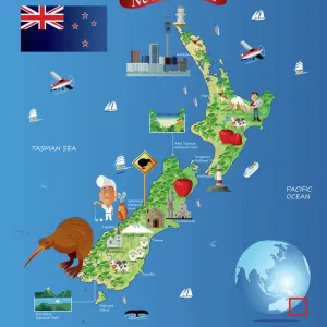
Illustrated map of New Zealand, Hawaiian Islands, Polynesian Islands and native population

Photo Prints
Jigsaw Puzzles
Poster Prints
Cards
Framed Photos
Home Decor
Mounted Prints
Canvas Prints
Fine Art Prints
Metal Prints
![]()
Wall Art and Photo Gifts from Fine Art Storehouse
Illustrated map of New Zealand, Hawaiian Islands, Polynesian Islands and native population
Dorling Kindersley
Media ID 13540761
© This content is subject to copyright
Easter Island Geography Hawaii Hawaii Islands Illustrated Map Indigenous Culture Island Large Group Of People Maori New Zealand Pacific Islands Pacific Ocean Polynesia Polynesian Rapa Nui Sailboat Sailing Boat
MADE IN THE UK
Safe Shipping with 30 Day Money Back Guarantee
FREE PERSONALISATION*
We are proud to offer a range of customisation features including Personalised Captions, Color Filters and Picture Zoom Tools
SECURE PAYMENTS
We happily accept a wide range of payment options so you can pay for the things you need in the way that is most convenient for you
* Options may vary by product and licensing agreement. Zoomed Pictures can be adjusted in the Basket.
Beautiful Photo Prints and Gifts
Professionally Printed
Photo Prints are in stock
Professional quality finish
Made with high-grade materials
Carefully packed to aid safe arrival
Related Images
+
Shipping
+
Choices
+