mail_outline sales@mediastorehouse.com
149 items
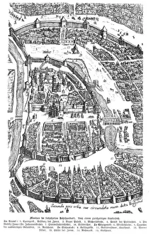
City of Moscow Russia 17th century map illustrationMoscow Russia 17th century Original edition from my own archives Source : Illustrierte Geschichte 1883
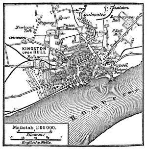
Kingston upon Hull mapIllustration of a Kingston upon Hull map
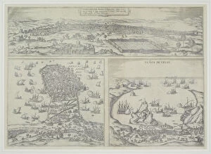
16th century, antique, archival, barbarie coast, barbary coast, battles, borders, boundaries, cartography, depicted, depicting, depiction, geography, historic, map, nobody, northern africa, ocean
Map of the Shangani Patrol and Major Wilsons Last StandVintage engraving of a Map of the Shangani Patrol and Major Wilsons Last Stand. The Shangani Patrol (or Wilsons Patrol), comprising 34 soldiers in the service of the British South Africa Company
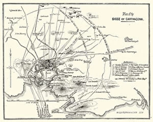
Third Carlist War - Siege of CarthagenaVintage engraving showing a plan of the Siege of Carthagena (Cartagena), Spain, during the Third Carlist War. The Carlist Wars were a series of civil wars that took place in Spain during the 19th
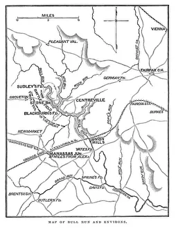
Battle of Bull RunVintage engraving from 1863 of a map of Bull Run and its environs at the time of the American Civil War. The First Battle of Bull Run
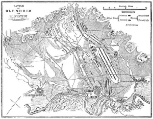
Battle of Blenheim (Hoechstedt) - map drawn in 1880Map of the Battle of Blenheim (Hoechstedt) which took place on 13 August 1704, during the War of the Spanish Succession. The English commander was John Churchill
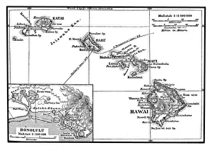
Map of the Hawaiian ArchipelagoIllustration of a Map of the Hawaiian Archipelago
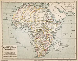
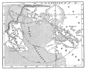
Africas exploration travel platformIllustration of a Africas exploration travel platform
Antique illustration of 31 december 1861 eclipse map
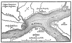
Antique illustration of Quebec map
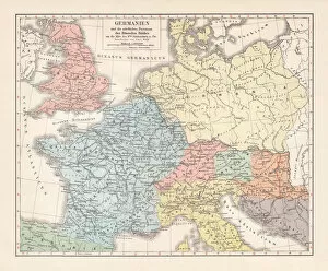
Map of Germannia, mid-2nd century AD, lithograph, published in 1897Map of Germania and the northern provinces of the Roman Empire around the middle of the 2nd century AD. Lithograph, published in 1897
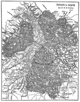
Plan of the battlefield near Leipzig 16. 18. 19. octoberIllustration of a Plan of the battlefield near Leipzig 16.18.19. october
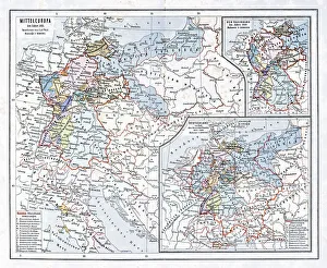
Central Europe in 1811Illustration of a Central Europe in 1811
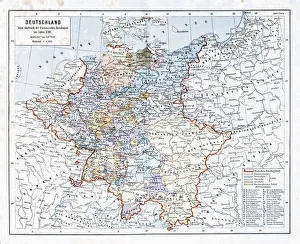
Germany, at the outbreak of the French Revolution in 1798Illustration of a Germany, at the outbreak of the French Revolution in 1798
20 - Germany - Vintage Color DarkMap of Germany - Vintage Vector illustration
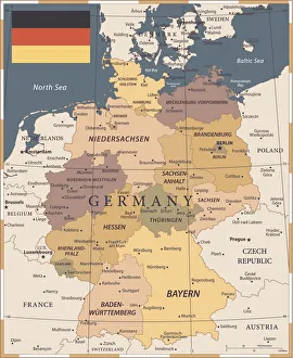
Germany Map - illustrationColored Map of the Germany
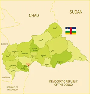
Flat map of Central African Republic with flagDetailed map of Central African Republic with surroundings, provinces, capital and flag. The url of the reference to political map is: Layers of data used: text, flag, map
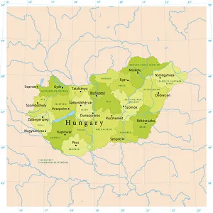
Hungary Vector MapHighly detailed vector map of Hungary. File was created on September 6, 2011. The colors in the.eps-file are ready for print (CMYK). Included files: EPS (v8) and Hi-Res JPG
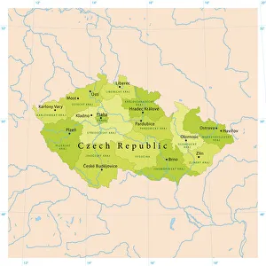
Czech Republic Vector MapHighly detailed vector map of the Czech Republic. File was created on September 9, 2011. The colors in the.eps-file are ready for print (CMYK). Included files: EPS (v8) and Hi-Res JPG
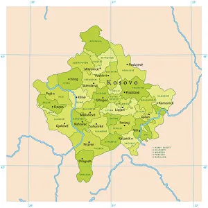
Kosovo Vector MapHighly detailed vector map of Kosovo. File was created on November 2, 2011. The colors in the.eps-file are ready for print (CMYK). Included files: EPS (v8) and Hi-Res JPG
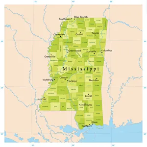
Mississippi Vector MapHighly detailed vector map of Mississippi, United States. Source data courtesy of NGDC (database: World Data Bank II), NASA (reference images: Blue Marble) and National Atlas (database)
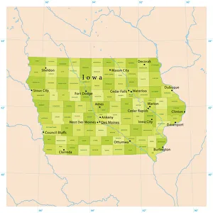
Iowa Vector MapHighly detailed vector map of Iowa, United States. File was created on January 16, 2013. The colors in the.eps-file are ready for print (CMYK)
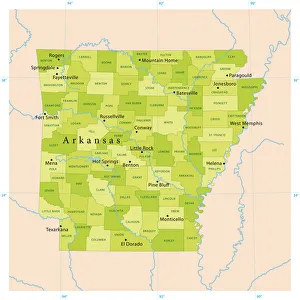
Arkansas Vector MapHighly detailed vector map of Arkansas, United States. File was created on April 12, 2012. The colors in the.eps-file are ready for print (CMYK). Included files: EPS (v8) and Hi-Res JPG
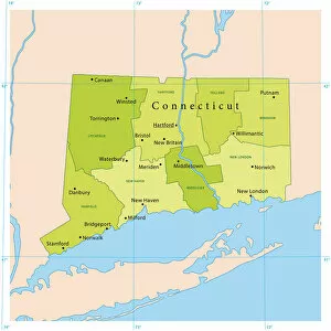
Connecticut Vector MapDetailed vector map of Connecticut, United States. File was created on November 7, 2012. The colors in the.eps-file are ready for print (CMYK)
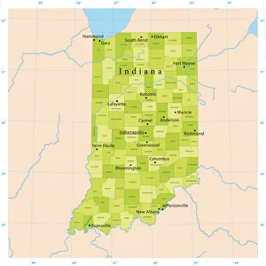
Indiana Vector MapHighly detailed vector map of Indiana, United States. File was created on January 16, 2013. The colors in the.eps-file are ready for print (CMYK)
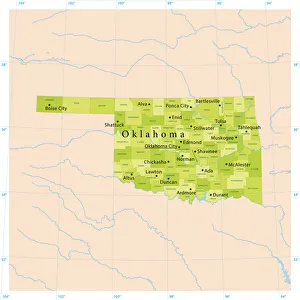
Oklahoma Vector MapHighly detailed vector map of Oklahoma, United States. File was created on January 15, 2013. The colors in the.eps-file are ready for print (CMYK)
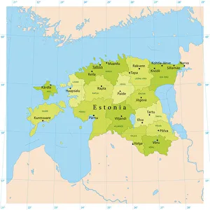
Estonia Vector MapHighly detailed vector map of Estonia. File was created on August 21, 2012. The colors in the.eps-file are ready for print (CMYK). Included files: EPS (v8) and Hi-Res JPG (2800 x 2800 px)
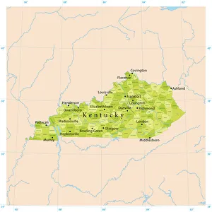
Kentucky Vector MapHighly detailed vector map of Kentucky, United States. Source data courtesy of NGDC (database: World Data Bank II), NASA (reference images: Blue Marble) and National Atlas (database)
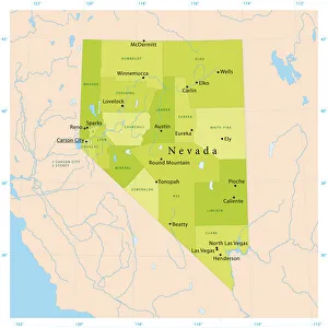
Nevada Vector MapHighly detailed vector map of Nevada, United States. File was created on January 27, 2012. The colors in the.eps-file are ready for print (CMYK). Included files: EPS (v8) and Hi-Res JPG
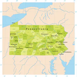
Pennsylvania Vector MapHighly detailed vector map of Pennsylvania, United States. File was created on November 26, 2012. The colors in the.eps-file are ready for print (CMYK)
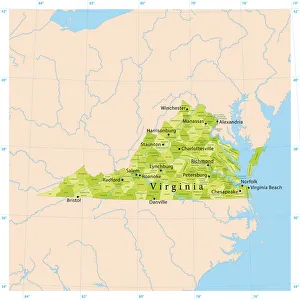
Virginia Vector MapHighly detailed vector map of Virginia, United States. Source data courtesy of NGDC (database: World Data Bank II), NASA (reference images: Blue Marble) and National Atlas (database)
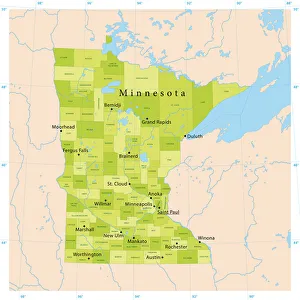
Minnesota Vector MapHighly detailed vector map of Minnesota, United States. File was created on December 19, 2012. The colors in the.eps-file are ready for print (CMYK)
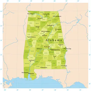
Alabama Vector MapHighly detailed vector map of Alabama, United States. File was created on April 10, 2012. The colors in the.eps-file are ready for print (CMYK). Included files: EPS (v8) and Hi-Res JPG
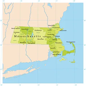
Massachusetts Vector MapHighly detailed vector map of Massachusetts, United States. File was created on October 31, 2012. The colors in the.eps-file are ready for print (CMYK)
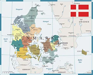
27 - Denmark - Color1 10Map of Denmark - Vector illustration
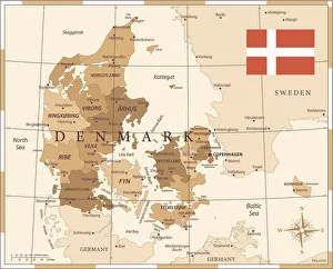
25 - Denmark - Vintage Golden 10Map of Denmark - Vintage Vector illustration
Canada Map - illustrationColored Map of the Canada The urls of the reference files are (country, continent, world map and globe): http:/lib.utexas.edu/maps/americas/canada_pol99.jpg http
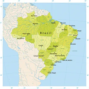
Brazil Vector MapUltra detailed vector map of Brazil with administrative divisions. Including main rivers and lakes. Each state is grouped separately. You can zoom in well in the vector file
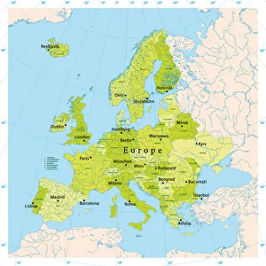
Europe Vector MapUltra detailed vector map of Europe. Including main rivers and lakes. Each country is grouped separately. You can zoom in well in the vector file
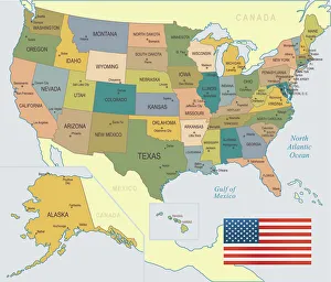
USA Map - illustrationColored Map of the United States
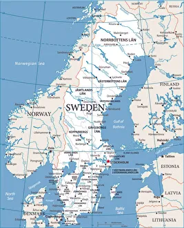
Map of Sweden - Vector illustration
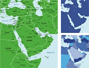
Middle east maphighly detailed map of Middle East with Individual Countries and Continents for your design, products and print
Map of Middle East and Navigation IconsBlue Map of Middle East Asia and Navigation Icons
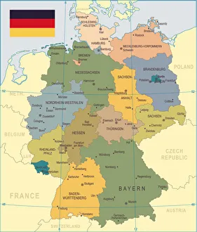
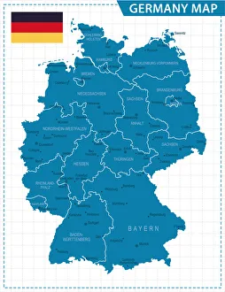
Germany Map - IllustrationVector maps of the Germany with infographic elements
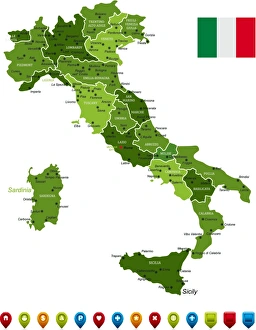
Italy MapHigh Detailed Italy Green Map with Navigation Icons
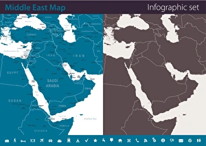
Map of Middle East - Infographic SetVector maps of Middle East Asia with variable specification and icons
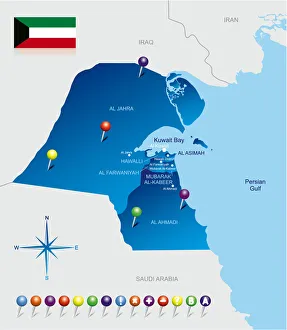
Map of Kuwait