mail_outline sales@mediastorehouse.com
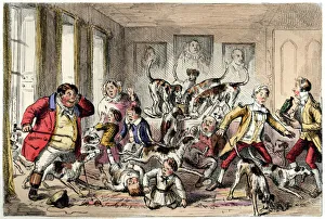
Foxhounds invading a Victorian houseA member of the local fox hunt has followed the foxhounds into a smart house - thankfully, without his horse - where the behaviour of the hounds is causing considerable uproar
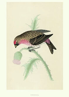
Natural History - Birds - RedpollVintage illustration of a Redpoll (in Britain also historically known as redpoles) are a group of small passerine birds in the finch family Fringillidae which have characteristic red markings
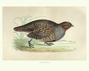
Natural history, Birds, grey partridge (Perdix perdix)Vintage engraving of a grey partridge (Perdix perdix) also known as the English partridge, Hungarian partridge, or hun, is a gamebird in the pheasant family Phasianidae of the order Galliformes
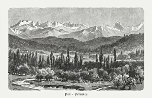
Valley of Pau, Pyrenees, France, wood engraving, published in 1897The Valley of Pau in the Pyrenees, France. Wood engraving after a photograph, published in 1897
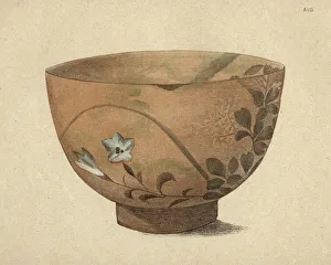
Japanese Art, Bowl of Pottery of Kioto, 19th CenturyVintage engraving of Japanese Art, Bowl of Pottery of Kioto, 19th Century
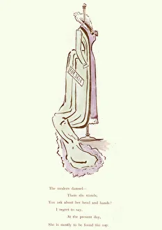
Victorian satirical cartoon - The modern damselVintage engraving of a Victorian satirical cartoon. The modern damsel
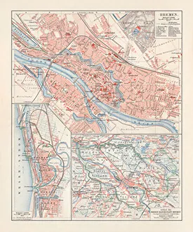
City map of Bremen, Germany, lithograph, published 1897City map of Bremen, Germany. Lithograph, published in 1897
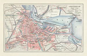
City map of Amsterdam, Netherlands, lithograph, published in 1897City map of Amsterdam, capital of the Netherlands. Lithograph, published in 1897
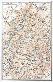
Brussels mapIllustration of a Brussels map
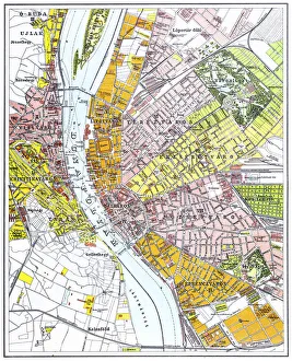
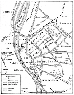
Budapest city mapIllustration of a Budapest city map
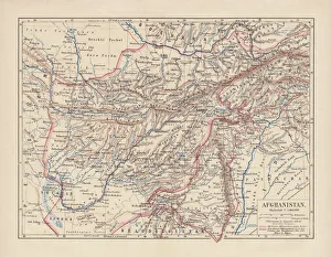
Afghanistan, lithograph, published in 1881Ancient map of Afghanistan. Lithograph, published in 1881
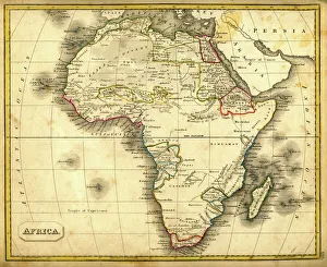
Antquie Map of AfricaVintage map of Africa from 1837
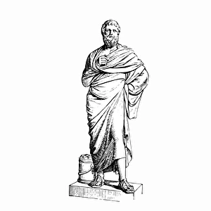
Sophocles ( circa 496a'406 bc ), Greek playwright. His seven surviving plays are notable for their complexity of plot and depth of characterization
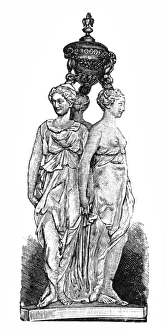
The Three GracesAntique illustration of The Three Graces
RomaniaAntique map of Romania
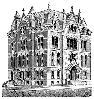
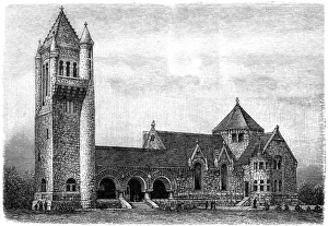
Rush Medical College building in ChicagoAntique illustration of a Rush Medical College building in Chicago
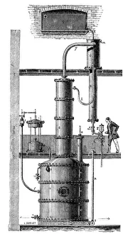
Rectification DeviceAntique illustration of a DesireSavalles device for rectifying alcohol
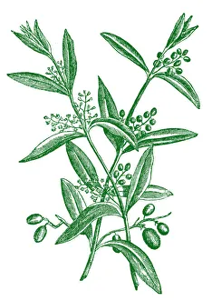
Olive Tree Branch with Fruitsillustration of a Olive Tree Branch with Fruits
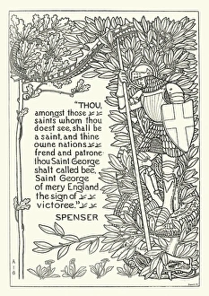
St. George of merry EnglandVintage engraving of a verse from Spensers Faerie Queene, with an image of Saint George and the Dragon. 1892
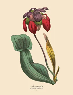
Sarracenia or Trumpet Pitcher Plant, Victorian Botanical IllustrationVery Rare, Beautifully Illustrated Antique Engraved Victorian Botanical Illustration of Sarracenia or Trumpet Pitcher Plant: Plate 54
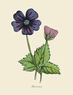
Geranium Plants, Victorian Botanical IllustrationVery Rare, Beautifully Illustrated Antique Engraved Victorian Botanical Illustration of Geranium Plants, Victorian Botanical Illustration Plate 57
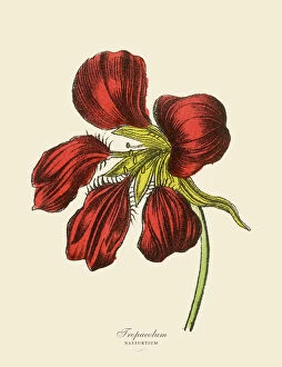
Tropaeolum and Nasturtium Plants, Victorian Botanical IllustrationVery Rare, Beautifully Illustrated Antique Engraved Victorian Botanical Illustration of Tropaeolum and Nasturtium Plants, Victorian Botanical Illustration Plate 57
Antique illustration of Casa Santi-birthplace of Raffello Sanzio (Urbino, Italy)Antique illustration of the 15th-century house where Italian Reinassance painter Raphael was born in 1483 in Urbino (Italy), now a Museum. The palace is called Casa Santi
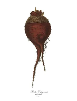
Red Beet, Root Crops and Vegetables, Victorian Botanical IllustrationVery Rare, Beautifully Illustrated Antique Engraved Victorian Botanical Illustration of Red Beet, Root Crops and Vegetables, Published in 1886. Source: Original edition from my own archives
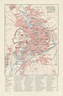
City map of Erfurt, Germany, lithograph, published in 1897City map of Erfurt with street directory, Thuringia, Germany. Lithograph, published in 1897
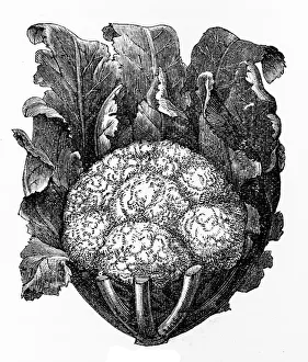
CauliflowerIllustration of a cauliflower
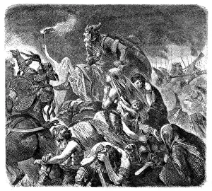
Attila in the battle on the fields Catalaunianillustration of Attila in the battle on the fields Catalaunian
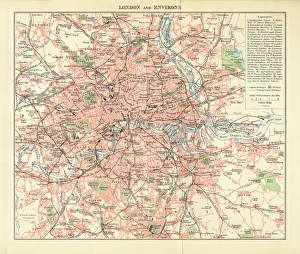
London and Environs Historical Map, Engraving, 1892Very rare, beautifully detailed engraving of London and Environs Historical Map, Engraving, Published in 1892. Original edition from my own archives. Copyright has expired on this artwork
Crematorium in Troy in New York State
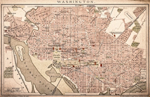
Map of Washington 1898Antique illustration of a Map of Washington 1898
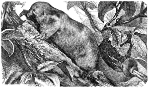
Silky anteater, pygmy anteater (Cyclopes didactylus)
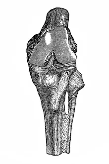
Knee joint with cruciate ligaments
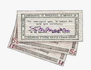
Illustration of signed wooden banknotes issued in Tenino in 1932
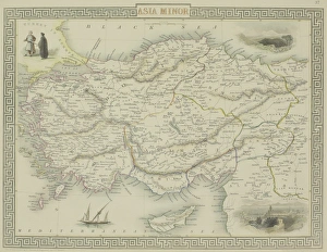
Antique map of Asia Minor
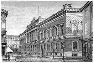
German Reichsbank in Berlin, GermanyAntique illustration of a German Reichsbank in Berlin, Germany
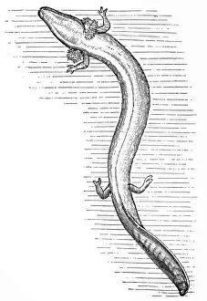
Olm or proteus (Proteus anguinus)Antique illustration of olm or proteus (Proteus anguinus)
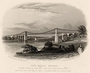
Suspension bridge over the Menai Straits, Wales, UKnobody, infrastructure, suspension bridge, Menai Straits, Wales, Great Britain, UK, Europe, rural, engraving c1840, 19th century, outdoor, black and white, history, archival, vintage, Menai Bridge
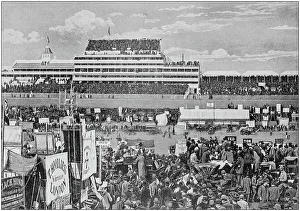
Antique black and white photograph of England and Wales: Derby Day, Epsom
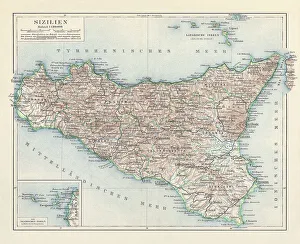
Topographic map of Sicily, Italy, lithograph, published in 1897Topographic map of Sicily, Italy - largest island in the Mediterranean Sea. Lithograph, published in 1897
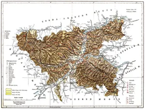
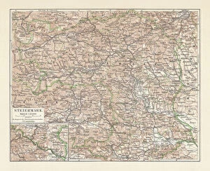
Topographic map of Styria, Austria, lithograph, published in 1897Topographic map of Styria - state (Bundesland) located in the southeast of Austria. Lithograph, published in 1897
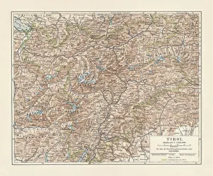
Tyrol, historical region in Austria and Italy, lithograph, published 1897Tyrol - historical region in the Alps; in northern Italy and western Austria. Lithograph, published in 1897
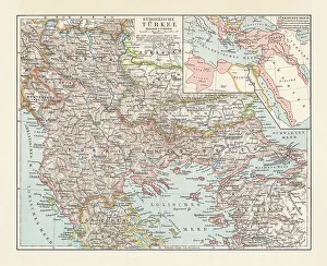
Historical map of the Ottoman Empire (Turkey), European part, 1897Historical map of European part of the Ottoman Empire (Turkey) at the end of the 19th century. Lithograph, published in 1897
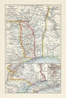
Historical map of Togo during the German colonial period (1884-1916)Historical map of Togo in West Africa during the German colonial period from 1884 to 1916. Lithograph, published in 1897
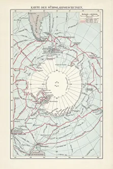
Antarctica map with sea routes of various explorers, lithograph, 1897Historical map of the unexplored Antarctica with sea routes of various explorers, 18th - 19th century. Lithograph, published in 1897
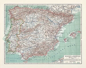
Topographic map of Spain and Portugal, lithograph, published in 1897Topographic map of Spain and Portugal. Lithograph, published in 1897
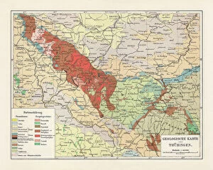
Geological map of Thuringia, Germany, lithograph, published in 1897Geological map of Thuringia, Germany. Lithograph, published in 1897
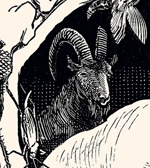
Drawing of a GoatDrawing of Goat. 19th century