mail_outline sales@mediastorehouse.com
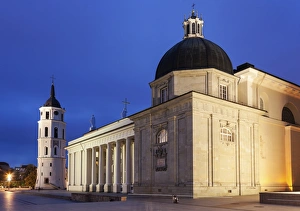
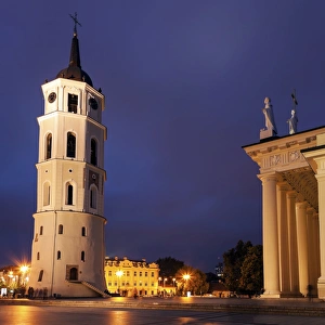
Vilnius Cathedral Basilica at eveningVilnius Cathedral Basilica of Sts Stanislaus and Vladislaus at evening. Vilnius, Lithuania
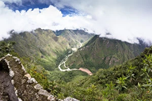
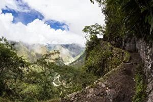
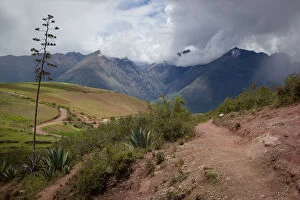
Archaeological ruins of Machu PicchuWay to the Inca bridge, surrounded by the river and valley Urubamba
Inca trail to bridge in Machu PicchuWay to the Inca bridge, surrounded by the river and valley Urubamba
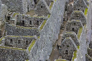
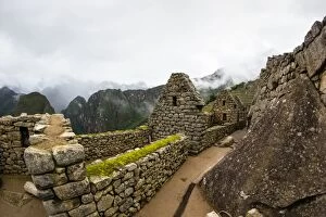
Archaeological ruins of Machu PicchuThis is a view of the ancient Incan houses in Machu Pichu
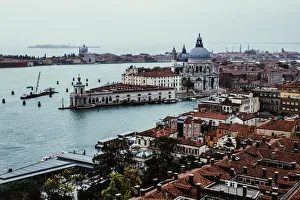
High-angle view on Venice cityscape with Basilica di Santa Maria della Salute during the rain
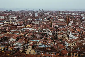
High-angle view on Venice cityscape during the rain
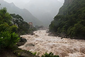
River Urubamba and the Aguas calientes townThis is a view of the rapids waters in Aguas calientes town (Machu Picchu)
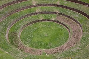
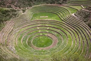
This is a landscape view of Moray ruins in CuscoNear of Moray archaeological site in Peru approximately 50 km (31 mi) northwest of Cuzco on a high plateau at about 3, 500 m
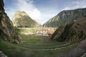
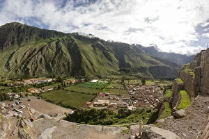
Archaeological ruins of Ollantaytambo and cityAerial view of the platforms and the city of Ollantaytambo
This is a landscape of the city OllantaytamboView from the top of the town and ruins of Ollantaytambo
View of Archaeological ruins of Pikillacta in PeruThe archaeological complex Piquillacta or Piki Llaqta is an archaeological site made up of the remains of a city of ancient Peru, the time preincaic
Archaeological ruins of MorayMoray or Muray (Quechua) is an archaeological site in Peru approximately 50 km (31 mi) northwest of Cuzco on a high plateau at about 3, 500 m
Archaeological ruins of Moray near of CuscoMoray or Muray (Quechua) is an archaeological site in Peru approximately 50 km (31 mi) northwest of Cuzco on a high plateau at about 3, 500 m
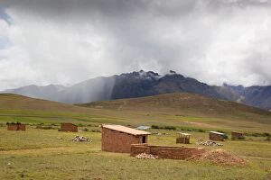
New houses in the valley of Cusco, MorayNear the archaeological site of Moray in Peru are new adobe buildings generating a new development
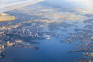
Sydney aerial sunriseVisible from left eg Mrs Macquaries Chair, Central Business District, Sydney opera house, the Rocks, Harbour bridge, Barangaroo Reserve, Kirribilli, Cremorne Point. Morning view
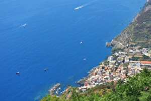
Aerial view of Riomaggiore and its rocky coastline in the Cinque Terre
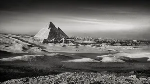
What A ViewView of the Pyramids from the Giza plateau, Giza, Egypt
Birds Eye ViewFrom the top of the Cheops pyramid, Giza, Egypt
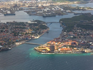
Aerial of the coast and Willemstad, CuraAzaoAerial view of Willemstad, Curacao, with Punda (right on the photo) and Otrabanda ( left on the photo. The harbor entrance to the natural bay (St. Anna bay) and Schottegat
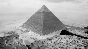
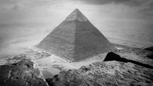
The Pyramids Of Giza, EgyptSunset at the ancient wonders, Giza, Egypt
Ancient WondersSunset at the ancient wonders, Giza, Egypt
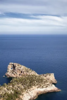
Mallorca coastline around Sa Foradada, Mallorca, Balearic Islands, Spain
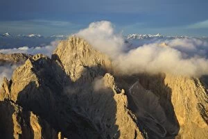
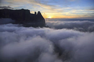
Odle surrounded by clouds South Tyrol ItalyAerial view of the mountain range of Odle surrounded by clouds Dolomites Val Funes Trentino Alto Adige South Tyrol Italy Europe
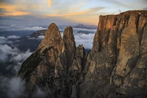
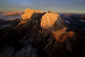
Sassolungo and Grohmann peak Dolomites ItalyAerial view of Sassolungo and Grohmann peak at sunset Dolomites Sella Group Trentino Alto Adige Italy Europe
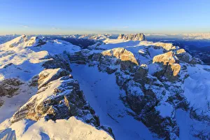
Santner peak at sunset Siusi Alp ItalyAerial view of Santner peak at sunset Sciliar Natural Park Plateau of Siusi Alp Dolomites Trentino Alto Adige Italy Europe
Sassolungo and Sassopiatto Dolomites ItalyAerial shot of Sassolungo and Sassopiatto at sunset Sella Group Val Gardena Dolomites Trentino Alto Adige Italy Europe
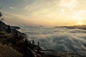
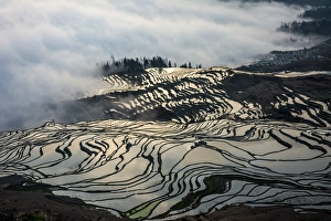
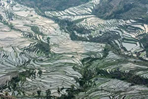
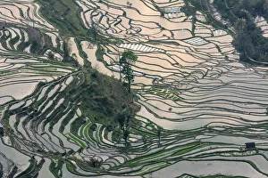
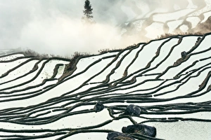
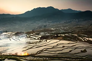
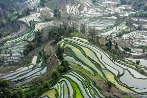
Rice terrace at Yuanyang. Yunnan. ChinaHonghe hani terraced fields in southern yunnan, and spread in honghe, honghe, jin, yuan Yang green spring four counties, a total area of about 1 million mu