mail_outline sales@mediastorehouse.com
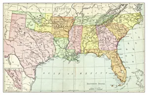
Map of Southern States USA 1895The Rand-McNally Grammar School Geography 1895 - Chicago & New York
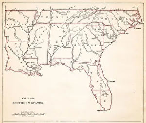
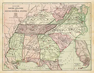
Map of Southern States USA 1877Warrens Common School Geography 1877
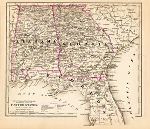
Alabama Florida Georgia map 1881Coltons Common School Geography 1881 New York Sheldon and Co
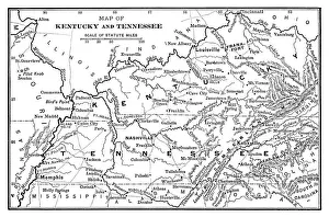
Map of Kentucky and Tennessee - Scanned 1886 Map
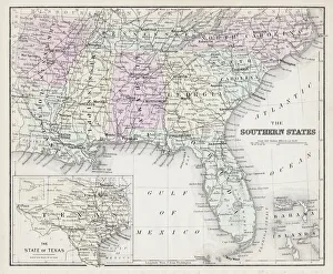
Map of Southern states USA 1883Warrens Common School Geography
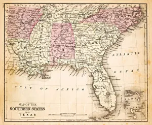
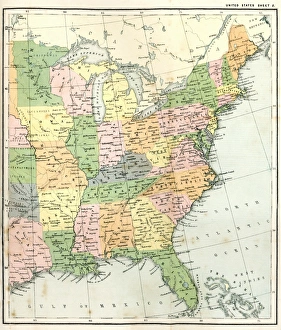
Map of USA Southern states 1869Cornells Grammars-School Geography - S.S. Cornell - New York D. Appleton and Company 1869
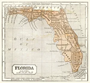
Map of Florida 1855System of Geography for the use of schools by Sidney E. Morse - Published by Harper & Brothers - New York 1855
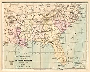
USA Southern states map 1889Indiana Educational Series The Complete Geography - Indianapolis 1889
Drawing Map of Southern states USA 1883Warrens Common School Geography
Antquie Map of the United StatesVintage map of the United States of America from 1837
Antique Map of Eastern USAAntique Map from 1867 of Eastern United States of America
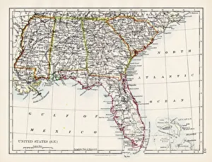
United States South East map 1897The World-Wide Atlas of Modern Geography, Political and Physical W. & A.K. Johnston - London 1897
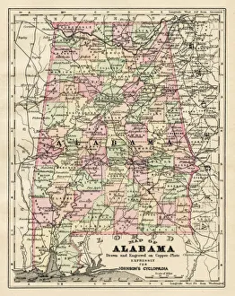
Alabama map 1893Johnsonas Universal Cyclopedia - Charles Kendall - New York 1893
Map EngravingsFine Art Storehouse Maps: Map Engravings
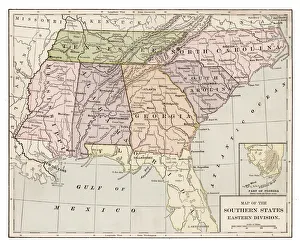
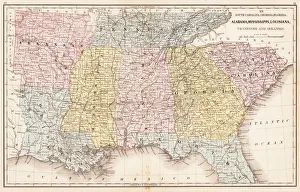
Souther States USA map 1881Coltons Common School Geography 1881 New York Sheldon and Co
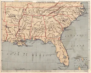
USA Southern States 1867Mitchells Modern Atlas - Published by E.H. Buttler & Co - Philadelphia 1867
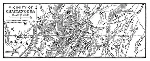
Vicinity of Chattanooga - 1886 scanned engraving
Southern States 1852 Map
United States 1852 Map
United States of America, Atlantic coast, lithograph, published in 1878United States of America, Atlantic coast. Lithograph, published in 1878
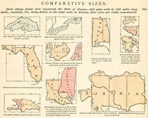
Comparative sizes map 1875The Independent Course Comprehensive Geography by James Monteith, A.S. Barnes & Co, New York & Chicago 1875
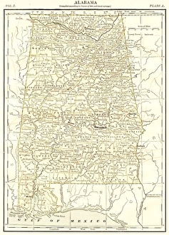
Alabama map 1878Encyclopedia Britannica 9th Edition Vol I New York, Samuel Hall 1878
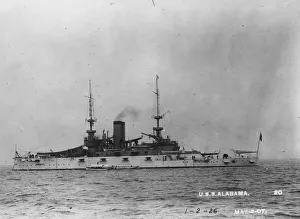
USS AlabamaMarch 1917: The USS Alabama, at sea as America prepares for War. (Photo by Topical Press Agency/Getty Images)