mail_outline sales@mediastorehouse.com
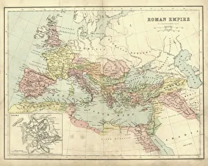
Antique map of the Roman Empire, with a detail on Rome
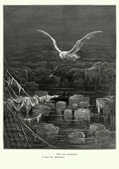
Rime of the Ancient Mariner - I shot AlbatrossVintage engraving by Gustave Dore of a scene from the Rime of the Ancient Mariner, With my crossbow I shot the Albatross. The Rime of the Ancient Mariner is the longest major poem by the English poet
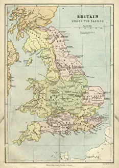
Antique map of Britain under the Anglo Saxons
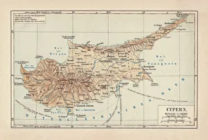
Map of Cyprus, published in 1880Ancient map of Cyprus. Lithograph, published in 1880
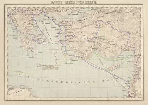
Apostle Pauls Missionary Journeys, lithograph, published in 1886Apostle Pauls Missionary Journeys: 1st (green); 2nd (red); 3rd (blue); last to Rome (yellow). Lithograph, published in 1886. Paul travelled over 10, 000 miles proclaiming the gospel of Jesus Christ
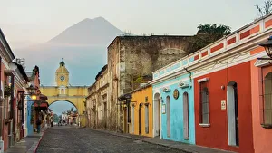
Agua Volcano and Arco de Santa Catalina (Santa Catalina Arch) in Antigua GuatemalaSanta Catalins Arch or Arco de Santa Catalina is probably the most iconic place in Antigua Guatemala, it was was built in 1693 - 1694 to allow nuns to cross the street without being seen
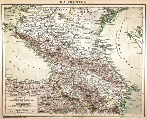
Old Caucasus mapAntique map of Caucasus
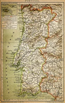
Map of PortugalAntique illustration engraving map og Portugal
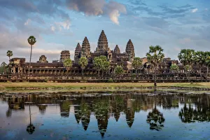
Sunrise with Angkor Wat, Siem Reap, Cambodia
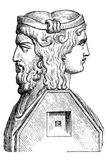
Roman God JanusIllustration of a Roman God Janus
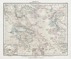
Greece at the beginning of the Peloponnesian War (431-404 BC)Antique Map of Greece at the beginning of the Peloponnesian War (431 - 404 BC) with the different tribal groups. Steel engraving with hand colored borderlines, published in 1861
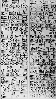
The Code of HammurabiA view of part of the code of Hammurabi, one of the earliest systems of law. It was named after the ruler of Babylon who reigned from 1795 - 1750 BCE. (Kean Collection/Getty Images)
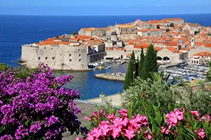
View of Old Town City of DubrovnikDubrovnik is one of the most prominent tourist destinations in the Mediterranean Sea, a seaport on the Dalmation coast. In 1979, the city of Dubrovnik joined the UNESCO list of World Heritage Sites
Angkor Wat Sunrise CambodiaMonumental Angkor Wat Temple in early morning light after sunrise under beautiful cloudy sky. Angkor Wat, Siem Reap, Cambodia, Asia
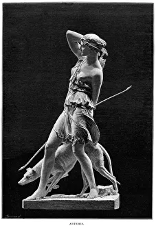
Ancient Statue of the Goddess ArtemisVintage engraving of Artemis Ancient Greek Goddess of the Hunt, Forests and Hills, the Moon. In roman mythology her name was Diana
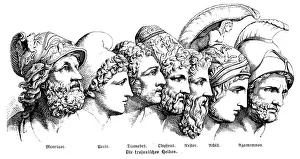
Heroes Of The Trojan WarIllustration of a Heroes Of The Trojan War
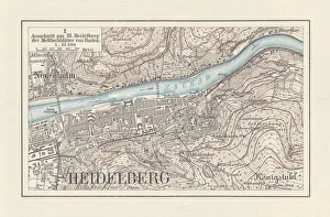
Historical city map of Heidelberg, Baden-WAOErttemberg, Germany, lithograph, published 1897Historical city map of Heidelberg, Baden-WAOErttemberg, Germany. Lithograph, published in 1897
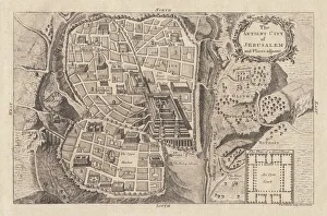
Map of the ancient Jerusalem, copperplate engraving, published in 1774Map of the ancient Jerusalem. Copperplate engraving, published in 1774
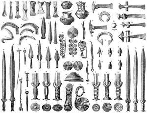
Bronze AgeIllustration of objects from a Bronze Age
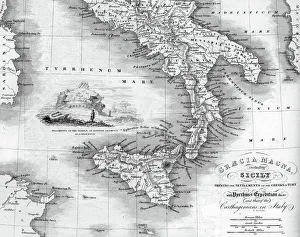
Vintage map of Magna Graecia, showing the settlements of the ancient greeks in Italy. Magna GrA|cia is the name of the coastal areas of Southern Italy on the Tarentine Gulf that was extensively
Senanque Sabbey Landscape with its lavender field, ProvenceFamous Senanque abbey in Vaucluse with its lavender field in full bloom. Gordes, Provence, France
Twilight at the Boudhanath Stupa in Kathmandu, NepalTurn up the light in new year in Boudhanath Stupa Boudhanath is a UNESCO world heritage site in the Kathmandu valley, Nepal
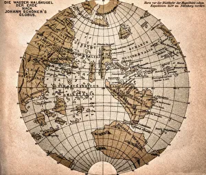
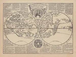
World map from 1520Western hemisphere of the Johannes SchAoner globe from 1520. expedition
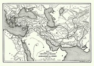
Ancient History - Map of Alexander the Great CampaignsVintage engraving of a map of the campaigns and marches of Alexander the Great
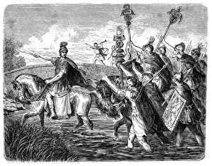
Caesar crossing the RubiconIllustration of a Caesar crossing the Rubicon. This event of crossing a small stream in Northern Italy became one of ancient historys most pivotal events, for from it sprang the Roman Empire
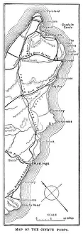
Map of the Cinque Ports (Victorian engraving)An old map of the Cinque Ports, which are five historic ports on the south-eastern corner of Kent, England. The Confederation of Cinque Ports (Cinque is pronounced asinka)
City map of Paris, lithograph, published in 1877City map of Paris, France. Lithograph, published in 1877
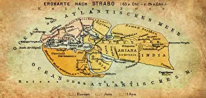
Map of the world according to Strabo 63 B.C
Torcello Cathedral, The Cathedral of Santa Maria Assunta (Cattedrale di Santa Maria Assunta) is a basilica church on the island of Torcello, Venice, northern Italy
Binturong (Arctictis binturong)Illustration of a Binturong or Arctictis binturong or Asian Bearcat or Palawan Bearcat or Bearcat in the meadow
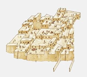
Catal Huyuk, ancient settlement in Anatolia, Turkey, from c. 6500 BC
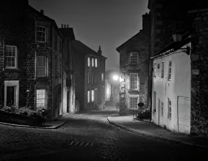
Lancaster City United KingdomCastle Hill an old street in Lancaster on a misty night in Winter
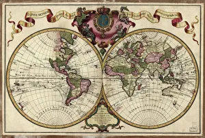
Map of the world, 1720(Original Caption) 18th century map of the world. Published in Paris in 1720, this French map shows the known world, including the new lands that had been discovered in the preceding centuries by
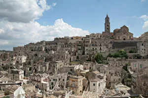
Sassi di Matera, Basilicata, ItalyLonely Planet describes Matera as Italys most extraordinary town" due to its incredible old town, the Sassi (i sassi)
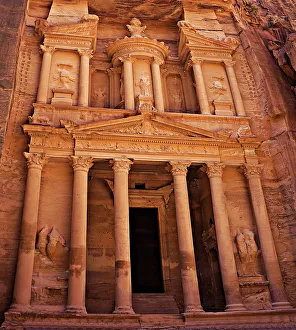
Al Khazneh (The Treasury), Petra, JordanThis little wonder measures 82 feet (25 meters) wide and 128 feet (39 meters) high. Its an absolute stunner and the first thing you see after walking through the canyon
Sunrise with a Buddha Statue with the Hand Position of Dharmachakra Mudra in Borobudur, Magelang, Central JavaBorobudur, or Barabudur, is a 9th-century Mahayana Buddhist Temple in Magelang, Central Java, Indonesia. This temple is the worlds largest Buddhist temple
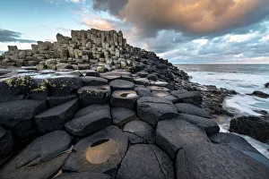
Giants Causeway early morningFresh weather above the basalt columns of the Giants Causeway in Northern Ireland
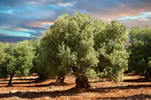
Ancient Cerignola olive trees -Olea europaea-, Ostuni, Apulia, Italy
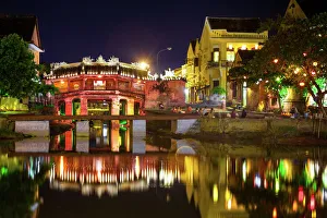
View to Japanese Covered Bridge, Hoi An, VietnamJapanese Bridge at night, Hoi An, UNESCO World Heritage Site, Vietnam
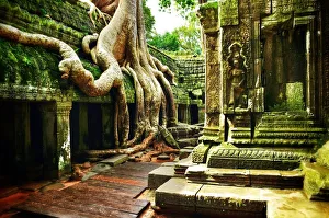
Ta Prohm Angkor Wat CambodiaThe famous temple of Ta Prohm at Angkor Wat, Cambodia where the roots of the jungle trees intertwine with the masonry of these ancient structures producing almost surreal images
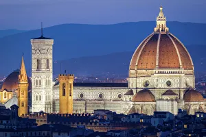
Florence, Tuscany, Italy
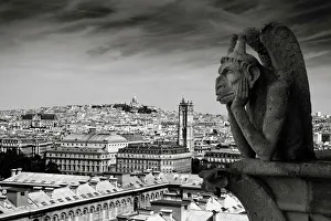
Gargoyle of the Notre Dame Cathedral, Paris, FranceThe gargoyles are an essential part of the history of the cathedral, and a key aspect of the site. The gargoyles main purpose is very practical
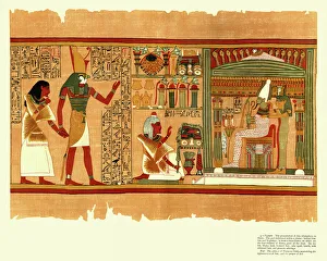
Ancient Egyptian Papyrus of Ani - Book of the DeadA section of the Papyrus of Ani (Book of the Dead), a papyrus manuscript with cursive hieroglyphs and color illustrations created circa 1250 BC
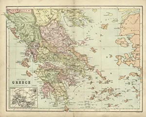
Antique map of Ancient Greece
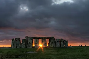
Stonehenge Sunset juust after the winter solstice
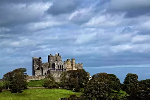
Ireland, Tipperary County, The Rock of CashelSep 2004
World map by Martin Behaim, 1492, wood engraving, published 1884World map by Martin Behaim, 1492. Woodcut engraving from my archive, published in 1884
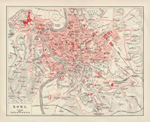
City map of Rome, lithograph, published in 1878City map of Rome, Italy. Lithograph, published in 1878