mail_outline sales@mediastorehouse.com
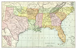
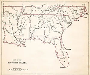
Map of Southern States USA 1895The Rand-McNally Grammar School Geography 1895 - Chicago & New York
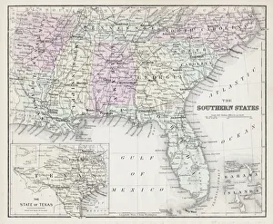
Map of Southern States USA 1877Warrens Common School Geography 1877
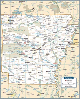
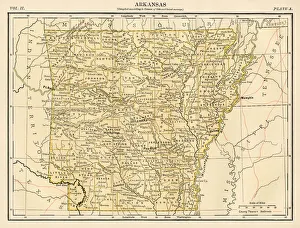
Arkansas State MapArkansas is a southern US state bordering the Mississippi River
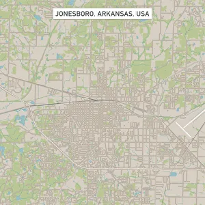
Jonesboro Arkansas US City Street MapVector Illustration of a City Street Map of Jonesboro, Arkansas, USA. Scale 1:60, 000. All source data is in the public domain. U.S
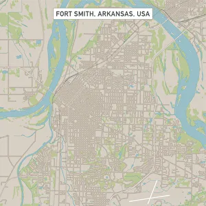
Fort Smith Arkansas US City Street MapVector Illustration of a City Street Map of Fort Smith, Arkansas, USA. Scale 1:60, 000. All source data is in the public domain. U.S
Fayetteville Arkansas US City Street MapVector Illustration of a City Street Map of Fayetteville, Arkansas, USA. Scale 1:60, 000. All source data is in the public domain. U.S
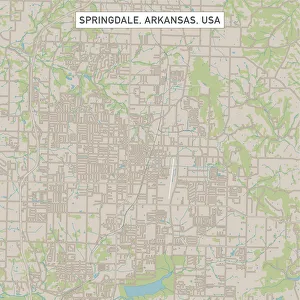
Springdale Arkansas US City Street MapVector Illustration of a City Street Map of Springdale, Arkansas, USA. Scale 1:60, 000. All source data is in the public domain. U.S
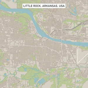
Little Rock Arkansas US City Street MapVector Illustration of a City Street Map of Little Rock, Arkansas, USA. Scale 1:60, 000. All source data is in the public domain. U.S
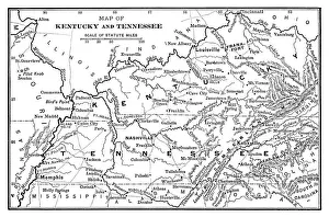
Map of Kentucky and Tennessee - Scanned 1886 Map
Map of Southern states USA 1883Warrens Common School Geography
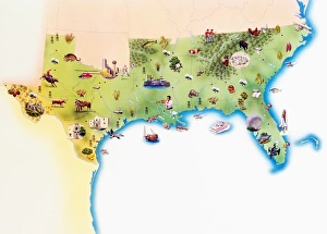
Map of Southern United States of America, with illustrations of distinguishing features and landmarks
Abandoned stone church in rural ArkansasAn abandoned stone church in rural Arkansas during spring
USA Southern states map 1889Indiana Educational Series The Complete Geography - Indianapolis 1889
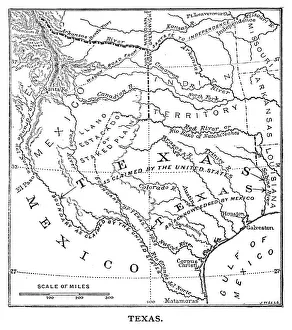
Old Texas Map - Scanned 1887 map
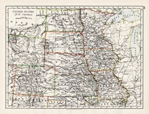
United States NW Central 1897The World-Wide Atlas of Modern Geography, Political and Physical W. & A.K. Johnston - London 1897
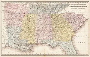
Drawing Map of Southern states USA 1883Warrens Common School Geography
Antquie Map of the United StatesVintage map of the United States of America from 1837
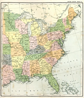
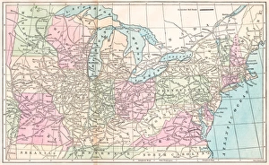
Antique Map of Eastern USAAntique Map from 1867 of Eastern United States of America
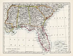
United States South East map 1897The World-Wide Atlas of Modern Geography, Political and Physical W. & A.K. Johnston - London 1897
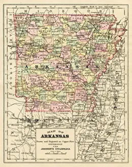
Arkansas map 1893Johnsonas Universal Cyclopedia - Charles Kendall - New York 1893
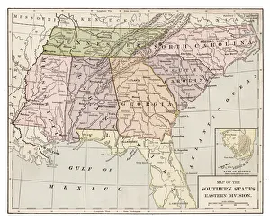
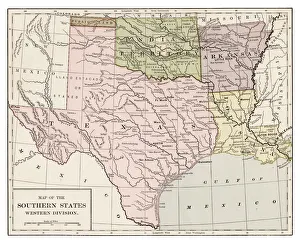
Southern states western division 1889Indiana Educational Series The Complete Geography - Indianapolis 1889
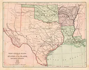
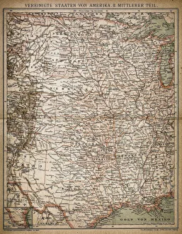
USA West Central states map 1881Harpers School Geography, New York, Harpers and Brothers, 1881
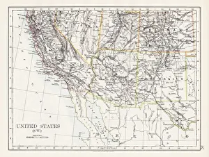
United States South West map 1897The World-Wide Atlas of Modern Geography, Political and Physical W. & A.K. Johnston - London 1897
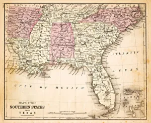
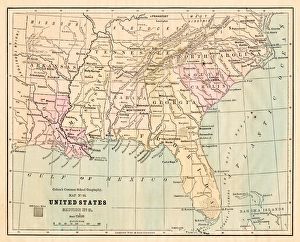
Souther States USA map 1881Coltons Common School Geography 1881 New York Sheldon and Co
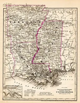
Arkansas Louisiana Pississippi map 1881Coltons Common School Geography 1881 New York Sheldon and Co
USA Southern States 1867Mitchells Modern Atlas - Published by E.H. Buttler & Co - Philadelphia 1867
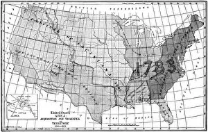
United States area: Acquisition and transfer of territory 1780 to 1870United States area: Acquisition and transfer of territory 1780 to1870
Southern States 1852 Map
United States 1852 Map
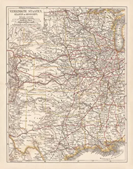
United States of America, States on Mississippi river, lithograph published 1878United States of America, States on the Mississippi river. Lithograph, published in 1878
Routes of travel in the United States map 1875The Independent Course Comprehensive Geography by James Monteith, A.S. Barnes & Co, New York & Chicago 1875
Arkansas map 1878Encyclopedia Britannica 9th Edition Vol II New York, Samuel Hall 1878
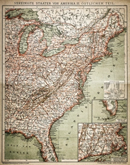
United States of America, eastern partAntique illustration of a United States of America, eastern part
United States of America, Middle sectionAntique illustration of a United States of America, Middle section
United States of America mapAntique illustration of a United States of America map
Little Rock, Arkansas, Exterior ViewUSA, Arkansas, Little Rock, city skyline
Hot Springs, Arkansas, City ViewUSA, Arkansas, Hot Springs, elevated city view from West Mountain, dawn