mail_outline sales@mediastorehouse.com
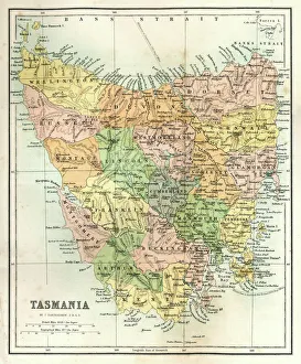
Antique Map of TasmaniaAntique map of Tasmania from 1867
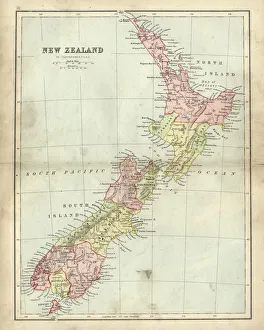
Antique map of New Zealand in the 19th Century, 1873Vintage engraving of a Antique map of New Zealand in the 19th Century, 1873
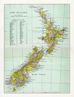
Antique Map of New ZealandVintage map of New Zealand, from 1894
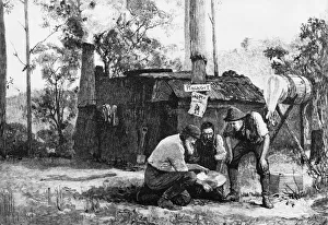
Gold ProspectingGold prospectors in Australia panning water and silt in search of small nuggets of the precious metal. (Photo by Three Lions/Getty Images)
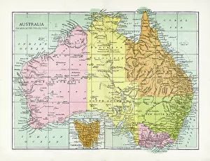
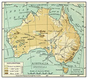
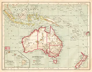
Antique Map of AustraliaVintage map of Australia, from 1894
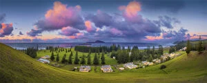
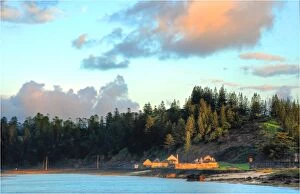
Kingston, Norfolk Island, is a very historic Georgian village and fully restored colonial outpost of the British Empire during the convict transportation era
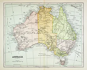
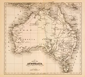
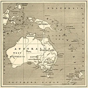
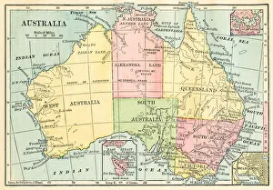
Map of Australia 1883Map of Australia
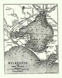
Map of Melbourne and Port Phillip, Australia, 19th CenturyVintage engraving of Map of Melbourne and Port Phillip, Australia, 19th Century
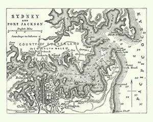
Map of Sydney and Port Jackson, Australia, 19th CenturyVintage engraving of Map of Sydney and Port Jackson, Australia, 19th Century
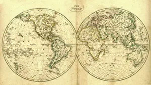
Vintage Map of the WorldVintage map of the world from 1837
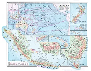
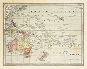
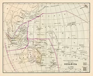
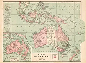
Map of Oceania 1877Warrens Common School Geography 1877
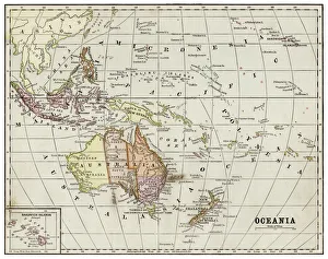
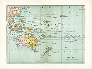
Oceania map 1889Indiana Educational Series The Complete Geography - Indianapolis 1889
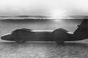
Bluebird16th May 1963: Donald Campbells racing car Bluebird in which he eventually won the land speed record. The car is silhouetted against the sun on the salt flats of Lake Eyre in Australia
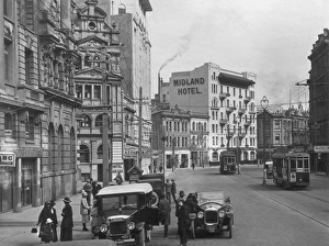
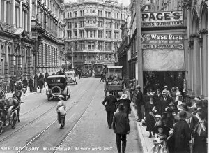
Lambton Quaycirca 1930: Cars park along the side of the road whilst trams rumble through the Lambton Quay area of Wellington, New Zealand, where hotels and guest houses line the streets. (Photo by S. C)
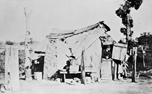
Wagga WaggaA hut in Wagga Wagga in New South Wales, Australia, 19th century. Butcher Arthur Orton, also known as Thomas Castrolate, subject of the famous Tichborne Claimant trial is said to have lived here
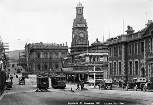
Dunedincirca 1910: Princess Street in the city of Dunedin, New Zealand. (Photo by S. C. Smith/Topical Press Agency/Getty Images)
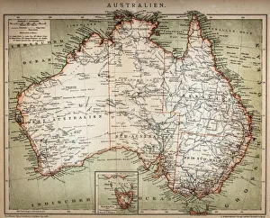
Map of Australia 1874Map of Australia
Map of Australia 1895The Rand-McNally Grammar School Geography 1895 - Chicago & New York
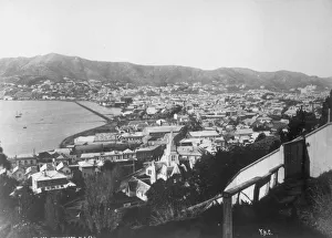
Wellington, NZcirca 1930: An overview of the coastal city of Wellington, New Zealand, showing the coastline and hills beyond. (Photo by Hulton Archive/Getty Images)
Map of Australasia (1898 engraving)Old map of Australasia from 1898
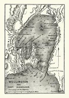
Map of Wellington and Port Nicholson, New Zealand, 19th CenturyVintage engraving of Map of Wellington and Port Nicholson, New Zealand, 19th Century
Map of Australasia (1882 engraving)Old map of Australasia from Royal Geographical Readers no. 5 of Asia, Africa, America and Oceania, publ. T Nelson & Sons, London in 1883
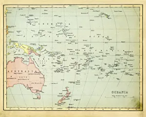
Antique Map of Oceania 1897Antique Map of the Oceania from 1897
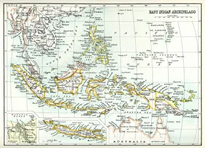
Antique map of East Indian Archipelago, including, the Phillippines, Papua New Guinea, Borneo and Java from 1891. With Detail of Batavia (Jakarta)
Map of Australia and Polynesia 1877Warrens Common School Geography 1877
Australia map 1875The Independent Course Comprehensive Geography by James Monteith, A.S. Barnes & Co, New York & Chicago 1875
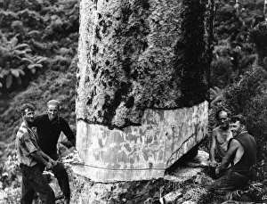
Cheerful At Workcirca 1930: Four smiling bushmen saw down a kauri tree. (Photo by Three Lions/Getty Images)
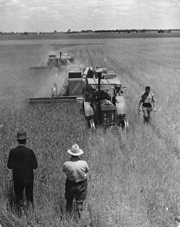
Combine Harvestingcirca 1945: A combine harvester at work on a farm in Australia. (Photo by Spencer Arnold Collection/Hulton Archive/Getty Images)
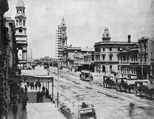
Adelaide Streetcirca 1910: King William Street in Adelaide, South Australia. (Photo by Spencer Arnold Collection/Hulton Archive/Getty Images)
Map of Oceania 1884
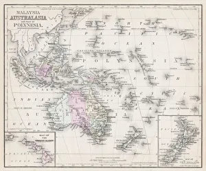
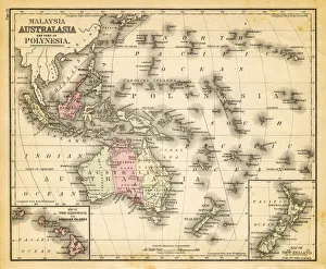
map of australia, malaysia and polynesiaold map of australia, malaysia and polynesia - 1883
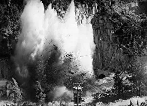
Hydro-Electric Power1st December 1951: Explosives are used to remove the barrier at the entrance to the tunnel which is used to divert the river at Marketai as part of a scheme to increase the electricity available
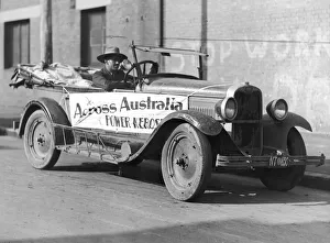
Across AustraliaAn explorer on his way to Adelaide, south Australia, in his kerosene powered Chevrolet tourer. (Photo by Hulton Archive/Getty Images)
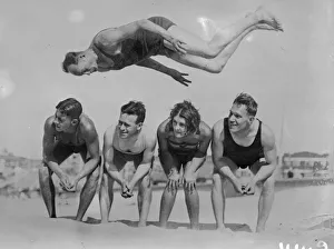
Flying ManJanuary 1929: Acrobatic feats by Australian swimmers on Sydney Beach. (Photo by Fox Photos/Getty Images)
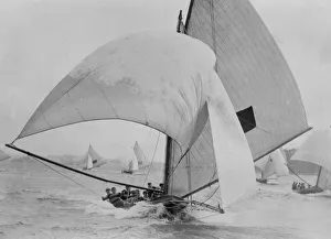
Full SailApril 1929: A yacht with its sails bellowing in the wind. (Photo by Fox Photos/Getty Images)
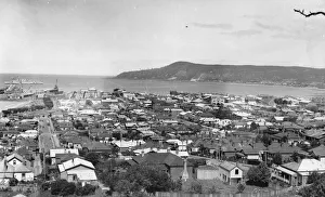
Tasmanian Viewcirca 1950: A view of the sea over the rooftops of Burnie, Tasmania. (Photo by Hulton Archive/Getty Images)
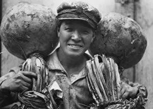
Turnipscirca 1930: Large white turnips shipped from Japan to Sydney. (Photo by Fox Photos/Getty Images)
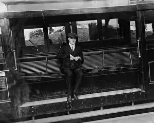
Sloping Seatscirca 1930: The seats of a street car in Wellington, New Zealand are slanted to counteract the slope of the hills that the cars ride. (Photo by General Photographic Agency/Getty Images)
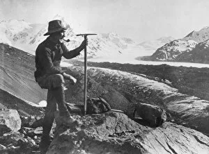
New Zealand Climbcirca 1930: Mr Camery stops for a smoke whilst hiking across the mountains in New Zealand. (Photo by Hulton Archive/Getty Images)
Kings Chamberscirca 1930: Shoppers in the Lambton Quay area of Wellington, this view looks down towards the citys Kings Chambers. (Photo by S. C. Smith/Topical Press Agency/Getty Images)
Map of Australia 1877The Eclectic Elementary Geography by Wilson & Hinkle / Cincinnati -New York 1881
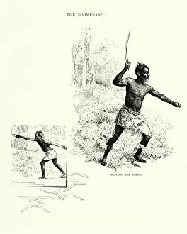
19th Century, Aboriginal, Aborigine, Antique, Armaments, Armed, Australasia, Australasian TribeVintage engraving of a man throwing a boomerang, 19th Century
Antique Map of OceaniaVintage map of North Oceania, from 1894
Oceania Australia map 1881Coltons Common School Geography 1881 New York Sheldon and Co
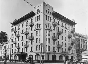
Midland Hotelcirca 1930: Wellingtons Midland Hotel on Lambton Quay, the leading hotel in the area. (Photo by S. C. Smith/Topical Press Agency/Getty Images)
Australia map 1881Harpers School Geography, New York, Harpers and Brothers, 1881
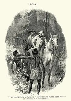
Two men lost in the Australian bush, 19th CenturyVintage engraving of Two men lost in the Australian bush, 19th Century. Asking aboriginals for directions to a water hole