mail_outline sales@mediastorehouse.com
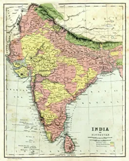
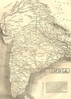
Antique map of India, 1864
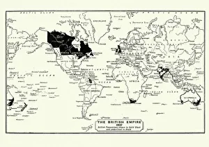
Map of the British Empire in 1837. At its height, the British Empire was the largest empire in history and, for over a century, was the foremost global power
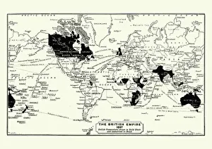
Map of the British Empire in 1897. At its height, the British Empire was the largest empire in history and, for over a century, was the foremost global power
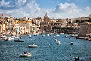
Marina baySailing boats on Senglea marina in Grand Bay, Valetta, Malta
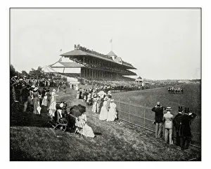
Antique photograph of horserace derby in Chicago
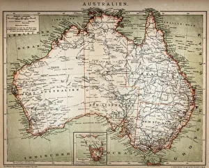
Map of Australasia (1898 engraving)Old map of Australasia from 1898
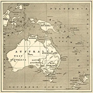
Map of Australasia (1882 engraving)Old map of Australasia from Royal Geographical Readers no. 5 of Asia, Africa, America and Oceania, publ. T Nelson & Sons, London in 1883
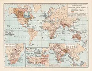
Development of the British Empire, lithograph, published 1897Map of the territorial development of the British Empire from the 17th century to the end of the 19th century. Lithograph, published in 1897
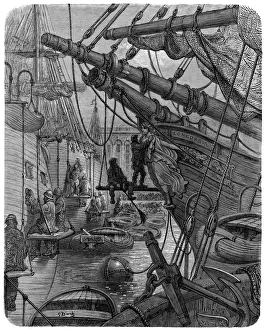
Victorian London - Docks and The ConcordiaVintage engraving showing a scene from 19th Century Victorian London England. Showing London Docks and the ship Concordia
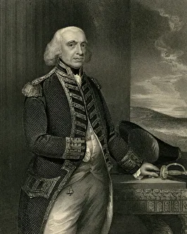
Richard Howe (XXXL)Portrait of Richard first earl Howe (1726-1799) engraved by H.Robinson from the original of Gainsborough(1727-1788) in the Trinity house and published by J.Tallis&Co in 1880
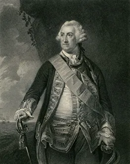
Admiral Lord Hawke (XXXL)" Portrait of Admiral Lord Edward Hawke (1705-1781) engraved by W.Holl (1807-1871), from the original by Cotes (1726-1770)
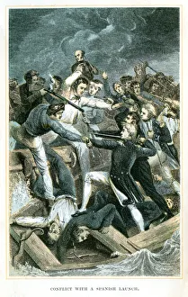
Nelson Conflict with a spanish launchA scene from the life of Lord Nelson - Nelson Conflict with a spanish launch
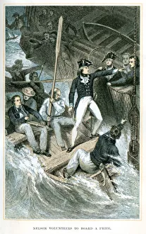
Nelson volunteers to board a prizeA scene from the life of Lord Nelson - Nelson volunteers to board a prize
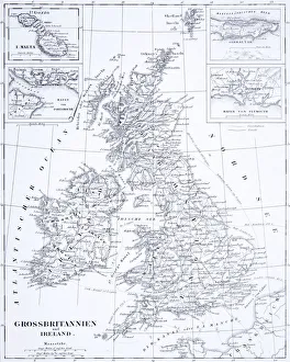
Engraving: Great Britain and IrelandEngraved illustrations of the Countries of Great Britain and Ireland from Iconographic Encyclopedia of Science, Literature and Art, Published in 1851. Copyright has expired on this artwork
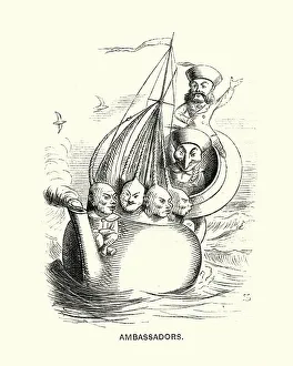
Victorian satirical cartoon about western ambassadors to China, 1869Vintage engraving of a Victorian satirical cartoon about western ambassadors to China, Punch, 1869
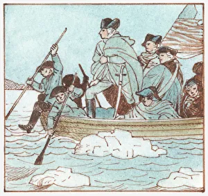
Illustration of George Washington in boat crossing the Delaware River to defeat the British at the Battle of Trenton during the American Revolution
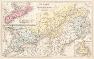
Map of Canada and New Brunswick 1867Mitchells Modern Atlas - Published by E.H. Buttler & Co - Philadelphia 1867
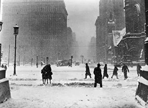
Winter street sceneUNITED STATES - CIRCA 1940s: Winter street scene in Philadelphia, pedestrians and cars at road intersection, snow falling. (Photo by H. Armstrong Roberts/Retrofile/Getty Images)
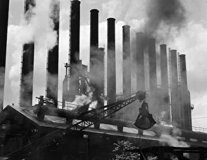
Factory smokestacksUNITED STATES - CIRCA 1930s: Steel industry, factory smokestacks, Conshohocken, Pennsylvania. (Photo by H. Armstrong Roberts/Retrofile/Getty Images)
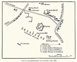
Plan of the Entrenchment at Cawnpore, June, 1857, during the Indian Rebellion of 1857
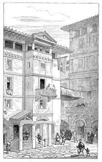
Street in ancient RomeIllustration of a Street in ancient Rome
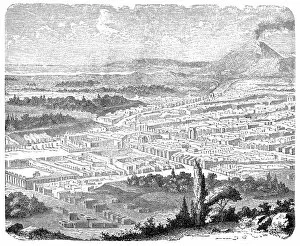
The excavated PompeiiIllustration of The excavated Pompeii
PompeiiIllustration of Pompeii
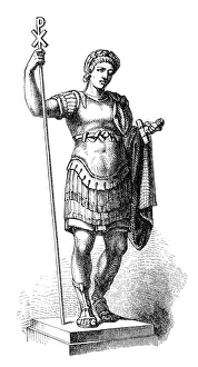
Constantine the Great (c. 272-337), Roman emperorillustration of a Constantine the Great (c.272-337), Roman emperor
Mid-Victorian map of IndiaA mid-Victorian map of the Indian subcontinent at the time of the British Empire, showing various missionary society stations
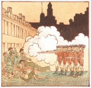
Illustration of British redcoats killing civilians, known as the Boston Massacre
Traditional BoatFront side of traditional yellow-blue maltese fisherman boat
Saint JuliansPanorama of Saint Julians Bay, island of Malta
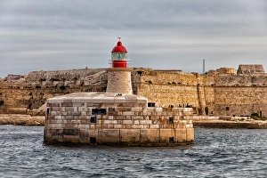
Lighthouse at Old Harbor of Maltese city of Valleta
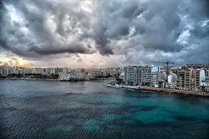
Malta VallettaPanorama of harbor and marina bay of Valletta, Malta
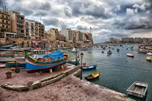
Saint Julians MarinaFisherman harbor of Saint Julians bay, Valletta, Malta
Flag of the Commonwealth of Nations
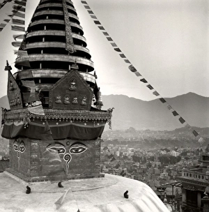
The Buddhist stupa of Swayambu (Monkey Temple) (Swayambhunath), UNESCO World Heritage Site, Kathmandu, Nepal, Asia
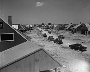
Housing developmentUNITED STATES - CIRCA 1950s: Housing development, Levittown, Pennsylvania. (Photo by H. Armstrong Roberts/Retrofile/Getty Images)
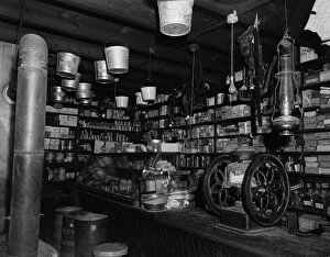
Country general store interiorUNITED STATES - CIRCA 1900s: Interior of country general store, Shiloh, Virginia. (Photo by H. Armstrong Roberts/Retrofile/Getty Images)
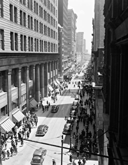
Street in PhiladelphiaUNITED STATES - CIRCA 1930s: Traffic and pedestrians on Chestnut Street, Philadelphia, aerial view. (Photo by H. Armstrong Roberts/Retrofile/Getty Images)
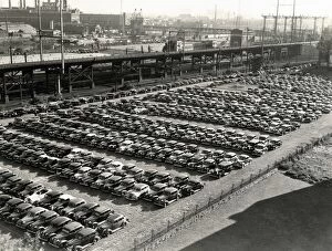
Parking lotUNITED STATES - CIRCA 1930s: Rows of cars in parking lot, aerial view, Philadelphia. (Photo by H. Armstrong Roberts/Retrofile/Getty Images)