mail_outline sales@mediastorehouse.com
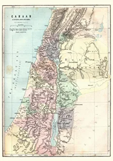
Historical map of Palestine with the twelve tribes of Israel. Colored steel engraving, published in 1886
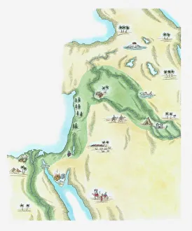
Illustration of strip of land known as the fertile crescent which stretched from Egypt through Canaan and Mesopotamia to Babylonia in the Old Testament
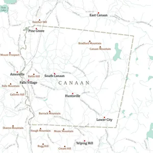
CT Litchfield Canaan Vector Road Map. All source data is in the public domain. U.S. Census Bureau Census Tiger. Used Layers: areawater, linearwater, roads, rails, cousub, pointlm, uac10
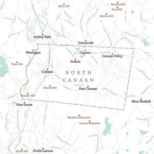
CT Litchfield North Canaan Vector Road Map. All source data is in the public domain. U.S. Census Bureau Census Tiger. Used Layers: areawater, linearwater, roads, rails, cousub, pointlm, uac10
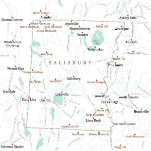
CT Litchfield Salisbury Vector Road Map. All source data is in the public domain. U.S. Census Bureau Census Tiger. Used Layers: areawater, linearwater, roads, rails, cousub, pointlm, uac10
Map of Canaan as divided amoung the tribesVintage engraving of a Map of Canaan as divided amoung the tribes
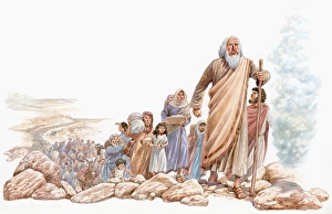
Illustration of Moses leading Hebrews Eastward on journey to Canaan
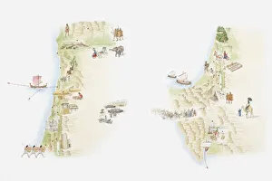
Illustrated maps of ancient Canaan (left) and Sinai peninsula (right)