mail_outline sales@mediastorehouse.com
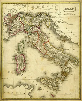
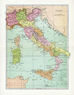
Antquie Map of ItalyVintage map of Italy fron 1837
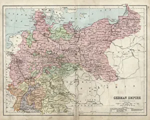
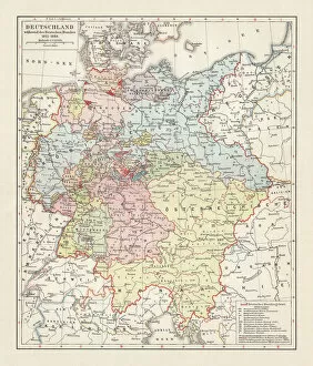
Antique damaged map of German Empire 19th Century
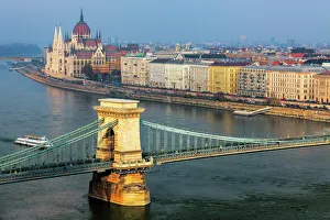
Budapest - Chain Bridge by NightThe Chain Bridge stands out against the night sky in Budapest
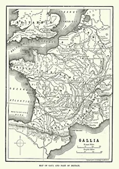
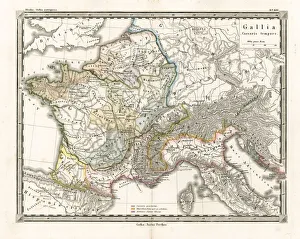
Map of Ancient Gaul (France)Vintage engraving of a Map of Ancient Gaul (France)
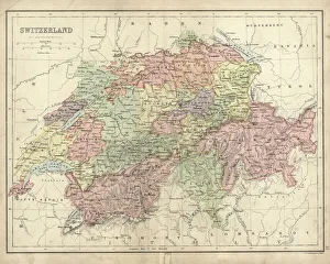
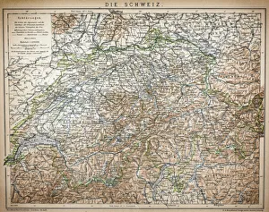
Antique map of Switzerland in the 19th Century, 1873
Hallstatt, AustriaThe village of Hallstatt, Lake Hallstatt, UNESCO World Heritage Hallstatt-Dachstein is a village in the Salzkammergut, a region in Austria. It is located near the HallstAÔé¼tter See (a lake)
Innsbruck, View of Dom zu St. Jacob, Tyrol, AustriaCityscape of Innsbruck with Cathedral of St. James on the right, houses at the Inn river bank and Alps mountains on the background. Innsbruck, Austria
Map of the German Confederation (1815-1866), lithograph, published in 1897Map of the German Confederation between 1815 and 1866. Lithograph, published in 1897
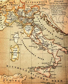
Antquie Map of ItalyVintage map of Italy from 1815
Antique Map of Switzerland from 1898
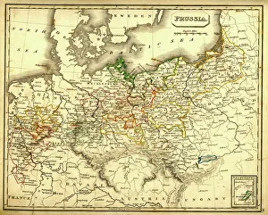
Antquie Map of PrussiaVintage map of Prussia from 1837
Antique Map of GaulAntique Map from 1862 of Gaul at the time of Julius Caesar. The Roman proconsul and general Julius Caesar pushed his army into Gaul in 58 BC
Budapest - Danube ArchitectureWarm sunlight spotlights the Chain Bridge and the Hungarian Parliament Building against a blue sky and Danube River
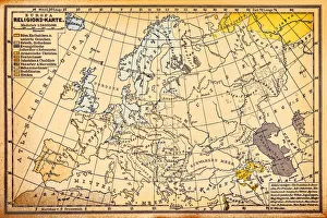
Religion map of Europe, 19th centuryIllustration of a Religion map of Europe, , 19th century
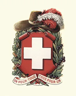
Coat of Arms of Switzerland, 1898
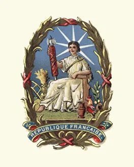
Coat of Arms of France, 1898. A woman holding a Fasces, a bound bundle of wooden rods, sometimes including an axe with its blade emerging
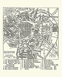
Map of Leipzig, Germany, 19th CenturyVintage engraving of a Map of Leipzig, Germany, 19th Century
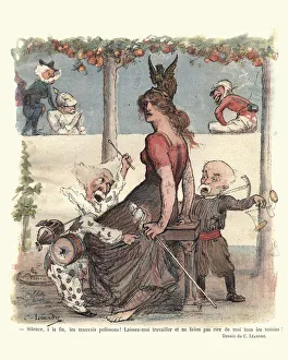
Silence, a la fin, les mauvais polissonsVintage french satirical cartoon. Silence, a la fin, les mauvais polissons ! Laissez-moi travailler et ne faites pas de moi tous les voisins ! silence at the end, evil pranks
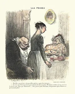
French satirical cartoon - Les PoiresVintage engraving of a French satirical cartoon, Les Poires. An old man pinches the bottom of the maid as she talks to his wife. 19th Century, C Leandre
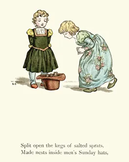
Rats made nests inside mens Sunday hatsVIntage Illustration of a scene from the story of the Pied Piper of Hamelin. Split open kegs of salted sprats, Made nests inside mens Sunday hats.. Kate Greenaway, 1888
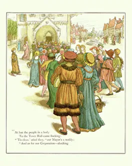
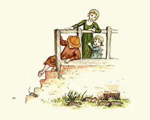
The Pied Piper of Hamelin To Town Hall came flockingVIntage engraing of a scene from the story of the Pied Piper of Hamelin. At last the people in a body To the Town Hall came flocking. Kate Greenaway, 1888
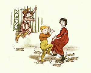
The Pied Piper of Hamelin Children and the ratsVIntage engraing of a scene from the story of the Pied Piper of Hamelin. Children afraid of the rats. Kate Greenaway, 1888
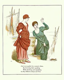
The Pied Piper of HamelinVIntage engraing of a scene from the story of the Pied Piper of Hamelin. and even spoiled the women's chats, by drowning their speaking with shrieking and squeaking. Kate Greenaway, 1888
Antique Map of ItalyVintage map of Italy, from 1894
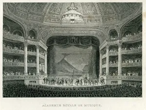
The Paris Royal Academy of Music"Academie royale du Musique, Paris, France, 1849". One of the most emblematic institutions of the Baroque period
Matterhorn or Mont Cervin"Vintage Colour Lithograph from 1884 of the Matterhorn (Monte Cervino or Mont Cervin), a mountain in the Pennine Alps on the border between Switzerland and Italy
18th Century Fashion - The BasketsVintage engraving of a lady wearing a Hoop skirt (Pannier) during the Reign of Louis XV, 1729. Modes et costumes historiques 1864
18th Century Fashion - Marie SalleVintage engraving of Marie Salle during the Reign of Louis XV, 1730. Marie Salle(1707 to 1756) was a French dancer and choreographer known for her expressive
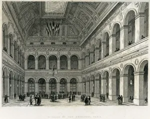
Interior of the Exchange, Paris" Vintage engraving from 1849 showing the Interior of the Exchange, Paris, France"
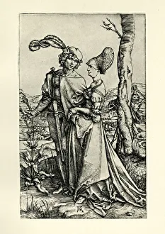
The PromenadeVintage engraving by Albrech Durer, showing The Promenade or Young Couple Threatened By Death, c.1498
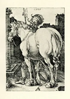
The Large HorseVintage engraving by Albrech Durer, showing The Large Horse, 1505
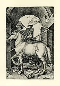
The Small HorseVintage engraving by Albrech Durer, showing The Small Horse, 1505
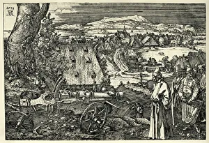
Landscape with CannonVintage engraving by Albrech Durer, showing a Landscape with Cannon, 1518
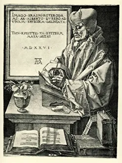
Erasmus of RotterdamVintage engraving by Albrech Durer, showing Erasmus of Rotterdam, 1526. Desiderius Erasmus Roterodamus (1466 to 1536), known as Erasmus of Rotterdam, or simply Erasmus
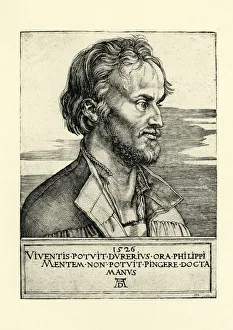
Philipp MelanchthonVintage engraving by Albrech Durer, showing Philipp Melanchthon, 1526. A German reformer, collaborator with Martin Luther, the first systematic theologian of the Protestant Reformation
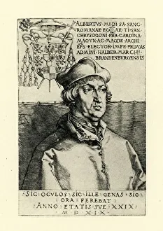
Cardinal Albrecht of BrandenburgVintage engraving by Albrech Durer, showing Cardinal Albrecht (Albert ) of Brandenburg, 1519. Cardinal Albert of Brandenburg ( Albrecht von Brandenburg) (28 June 1490 to 24 September 1545)
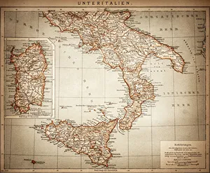
Antique Map of Lower Italy
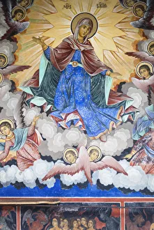
Bulgaria, Southern Mountains, DetailBulgaria, Southern Mountains, Rila, Rila Monastery, UNESCO-listed wall frescoes
Federal Cross of Meritachievement, award, bavaria, central europe, color image, concept ima, Digital Vision Vectors, 135382980
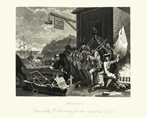
William Hogarths FranceVintage engraving by William Hogarth, France. The complementary plates England and France, first published in 1756 and republished in 1759
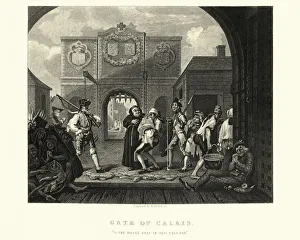
William Hogarths The Gate of CalaisVintage engraving of The Gate of Calais, or O, the Roast Beef of Old England by William Hogarth. The scene depicts a side of beef being transported from the harbour to an English tavern in the port
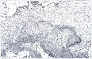
Engraving: Mountains and River Systems of EuropeEngraved illustrations of the Mountains and River Systems of Central Europe from Iconographic Encyclopedia of Science, Literature and Art, Published in 1851. Copyright has expired on this artwork
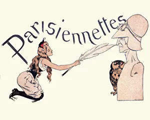
Parisiennettes Tickling the nose of the EstablishmentVintage french cartoon by H Gerbault. Parisiennettes, a young french woman Tickling the nose of the Establishment with a giant feather. 1897
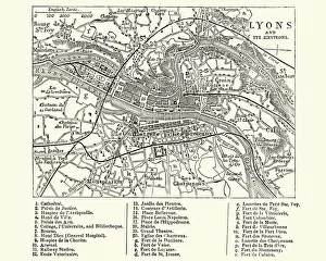
Map of Lyons, France, 19th CenturyVintage engraving of a Map of Lyons, France, 19th Century
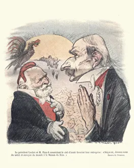
Satirical cartoon Emile Loubet President of FranceVintage engraving of a French satirical cartoon of Emile Loubet. Emile Francois Loubet was the eighth President of France
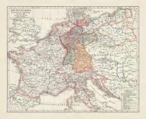
Map of Europe at the Napoleonic Wars of Liberty (1813)Map of Central Europe at the beginning of the Napoleonic Wars of Liberty in 1813. Lithograph, published in 1897
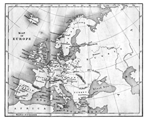
Vintage Map of Europe Mid 19th CenturyVinateg Map of Europe Mid 19th Century, circa 1850