mail_outline sales@mediastorehouse.com
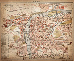
PragueAntique map of Prague from 1898
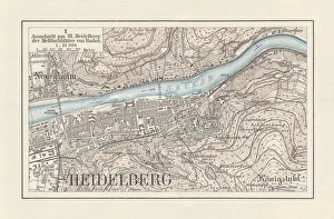
Historical city map of Heidelberg, Baden-WAOErttemberg, Germany, lithograph, published 1897Historical city map of Heidelberg, Baden-WAOErttemberg, Germany. Lithograph, published in 1897
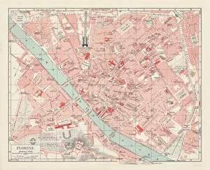
City map of Florence, Italy, lithograph, published in 1897City map of Florence - capital city of the Italian region of Tuscany. Lithograph, published in 1897
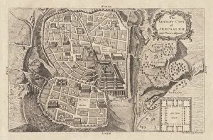
Map of the ancient Jerusalem, copperplate engraving, published in 1774Map of the ancient Jerusalem. Copperplate engraving, published in 1774
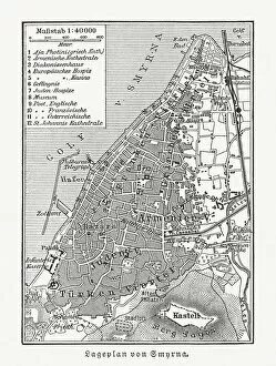
Historical city map of Smyrna (Izmir), Turkey, woodcut, published 1897Historical city map of Smyrna (Izmir), Turkey. Wood engraving, published in 1897
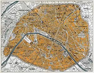
City map of Paris, lithograph, published in 1877City map of Paris, France. Lithograph, published in 1877
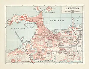
City map of Alexandria, Egypt, lithograph, published in 1897City map of Alexandria, Egypt. Lithograph, published in 1897
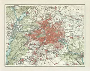
City map of Berlin and surrounding, Germany, lithograph, published 1897City map of Berlin and surrounding, capital of Germany. Lithograph, published in 1897
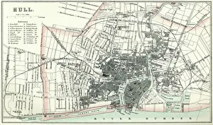
Map of HullVintage map from 1880 of Hull in the East Riding of Yorkshire, England. The city of Hull has served as market town, military supply port, trading hub, fishing and whaling centre
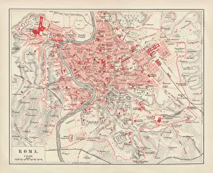
City map of Rome, lithograph, published in 1878City map of Rome, Italy. Lithograph, published in 1878
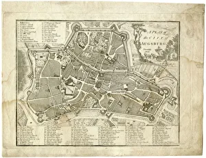
17th century city, plan of Augsburg, GermanyTypical fortifications and references. Rich in details, beautifully aged paperPublished by J. Stockdale, Piccadilly 1800
City map of ParisAntique illustration of a City map of Paris
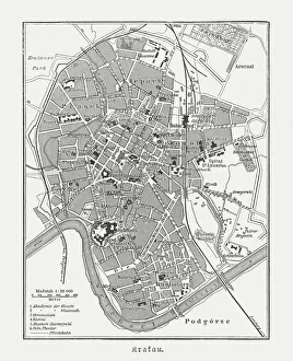
Historical city map of Krakow, Poland, wood engraving, published 1897Historical city map of Krakow, Poland. Wood engraving, published in 1897
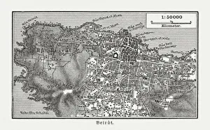
Historic city map of Beirut, Lebanon, wood engraving, published 1897Historic city map of Beirut - capital and largest city of Lebanon. Wood engraving, published in 1897
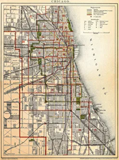
Chicago mapAntique illustration of a Chicago map
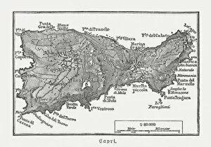
Map of Capri, Italian island, wood engraving published in 1897Map of Capri, Italian island. Wood engraving, published in 1897
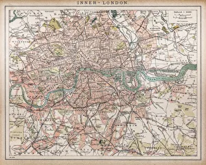
Historic map of London (18th Century)map/plan of the inner city of London from 1898
Pueblo Colorado US City Street MapVector Illustration of a City Street Map of Pueblo, Colorado, USA. Scale 1:60, 000. All source data is in the public domain. U.S
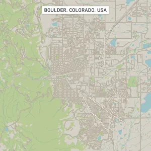
Boulder Colorado US City Street MapVector Illustration of a City Street Map of Boulder, Colorado, USA. Scale 1:60, 000. All source data is in the public domain. U.S
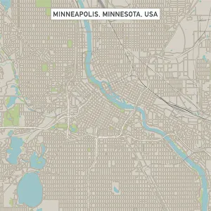
Minneapolis Minnesota US City Street MapVector Illustration of a City Street Map of Minneapolis, Minnesota, USA. Scale 1:60, 000. All source data is in the public domain. U.S
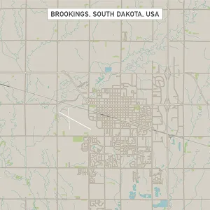
Brookings South Dakota US City Street MapVector Illustration of a City Street Map of Brookings, South Dakota, USA. Scale 1:60, 000. All source data is in the public domain. U.S
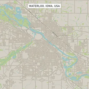
Waterloo Iowa US City Street MapVector Illustration of a City Street Map of Waterloo, Iowa, USA. Scale 1:60, 000. All source data is in the public domain. U.S
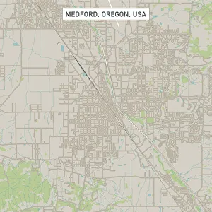
Medford Oregon US City Street MapVector Illustration of a City Street Map of Medford, Oregon, USA. Scale 1:60, 000. All source data is in the public domain. U.S
Casper Wyoming US City Street MapVector Illustration of a City Street Map of Casper, Wyoming, USA. Scale 1:60, 000. All source data is in the public domain. U.S
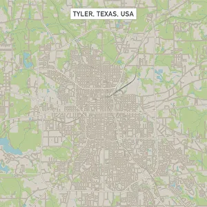
Tyler Texas US City Street MapVector Illustration of a City Street Map of Tyler, Texas, USA. Scale 1:60, 000. All source data is in the public domain. U.S
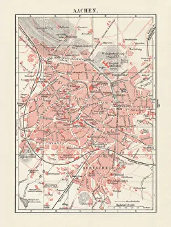
City map of Aachen, Germany, lithograph, published in 1897City map of Aachen, Germany. Lithograph, published in 1897
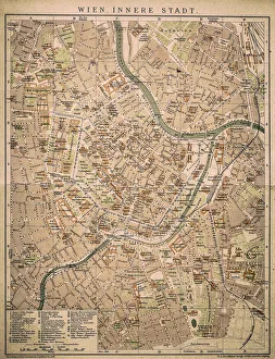
Vienna inner cityAntique map of Vienna from 1898
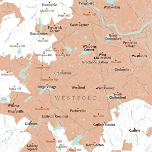
MA Middlesex Westford Vector Road Map. All source data is in the public domain. U.S. Census Bureau Census Tiger. Used Layers: areawater, linearwater, roads, rails, cousub, pointlm, uac10
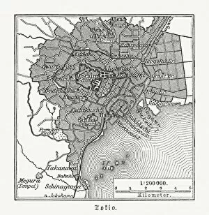
Historical city map of Tokyo, Japan, woodcut, published 1897Historical map of Tokyo, capital city of Japan. Wood engraving, published in 1897
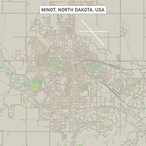
Minot North Dakota US City Street MapVector Illustration of a City Street Map of Minot, North Dakota, USA. Scale 1:60, 000. All source data is in the public domain. U.S
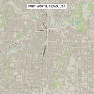
Fort Worth Texas US City Street MapVector Illustration of a City Street Map of Fort Worth, Texas, USA. Scale 1:60, 000. All source data is in the public domain. U.S
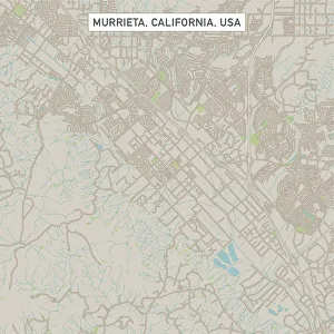
Murrieta California US City Street MapVector Illustration of a City Street Map of Murrieta, California, USA. Scale 1:60, 000. All source data is in the public domain. U.S
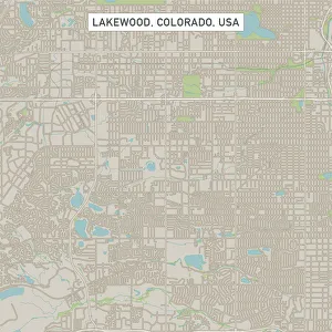
Lakewood Colorado US City Street MapVector Illustration of a City Street Map of Lakewood, Colorado, USA. Scale 1:60, 000. All source data is in the public domain. U.S
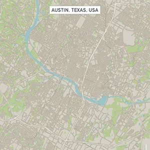
Austin Texas US City Street MapVector Illustration of a City Street Map of Austin, Texas, USA. Scale 1:60, 000. All source data is in the public domain. U.S
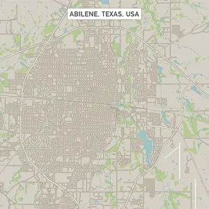
Abilene Texas US City Street MapVector Illustration of a City Street Map of Abilene, Texas, USA. Scale 1:60, 000. All source data is in the public domain. U.S
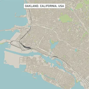
Oakland California US City Street MapVector Illustration of a City Street Map of Oakland, California, USA. Scale 1:60, 000. All source data is in the public domain. U.S
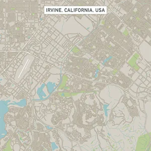
Irvine California US City Street MapVector Illustration of a City Street Map of Irvine, California, USA. Scale 1:60, 000. All source data is in the public domain. U.S
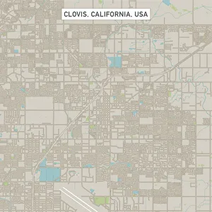
Clovis California US City Street MapVector Illustration of a City Street Map of Clovis, California, USA. Scale 1:60, 000. All source data is in the public domain. U.S
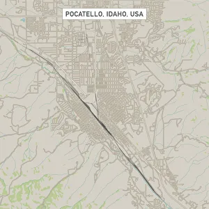
Pocatello Idaho US City Street MapVector Illustration of a City Street Map of Pocatello, Idaho, USA. Scale 1:60, 000. All source data is in the public domain. U.S
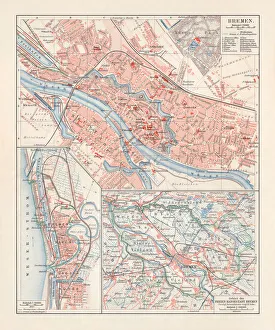
City map of Bremen, Germany, lithograph, published 1897City map of Bremen, Germany. Lithograph, published in 1897
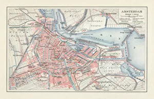
City map of Amsterdam, Netherlands, lithograph, published in 1897City map of Amsterdam, capital of the Netherlands. Lithograph, published in 1897
Brussels mapIllustration of a Brussels map
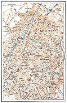
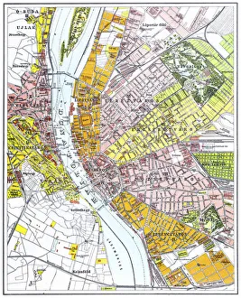
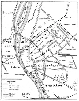
Budapest city mapIllustration of a Budapest city map
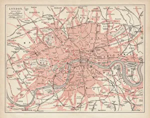
City map of London, lithograph, lithograph, published in 1877City map of London, United Kingdom. Lithograph, published in 1877
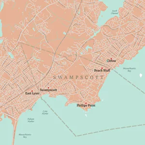
MA Essex Swampscott Vector Road Map. All source data is in the public domain. U.S. Census Bureau Census Tiger. Used Layers: areawater, linearwater, roads, rails, cousub, pointlm, uac10
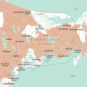
MA Barnstable Town Vector Road Map. All source data is in the public domain. U.S. Census Bureau Census Tiger. Used Layers: areawater, linearwater, roads, rails, cousub, pointlm, uac10
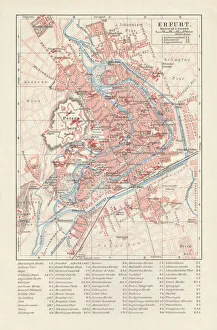
City map of Erfurt, Germany, lithograph, published in 1897City map of Erfurt with street directory, Thuringia, Germany. Lithograph, published in 1897