mail_outline sales@mediastorehouse.com
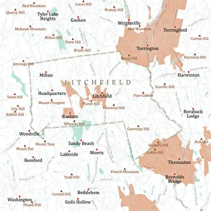
CT Litchfield Litchfield Town Vector Road Map. All source data is in the public domain. U.S. Census Bureau Census Tiger. Used Layers: areawater, linearwater, roads, rails, cousub, pointlm, uac10
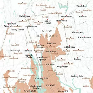
CT Litchfield New Milford Vector Road Map. All source data is in the public domain. U.S. Census Bureau Census Tiger. Used Layers: areawater, linearwater, roads, rails, cousub, pointlm, uac10
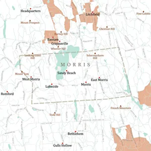
CT Litchfield Morris Vector Road Map. All source data is in the public domain. U.S. Census Bureau Census Tiger. Used Layers: areawater, linearwater, roads, rails, cousub, pointlm, uac10
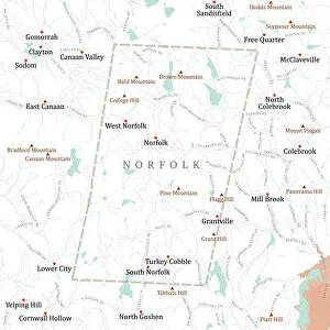
CT Litchfield Norfolk Vector Road Map. All source data is in the public domain. U.S. Census Bureau Census Tiger. Used Layers: areawater, linearwater, roads, rails, cousub, pointlm, uac10
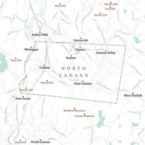
CT Litchfield North Canaan Vector Road Map. All source data is in the public domain. U.S. Census Bureau Census Tiger. Used Layers: areawater, linearwater, roads, rails, cousub, pointlm, uac10
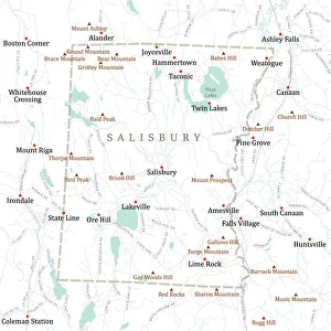
CT Litchfield Salisbury Vector Road Map. All source data is in the public domain. U.S. Census Bureau Census Tiger. Used Layers: areawater, linearwater, roads, rails, cousub, pointlm, uac10
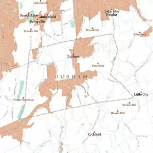
CT Middlesex Durham Vector Road Map. All source data is in the public domain. U.S. Census Bureau Census Tiger. Used Layers: areawater, linearwater, roads, rails, cousub, pointlm, uac10
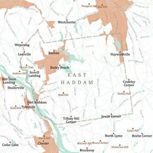
CT Middlesex East Haddam Vector Road Map. All source data is in the public domain. U.S. Census Bureau Census Tiger. Used Layers: areawater, linearwater, roads, rails, cousub, pointlm, uac10
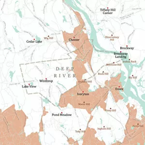
CT Middlesex Deep River Vector Road Map. All source data is in the public domain. U.S. Census Bureau Census Tiger. Used Layers: areawater, linearwater, roads, rails, cousub, pointlm, uac10
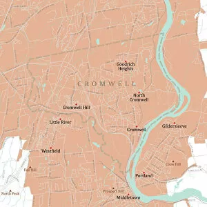
CT Middlesex Cromwell Vector Road Map. All source data is in the public domain. U.S. Census Bureau Census Tiger. Used Layers: areawater, linearwater, roads, rails, cousub, pointlm, uac10
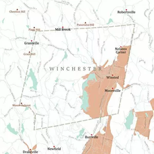
CT Litchfield Winchester Vector Road Map. All source data is in the public domain. U.S. Census Bureau Census Tiger. Used Layers: areawater, linearwater, roads, rails, cousub, pointlm, uac10
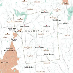
CT Litchfield Washington Vector Road Map. All source data is in the public domain. U.S. Census Bureau Census Tiger. Used Layers: areawater, linearwater, roads, rails, cousub, pointlm, uac10
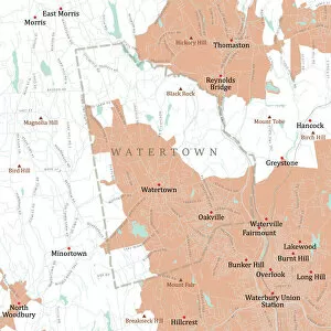
CT Litchfield Watertown Vector Road Map. All source data is in the public domain. U.S. Census Bureau Census Tiger. Used Layers: areawater, linearwater, roads, rails, cousub, pointlm, uac10
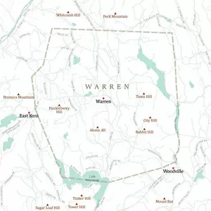
CT Litchfield Warren Vector Road Map. All source data is in the public domain. U.S. Census Bureau Census Tiger. Used Layers: areawater, linearwater, roads, rails, cousub, pointlm, uac10
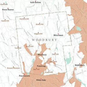
CT Litchfield Woodbury Vector Road Map. All source data is in the public domain. U.S. Census Bureau Census Tiger. Used Layers: areawater, linearwater, roads, rails, cousub, pointlm, uac10
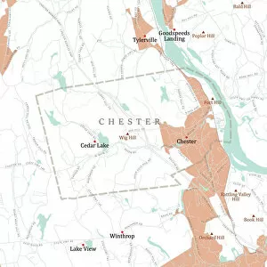
CT Middlesex Chester Vector Road Map. All source data is in the public domain. U.S. Census Bureau Census Tiger. Used Layers: areawater, linearwater, roads, rails, cousub, pointlm, uac10
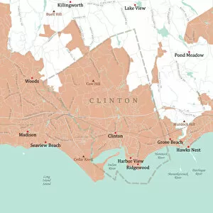
CT Middlesex Clinton Vector Road Map. All source data is in the public domain. U.S. Census Bureau Census Tiger. Used Layers: areawater, linearwater, roads, rails, cousub, pointlm, uac10
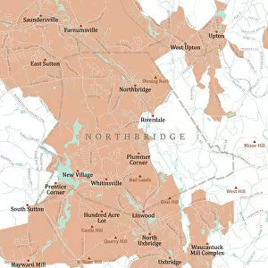
MA Worcester Northbridge Vector Road Map. All source data is in the public domain. U.S. Census Bureau Census Tiger. Used Layers: areawater, linearwater, roads, rails, cousub, pointlm, uac10
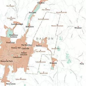
MA Berkshire Dalton Vector Road Map. All source data is in the public domain. U.S. Census Bureau Census Tiger. Used Layers: areawater, linearwater, roads, rails, cousub, pointlm, uac10
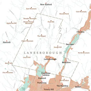
MA Berkshire Lanesborough Vector Road Map. All source data is in the public domain. U.S. Census Bureau Census Tiger. Used Layers: areawater, linearwater, roads, rails, cousub, pointlm, uac10
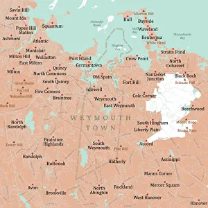
MA Norfolk Weymouth Town Vector Road Map. All source data is in the public domain. U.S. Census Bureau Census Tiger. Used Layers: areawater, linearwater, roads, rails, cousub, pointlm, uac10
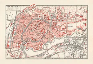
Historical city map of Strasbourg, Alsace, France, lithograph, published 1897Historical city map of Strasbourg - capital and largest city of Alsace, France. Lithograph, published in 1897
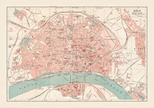
City map of Cologne, North Rhine-Westphalia, Germany, lithograph, published 1897City map of Cologne, North Rhine-Westphalia, Germany. Lithograph, published in 1897
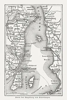
Map of Copenhagen and sourroundings, Denmark, wood engraving, published 1897Map of Copenhagen and sourroundings, Denmark. Wood engraving, published in 1897
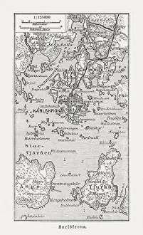
Historic map of Karlskrona and surroundings, wood engraving, published 1897Historic map of Karlskrona and surroundings. Wood engraving, published in 1897
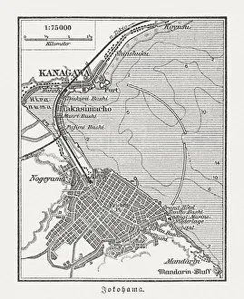
Old map of Yokohama, Japan, wood engraving, published in 1897Old map of Yokohama, Japan. Wood engraving, published in 1897
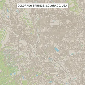
Colorado Springs Colorado US City Street MapVector Illustration of a City Street Map of Colorado Springs, Colorado, USA. Scale 1:60, 000. All source data is in the public domain. U.S
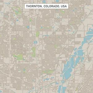
Thornton Colorado US City Street MapVector Illustration of a City Street Map of Thornton, Colorado, USA. Scale 1:60, 000. All source data is in the public domain. U.S
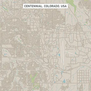
Centennial Colorado US City Street MapVector Illustration of a City Street Map of Centennial, Colorado, USA. Scale 1:60, 000. All source data is in the public domain. U.S
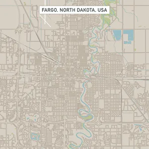
Fargo North Dakota US City Street MapVector Illustration of a City Street Map of Fargo, North Dakota, USA. Scale 1:60, 000. All source data is in the public domain. U.S
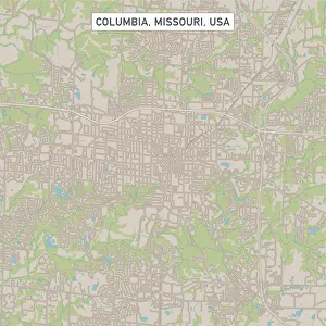
Columbia Missouri US City Street MapVector Illustration of a City Street Map of Columbia, Missouri, USA. Scale 1:60, 000. All source data is in the public domain. U.S
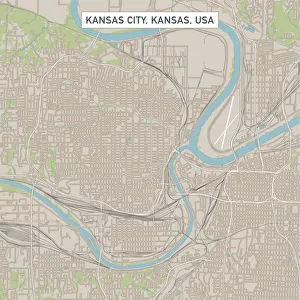
Kansas City Kansas US City Street MapVector Illustration of a City Street Map of Kansas City, Kansas, USA. Scale 1:60, 000. All source data is in the public domain. U.S
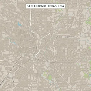
San Antonio Texas US City Street MapVector Illustration of a City Street Map of San Antonio, Texas, USA. Scale 1:60, 000. All source data is in the public domain. U.S
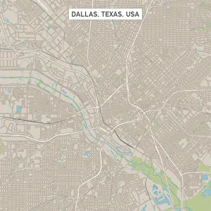
Dallas Texas US City Street MapVector Illustration of a City Street Map of Dallas, Texas, USA. Scale 1:60, 000. All source data is in the public domain. U.S
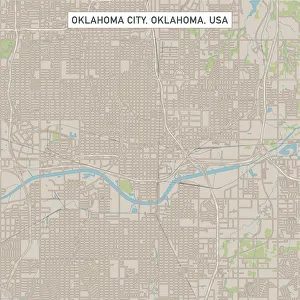
Oklahoma City Oklahoma US City Street MapVector Illustration of a City Street Map of Oklahoma City, Oklahoma, USA. Scale 1:60, 000. All source data is in the public domain. U.S
18th Century Style, Cartography, Travel, Painted Image, Antique, Engraved ImageSteel engraving from 1886 - Text in german Original edition from my own archives
18th Century Style, Painted Image, Engraved Image, Woodcut, Illustration and Painting[url=/file_closeup.php?id=11192953 t=_blank][img]/file_thumbview_approve.php?size=1&id=11192953[/img][/url] [url=/file_closeup.php?id=11193877 t=_blank][img]/file_thumbview_approve.php
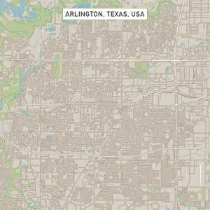
Arlington Texas US City Street MapVector Illustration of a City Street Map of Arlington, Texas, USA. Scale 1:60, 000. All source data is in the public domain. U.S
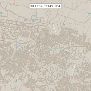
Killeen Texas US City Street MapVector Illustration of a City Street Map of Killeen, Texas, USA. Scale 1:60, 000. All source data is in the public domain. U.S
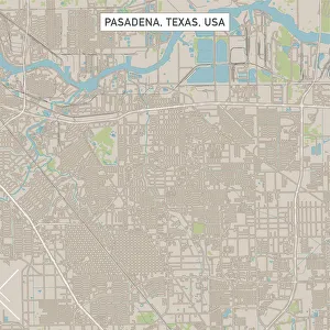
Pasadena Texas US City Street MapVector Illustration of a City Street Map of Pasadena, Texas, USA. Scale 1:60, 000. All source data is in the public domain. U.S
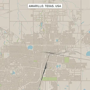
Amarillo Texas US City Street MapVector Illustration of a City Street Map of Amarillo, Texas, USA. Scale 1:60, 000. All source data is in the public domain. U.S
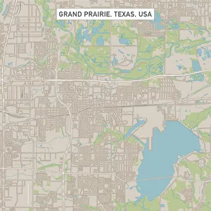
Grand Prairie Texas US City Street MapVector Illustration of a City Street Map of Grand Prairie, Texas, USA. Scale 1:60, 000. All source data is in the public domain. U.S
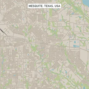
Mesquite Texas US City Street MapVector Illustration of a City Street Map of Mesquite, Texas, USA. Scale 1:60, 000. All source data is in the public domain. U.S
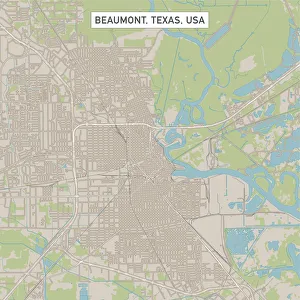
Beaumont Texas US City Street MapVector Illustration of a City Street Map of Beaumont, Texas, USA. Scale 1:60, 000. All source data is in the public domain. U.S
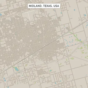
Midland Texas US City Street MapVector Illustration of a City Street Map of Midland, Texas, USA. Scale 1:60, 000. All source data is in the public domain. U.S
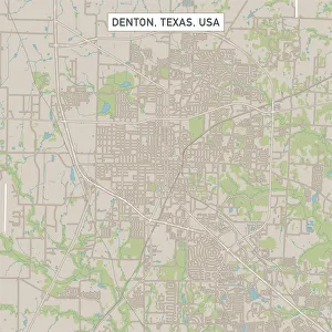
Denton Texas US City Street MapVector Illustration of a City Street Map of Denton, Texas, USA. Scale 1:60, 000. All source data is in the public domain. U.S
College Station Texas US City Street MapVector Illustration of a City Street Map of College Station, Texas, USA. Scale 1:60, 000. All source data is in the public domain. U.S