mail_outline sales@mediastorehouse.com
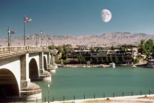
British flags on London Bridge, Lake Havasu, Arizona, USA
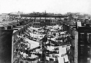
Tenements In New York CityPhotograph shows laundry drying on clotheslines in the backyards of New York City tenement slums, circa 1900. (Photo by FPG/Getty Images)
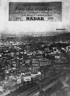
First Aerial PhotoThe first aerial photograph showing the Place de l Etoile, Paris, taken by Nadar in 1858 from an altitude of 520 meters in a tethered balloon. (Photo by Nadar/Getty Images)
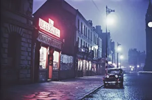
A night-time view of the Lifeboat Bar in Dublin, Eire, June 1955. Original publication: Picture Post - 7808 - Dublin - pub. 18th June 1955
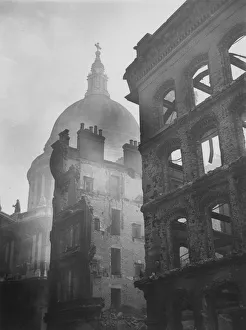
Air Raid Ruined Buildings12th May 1941: Buildings devastated during air raids near the dome of St Pauls Cathedral in the City. (Photo by Topical Press Agency/Getty Images)
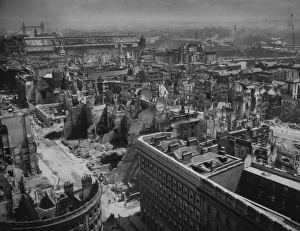
Bombed Londoncirca 1940: Bomb damage sustained by the City of London. Tower Bridge can be seen in the background. (Photo by Hulton Archive/Getty Images)
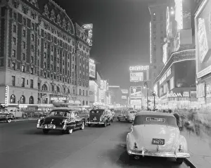
Times Square at nightUNITED STATES - CIRCA 1950s: Times Square and Broadway at night, New York City. (Photo by H. Armstrong Roberts/Retrofile/Getty Images)
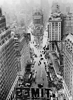
Times Square In The RainHigh-angle view looking north of rainy Times Square from the top of the Times Tower (now One Times Square) at the intersection of Broadway and Seventh Avenue at 42nd Street, New York, New York
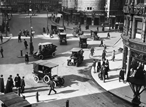
Strand Traffic London 1910May 1910: A busy junction on The Strand in London. The Gaiety Theatre is showing Our Miss Gibbs. (Photo by Hulton Archive/Getty Images)
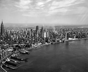
East Midtown SkylineAerial view from the East River looking west of the East Midtown Manhattan skyline, New York, New York, 1950s or 1960s. Prominant structures include the United Nations Headquarters (right)
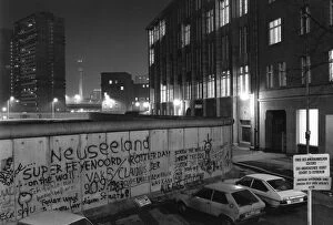
View over the Berlin Wall in 1985, towards the TV Tower at Alexanderplatz in East Berlin, at night, Berlin, Germany, Europe
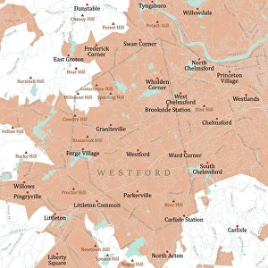
MA Middlesex Westford Vector Road Map. All source data is in the public domain. U.S. Census Bureau Census Tiger. Used Layers: areawater, linearwater, roads, rails, cousub, pointlm, uac10
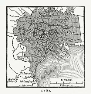
Historical city map of Tokyo, Japan, woodcut, published 1897Historical map of Tokyo, capital city of Japan. Wood engraving, published in 1897
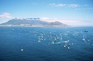
Aerial view of Sailboats - Cape to Rio Yacht RaceCape Town, Western Cape Province, South Africa
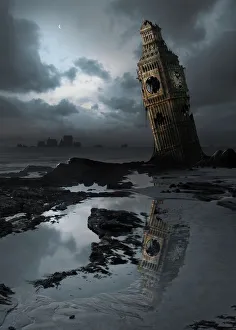
Illustration depicting global warmingGlobal warming. Computer artwork of Big Ben, London, England, flooded and in ruins, in a possible future. This is showing a rise in sea levels due to global warming
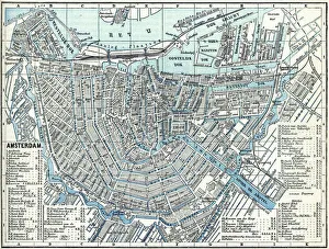
Map of city Amsterdam Netherlands from 1881 Original edition from my own archives Source : Illustriertes Konversations Lexikon 1881
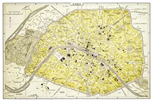
Map of Paris 1894map/plan of the city of Paris, France
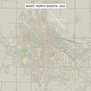
Minot North Dakota US City Street MapVector Illustration of a City Street Map of Minot, North Dakota, USA. Scale 1:60, 000. All source data is in the public domain. U.S
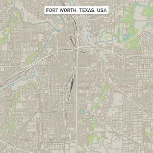
Fort Worth Texas US City Street MapVector Illustration of a City Street Map of Fort Worth, Texas, USA. Scale 1:60, 000. All source data is in the public domain. U.S
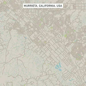
Murrieta California US City Street MapVector Illustration of a City Street Map of Murrieta, California, USA. Scale 1:60, 000. All source data is in the public domain. U.S
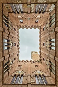
Low angle view of the Torre Del Mangia from Palazzo Pubblico Siena TuscanyLow angle view of the Torre Del Mangia and decorated windows from the interior courtyard of Palazzo Pubblico Piazza Del Campo Siena Tuscany Italy Europe
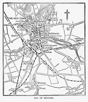
Map of the City of Bedford, England Victorian Engraving, 1840Very Rare, Beautifully Illustrated Antique Engraving of Map of the City of Bedford, England Victorian Engraving, 1840. Source: Original edition from my own archives
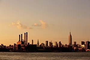
Manhattan skyline seen from Williamsburg, Brooklyn
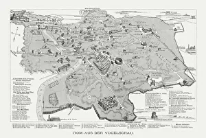
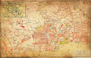
Rome in the birds eye view, published in 1878Rome in the birds eye view with the known historic buildings and places. Wood engraving, published in 1878
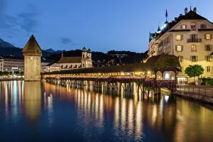
Lucerne, SwitzerlandLucerne is a city in central Switzerland, in the German-speaking portion of the country. Lucerne is the capital of the Canton of Lucerne and the capital of the district of the same name
Wroclaw city map 1895Meyers Konversations-Lexikon. Ein Nachschlagewerk des allgemeinen Wissens, 5th edition 17 volumes Bibliographisches Institut - Leipzig 1895-1897
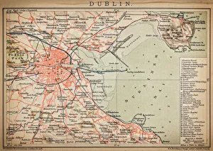
DublinAntique map of Dublin
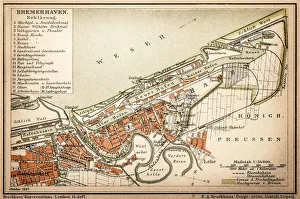
Bremerhaven is a seaport in northwestern Germany, on the North Sea coast, north of Bremen, illustration from 1898
SingaporeAntique illustration of a Republic of Singapore
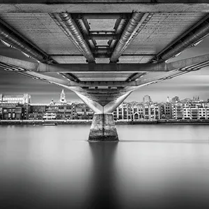
Thames walkThe Millennium Bridge, London
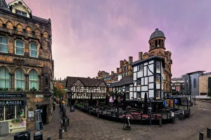
The ShamblesPastel skies over the historical architecture of Shambles Square in the middle of the city of Manchester, UK
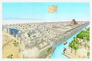
Illustration of ancient city of Babylon
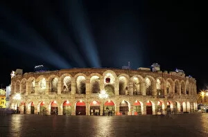
Arena of Verona illuminated at night, Italy
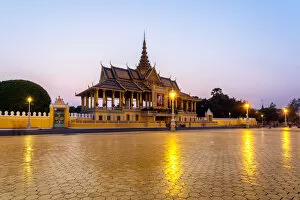
Moonlight pavilion, Royal Palace, Phnom PenhMoonlight pavilion at dusk, Royal Palace, Phnom Penh, Cambodia
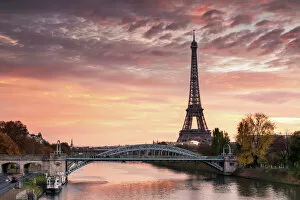
Dawn over Eiffel tower and Seine, Paris, FranceParis, Ile de France, France
Golden gate bridge, San Francisco, California, USAGolden gate bridge and bay, San Francisco, California, USA
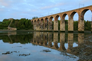
The railway viaduct at Berwick-upon-Tweed, EnglandRoyal Border Bridge: 19th Century railway viaduct reflected in the river Tweed, Berwick-upon-Tweed, UK
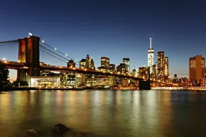
Brooklyn bridge and Manhattan at night, New York
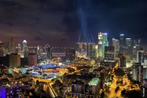
Singapore City Lights at NightSingapore Cityscape at Night
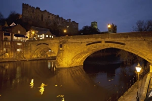
Durham Castle And Cathedral In Evening; Durham, England
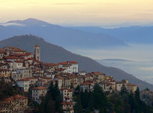
View of Sacro Monte di Varese, ItalyView of the UNESCO World Heritage listed Sacro Monte di Varese - the Sacred Mountain at Varese
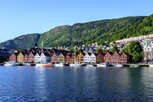
Bergen old townRegistered as World Heritage by the Unesco
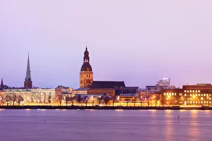
Old Riga skyline at dusk and Daugava river. Riga, Latvia
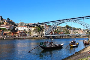
Rabelo boats and Dom Luis I bridge in Douro river, PortoDom Luis I bridge and rabelo boats from Vila Nova de Gaia. The Dom Lu's I Bridge is a double-decked metal arch bridge that spans the Douro River between the cities of Porto
Bali Rice Terraces. Sunrise rice fields of Jatiluwih at Tabanan, Bali Indonesia
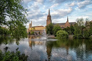
Church IxellesReflection of Saint Cross Church in Flagey area, Brussels, Belgium