mail_outline sales@mediastorehouse.com
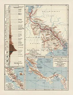
Panama Canal Project, lithograph, published in 1880Ancient map of the Panama Canal Project. Lithograph, published in 1880
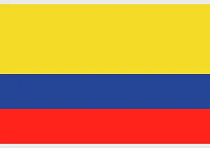
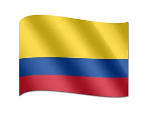
Illustration of national flag and state ensign of Colombia, a horizontal tricolor of yellow, blue and red
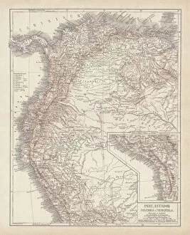
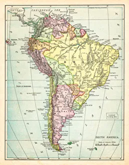
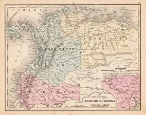
Peru, Ecuador, Colombia, Venezuela, lithograph, published in 1877Ancient map of Peru, Ecuador, Colombia, and Venezuela. Lithograph, published in 1877
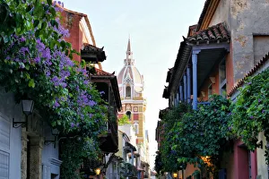
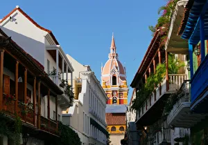
The walled city of Cartagena de IndiasCartagenas colonial walled city is an UNESCO world heritage site which attracts countless number of tourists every year
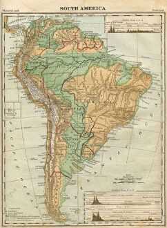
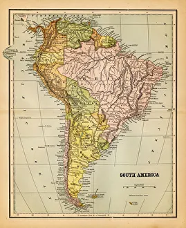
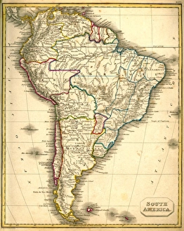
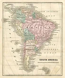
South America Map Illustration, Travel, Exploration, Antique 1871 IllustrationColor stock photo of an antique South America map illustration. Salvaged from an 1871 geography book
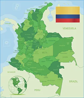
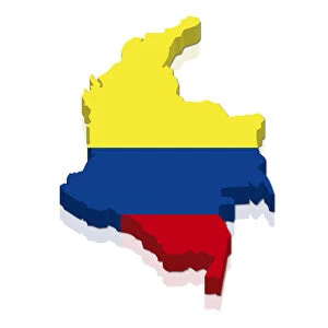
Green Map of Colombia - states, cities and flagColombia, country of northwestern South America. Its 1, 000 miles (1, 600 km) of coast to the north are bathed by the waters of the Caribbean Sea, and its 800 miles (1)
Map of South America 1895The Rand-McNally Grammar School Geography 1895 - Chicago & New York
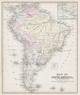
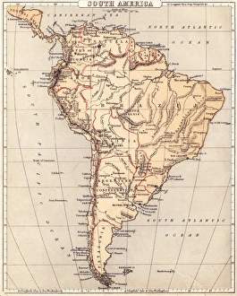
Map of South America 1877Warrens Common School Geography 1877
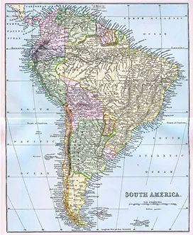
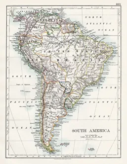
Map of South America 19th CenturyVintage map of South America from the 19th Century
old map of south americaan old south american map (1881)
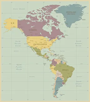
Vintage Map of North and South America534055040
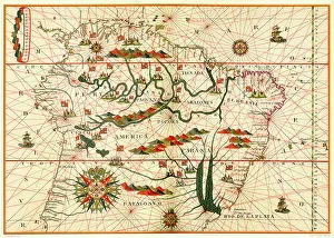
Map of South America, from a Spanish Atlas, 1582
south america 1883an old south american map (1883)
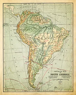
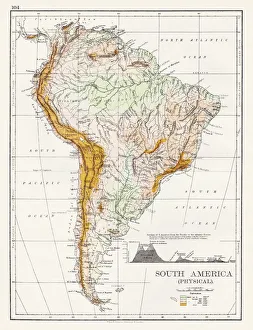
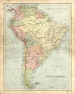
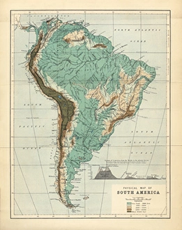
South America Physical map 1897The World-Wide Atlas of Modern Geography, Political and Physical W. & A.K. Johnston - London 1897
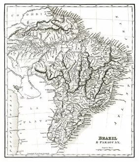
Map of Brazil and Paraguay (early 19th century steel engraving)A steel engraving of a map from the early 19th century of Brazil and Paraguay in South America, from A System of Geography, Popular and Scientific, or A Physical, Political
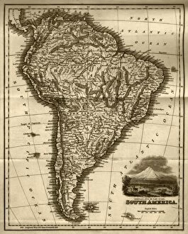
Map of South America (early 19th century steel engraving)A steel engraving of a map from the early 19th century of Brazil and Paraguay in South America, from A System of Geography, Popular and Scientific, or A Physical, Political
Antquie Map of South AmericaVintage map of South America from 1837
Antique damaged map of South America in the 19th CenturyVintage engraving of a Antique map of South America in the 19th Century, 1873
Corbis CollectionFine Art Storehouse Corbis Collection
Shape and national flag of Colombia, 3D computer graphics
South America map 1897The World-Wide Atlas of Modern Geography, Political and Physical W. & A.K. Johnston - London 1897
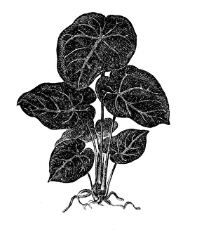
Anthurium magnificumIllustration of a Anthurium magnificum
Map of South America 1869Cornells Grammars-School Geography - S.S. Cornell - New York D. Appleton and Company 1869
Map of South America 1855System of Geography for the use of schools by Sidney E. Morse - Published by Harper & Brothers - New York 1855
Map of South America 1856Colton and Fitchs Modern School Geography by George W. Fitch - New York 1856
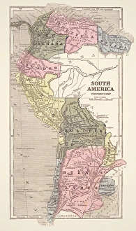
Colombia Ecuador Venezuela map 1867Mitchellas Modern Atlas - Published by E.H. Butler and Co - Philadelphia 1867
South America Physical Map, Engraving, 1892Very rare, beautifully detailed engraving of South America Physical Map, Engraving, Published in 1892. Original edition from my own archives. Copyright has expired on this artwork. Digitally restored
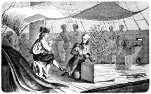
De Clie on voyages to Martinique with coffee plantsAntique illustration of a De Clie on voyages to Martinique with coffee plants
Multnomah Falls in SpringtimeMultnomah Falls at Columbia River Gorge Oregon in Spring
Colourful Weathered Wall, Cartagena, ColombiaA typical pastel coloured wall in Cartagena de Indias stunning colonial old town, a UNESCO World Heritage Site since 1984
Highly detailed hand-drawn map of Brazil within the outline of South America with a compass rose and the equator
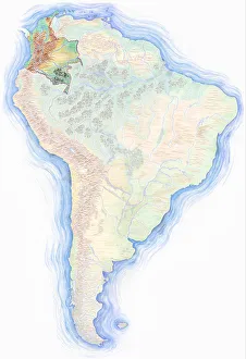
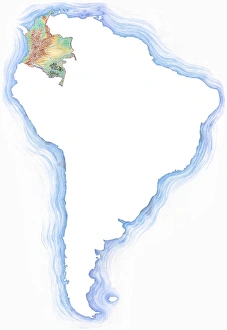
Highly detailed hand-drawn map of Colombia within the outline of South America with a compass rose and the equator
Five-spotted Longwing -Heliconius hecalesia-, native to Colombia, butterfly house, Forgaria nel Friuli, Udine province, Italy
Blue-and-Yellow Macaw or Blue-and-Gold-Macaw -Ara ararauna-, Antioquia, Colombia, South America, Latin America
Flag of Colombia
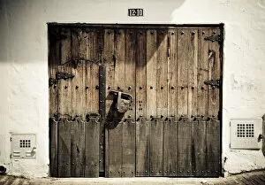
Old wooden door with a large padlock, Bogota, Colombia, South America
Scalloped Hammerhead off the remote small island of Malpelo, a UNESCO world heritage site
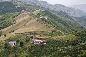
Coffee plantations in hilly landscape, Central Colombia, in the Colombian coffee growing axis (Eje Cafetero)
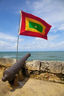
Flag of colombia over cannon on cartagena city wallartagena colombia
Cartagena old cityThe historic old city of Cartagena is a UNESCO world heritage site
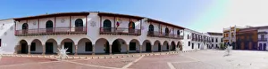
The historic centre of CartagenaCartagena is a city located in the northern coast of Colombia. Its historic centre and fortified walls have been declared a UNESCO world heritage site
Dawn of Angkor Wat, Siem Reap, CambodiaSunrise at Angkor Wat in Siem Reap, Cambodia
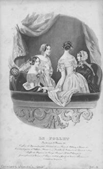
Parisian Womens FashionIllustration of womens Parisian fashion, printed in Colombian Magazine, with fashions from Le Follet, 1846 (Photo by Kean Collection/Archive Photos/Getty Images)