mail_outline sales@mediastorehouse.com
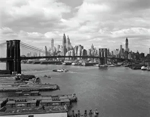
Skyline Of The Financial Section Of N. Y. The EastUNITED STATES - Circa 1950s: Skyline Of The Financial Section Of N.Y. The East River & The Brooklyn Bridge View From The Manhattan Bridge Barges Wharves Skyscrapers Piers. (Photo by H)
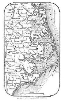
Map of Pamlico and Albemarle SoundsVintage engraving from 1863 of a map of Map of Pamlico and Albemarle Sounds at the time of the American Civil War
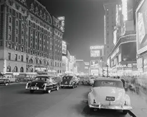
Times Square at nightUNITED STATES - CIRCA 1950s: Times Square and Broadway at night, New York City. (Photo by H. Armstrong Roberts/Retrofile/Getty Images)
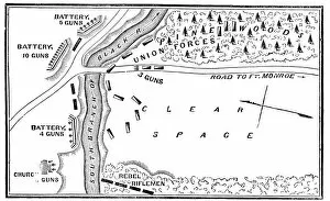
Battle of Big BethelVintage engraving from 1863 of a map of the Battle of Big Bethel also known as the Battle of Bethel Church or Great Bethel was an American Civil War battle that took place on June 10, 1861
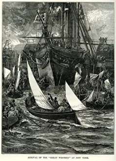
SS Great Western at New YorkVintage engraving showing the arrival of the SS Great Western at New York. SS Great Western of 1838, was an oak-hulled paddle-wheel steamship; the first purpose-built for crossing the Atlantic
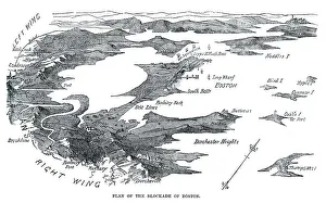
Blockade of BostonVintage engraving from 1861 showing the Plan of the Blockade of Boston during the American Revolutionary War
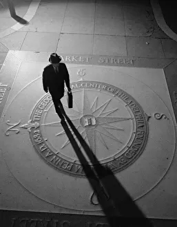
Silhouetted businessman with briefcase walking across compass in the sidewalkUNITED STATES - CIRCA 1950s: Silhouetted businessman with briefcase walking across compass in the sidewalk, elevated view, Philadelphia
Toddlers In Field Of Daisies. They Wear Fancy Clothes Dress And SuitUNITED STATES - CIRCA 1950s: Toddlers In Field Of Daisies. They Wear Fancy Clothes Dress And Suit. The Girl Holds Daisy Bouquet While The Boy Pulls Daisy Petals For Loves Me Not Game
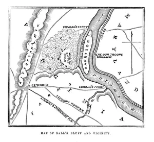
Map of Balls Bluff" Vintage engraving from 1863 of a map of Balls Bluff at the time of the American Civil War. The Battle of Balls Bluff, also known as the Battle of Harrisons Island or the Battle of Leesburg
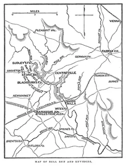
Battle of Bull RunVintage engraving from 1863 of a map of Bull Run and its environs at the time of the American Civil War. The First Battle of Bull Run
Antquie Map of the United StatesVintage map of the United States of America from 1837
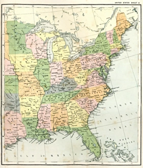
Antique Map of Eastern USAAntique Map from 1867 of Eastern United States of America
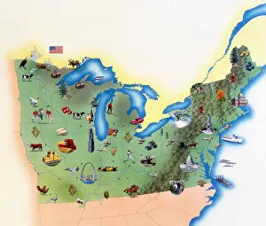
USA, Northern States of America, map with illustrations showing distinguishing features
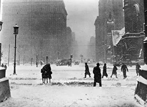
Winter street sceneUNITED STATES - CIRCA 1940s: Winter street scene in Philadelphia, pedestrians and cars at road intersection, snow falling. (Photo by H. Armstrong Roberts/Retrofile/Getty Images)
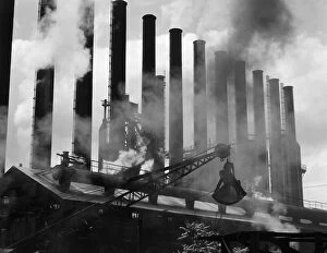
Factory smokestacksUNITED STATES - CIRCA 1930s: Steel industry, factory smokestacks, Conshohocken, Pennsylvania. (Photo by H. Armstrong Roberts/Retrofile/Getty Images)
Crowd At Coney IslandUNITED STATES - CIRCA 1940s Beach Crowd At Coney Island In Bathing Suits & Street Clothes With The Boardwalk Stores & Billboards In The Background Sunbathing (Photo by H)
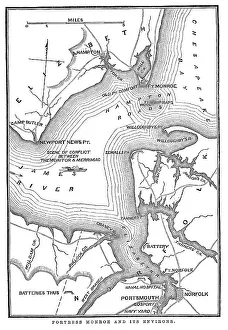
Fort Monroe and its environsVintage engraving from 1863 of a map of Fort Monroe and its environs. Fort Monroe played an important role in the American Civil War
Full moon, plane wing, sunriseFull moon, blue sky, and wing of flying plane above low golden clouds at sunrise, spring, East Coast, USA
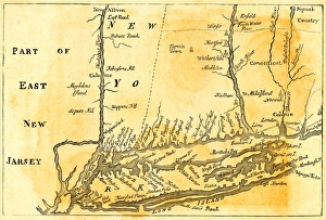
Vintage Map of New York at the beginning of the 18th Century. from 1880
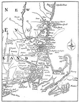
Vintage Map of New England at the beginning of the 18th century
On top of Cadillac MountainFoggy landscape of rolling clouds and fog seen from the top of Cadillac Mountain in Acadia National Park in late fall. Wet
Foggy mountain landscapeFoggy landscape of rolling fog seen on top of Cadillac Mountain in Acadia National Park in late fall. Wet lichen covered rocks in the foreground
Chalerm Burapa Chollathit Road is the scenic road. This road along the east coast of Thailand. It start from Chonburi province to Chanthaburi province
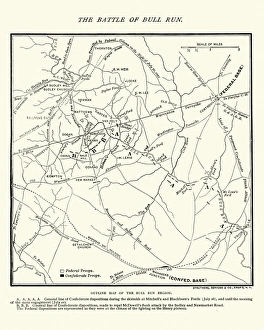
Map of the Battle of Bull RunVintage engraving of a Map of the Battle of Bull Run, The Century Magazine, 1884
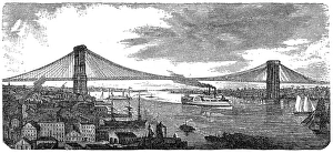
Brooklyn Bridge from 1878Illustration of a Brooklyn Bridge from 1878
Hoga Kusten - BonhamnBonhamn is a small fishermens settlement at the High Coast of Sweden. High Coast (Hoga Kusten) is on the Unesco World Heritage Site
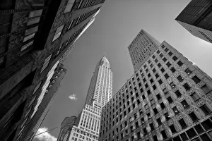
View of the Chrysler Building from 41st StreetBlack and white view of the Chrysler Building from East 41st Street, Midtown Manhattan
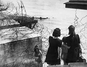
So Near1st August 1943: These two women and their children travelled all day from west Kensington, London, to the East Coast, only to find when they got there that they had to look at the sea through barbed
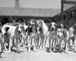
Group Of Six Hounds Facing The Camera Dogs From ThUNITED STATES - Circa 1950s: Group Of Six Hounds Facing The Camera Dogs From The Kirkwood Kennels In Berwyn Pa Eager Ready To Hunt. (Photo by H. Armstrong Roberts/Retrofile/Getty Images)
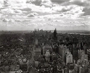
New York City Skyline Looking South To Downtown FrUNITED STATES - Circa 1930s: New York City Skyline Looking South To Downtown From Midtown Cloudy Sky Manhattan Retro. (Photo by H. Armstrong Roberts/Retrofile/Getty Images)
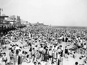
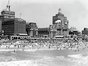
Crowded BeachUNITED STATES - CIRCA 1940s: Crowded Beach, With Ocean In The Foreground. Swimmers, Sunbathers, The Boardwalk And Old Time Hotels Are In The Background At Atlantic City. (Photo by H)
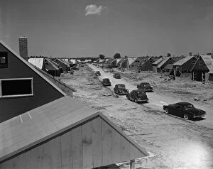
Housing developmentUNITED STATES - CIRCA 1950s: Housing development, Levittown, Pennsylvania. (Photo by H. Armstrong Roberts/Retrofile/Getty Images)
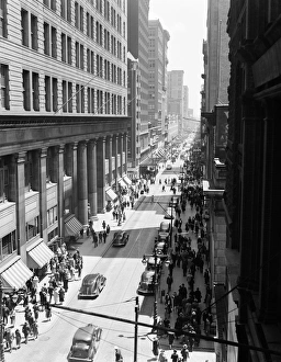
Street in PhiladelphiaUNITED STATES - CIRCA 1930s: Traffic and pedestrians on Chestnut Street, Philadelphia, aerial view. (Photo by H. Armstrong Roberts/Retrofile/Getty Images)
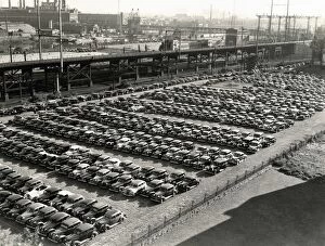
Parking lotUNITED STATES - CIRCA 1930s: Rows of cars in parking lot, aerial view, Philadelphia. (Photo by H. Armstrong Roberts/Retrofile/Getty Images)
Christmas tree in town square at night with church and other decorations in background