mail_outline sales@mediastorehouse.com
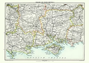
Map of South East England, Hampshire, Dorset, Wiltshire 1891Antique Map of Map of South East England, showing Hampshire, Dorset, Wiltshire, and the Isle of Wight 1891
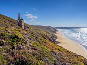
Abanoned tin mine at Wheal Coates, Cornwall, UKThis abandoned structure used to house a water pumping engine that was used in the mining process
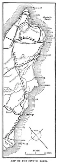
Map of the Cinque Ports (Victorian engraving)An old map of the Cinque Ports, which are five historic ports on the south-eastern corner of Kent, England. The Confederation of Cinque Ports (Cinque is pronounced asinka)
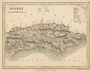
Hand coloured antique map of Sussex EnglandThis detailed map of Sussex is from Dugdales England and Wales Delineated. The map was drawn by G.Cole and engraved by John Roper for publication first in The Beauties Of England And Wales
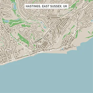
Hastings East Sussex UK City Street MapVector Illustration of a City Street Map of Hastings, East Sussex, UK. Included files are EPS (v10) and Hi-Res JPG. Data courtesy from Ordnance Survey: VectorMap District https
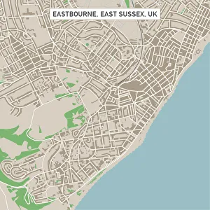
Eastbourne East Sussex UK City Street MapVector Illustration of a City Street Map of Eastbourne, East Sussex, UK. Included files are EPS (v10) and Hi-Res JPG. Data courtesy from Ordnance Survey: VectorMap District https
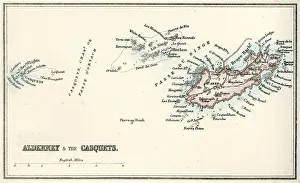
Map of Alderney and the Casquets" Vintage map from 1880 of Alderney and the Casquets. Alderney is the most northerly of the Channel Islands. It is part of the Bailiwick of Guernsey, a British Crown dependency
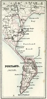
Map of Portland" Vintage map from 1880 of Portland a limestone tombolo or tied island, 6 kilometres long by 2.4 kilometres wide, in the English Channel."
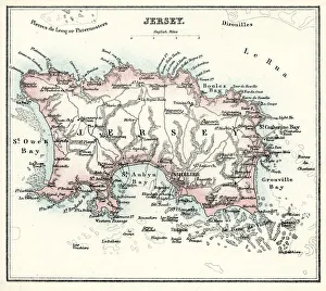
Map of Jersey" Vintage engraving from 1880 of Jersey a British Crown Dependency off the coast of Normandy, France. As well as the island of Jersey itself
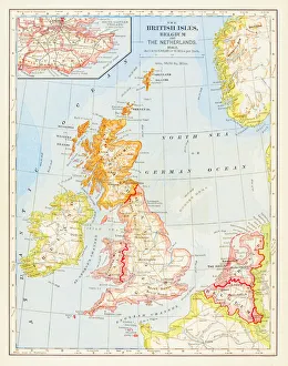
1883 British Isles Map
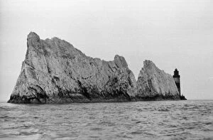
The Needles5th November 1938: One of the isolated cliff faces that form the Needles, obscuring their lighthouse off the Isle of Wight. Original Publication: Picture Post - 10 - Life In A Lighthouse - pub
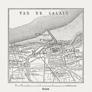
Calais, France, wood engraving, published in 1882City map of Calais, France. Wood engraving, published in 1882
Windy seaShip on a windy day
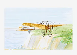
Illustration of Louis Bleriot in his aircraft Bleriot XI, crossing the English Channel, 1909
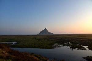
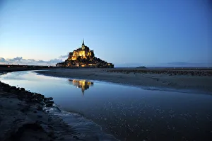
Mont saint michel island after dredging, higt tide. UNESCO world heritage place in 2015
mont saint michel bay in normandy france.Unesco world heritage with protection area
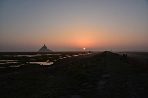
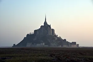
Sunrise on Mont Saint Michel Unesco wonder. Landscape taken on hiking path in 2015. Normandy, France
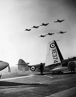
Air Trials10th October 1955: A squadron of Gannet anti-submarine aircraft fly over the HMS Ark Royal during the carrier drill and flying trials in the English Channel
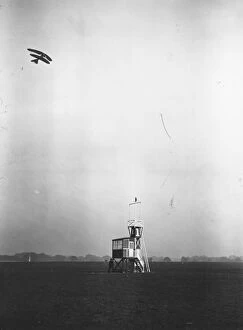
Channel Flight21st May 1914: Aviator Princess Ludwig of Lowenstein-Wertheim in the skies above Hendon, during her flight across the English Channel. (Photo by Topical Press Agency/Getty Images)
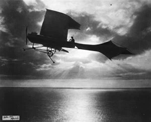
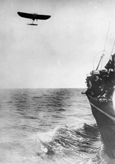
Early FlightHubert Lathams attempt to cross the Channel in his Antoinette IV monoplane. (Photo by Topical Press Agency/Getty Images)
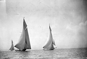
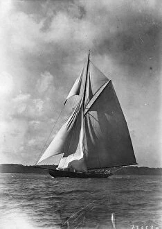
Bournemouth RegattaJuly 1924: Three yachts Britannia, Shamrock IV and White Heather at the Bournemouth Yachting Regatta. (Photo by Topical Press Agency/Getty Images)
Cowes YachtAugust 1922: R H Lees cutter Terpsichore at Cowes Yachting Week, Isle of Wight. (Photo by Topical Press Agency/Getty Images)
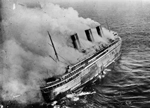
L Atlantique4th January 1933: The French liner L Atlantique is gutted by an accidental fire in the English Channel. (Photo by Topical Press Agency/Getty Images)
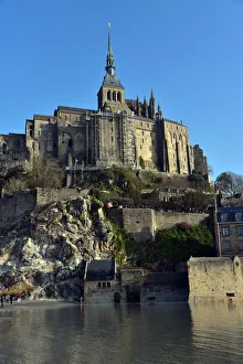
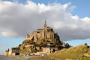
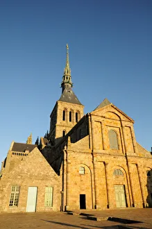
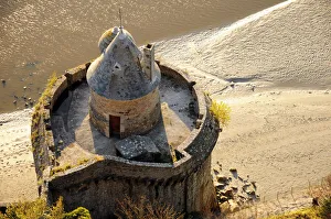
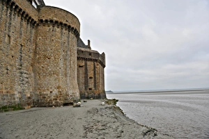
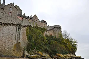
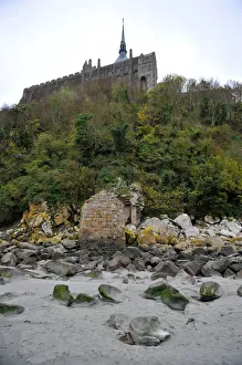
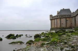
Mont Saint-Michel Normandy FranceMont Saint-Michel is an island commune in Normandy, France. It is located approximately one kilometre (0.6 miles) off the countrys northwestern coast, at the mouth of the Couesnon River near Avranches
Mont Saint-Michel Normandy FranceMont Saint-Michel is an island commune in Normandy, France. It is located approximately one kilometre (0.6 miles) off the countrys northwestern coast
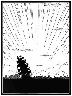
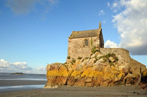
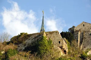
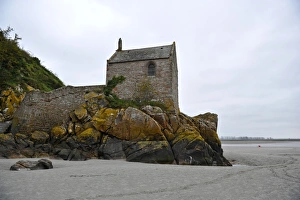
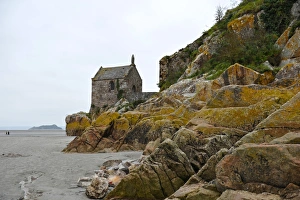
Small Chapel of Mont Saint-Michel of Normany region in FranceMont Saint-Michel is an island commune in Normandy region of Manche department in France
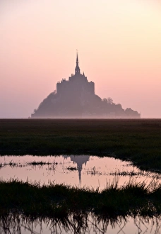
Mont Saint Michel sunrise, UNESCO wonder in Normandy, France
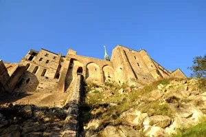
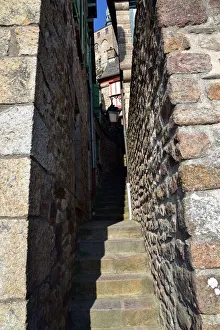
Mont saint Michel Alley for going to abbey. UNESCO heritage france
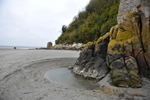
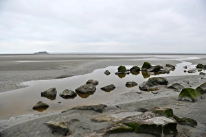
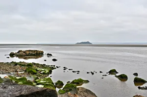
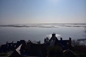
Mont saint michel bayA mont saint michel bay view taken near abbey. French wonder classifed on UNESCO heritage
Mont Saint Michel reflection on bay. UNESCO wonder heritage in France
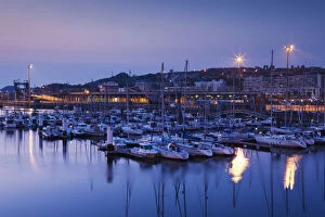
Boulogne sur Mer, France, Harbor ViewFrance, Nord-Pas de Calais Region, Pas de Calais Department, Boulogne sur Mer, Haut Ville, elevated port view, dusk
circa 1909: French Aviator Louis Bleriot, the first pilot to fly from Calais to Dover in a monoplane, flies across the English Channel. (Photo by Edwin Levick/Hulton Archive/Getty Images)