mail_outline sales@mediastorehouse.com
Panoramic view of the Mweni Valley at dawn, Drakensberg uKhahlamba National Park, Kwazulu-Natal, South AfricaThe Mweni region is a community owned portion of the Drakensberg uKhahlamba World Heritage Site. the source of the Orange river lies in this portion of the Drakensberg range
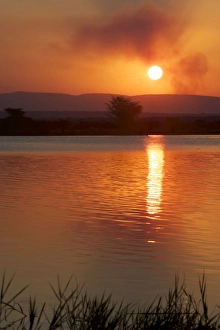
Sunset over water at Isimangaliso, Kwazulu-Natal, South Africa
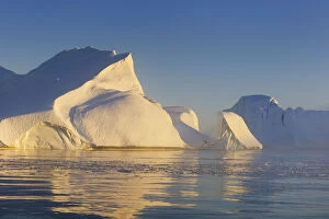
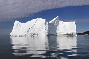
Iceberg at Disco BayA giant Iceberg, Ilulissat Icefjord, Disco Bay, World Heritage Site, Greenland
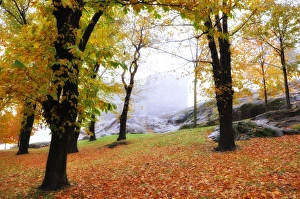
Castle in autumnCastle Sasso Corbaro and trees in autumn and fog in Bellinzona, Switzerland
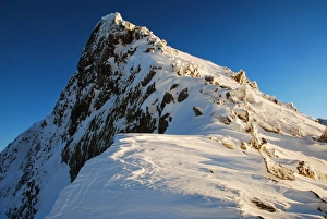
Snowcapped peak in Pirin national parkKralev dvor peak, Pirin mountain national park, UNESCO world heritage site, Europe, Bulgaria
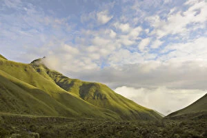
Intunja Peak with a grassy valley below, Monks Cowl, Kwazulu-Natal, South Africa
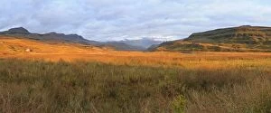
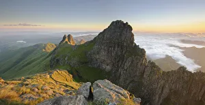
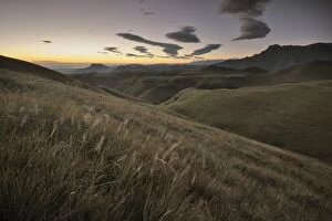
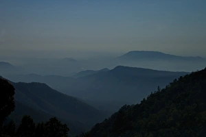
Panoramic view of mountain peak at dawn in the Drakensberg, Free State Province, South Africa
The Amphitheatre at Dawn in the Drakensberg, Witsieshoek, Kwazulu-Natal, South Africa
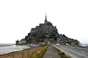
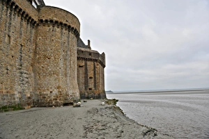
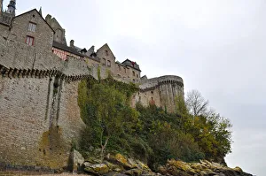
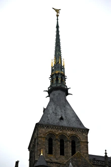
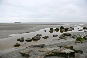
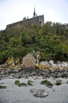
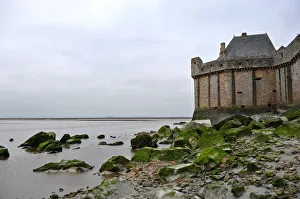
In front of Mont Saint-Michel of Normany region in FranceMont Saint-Michel is an island commune in Normandy region of Manche department in France
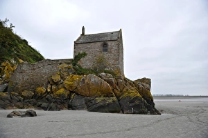
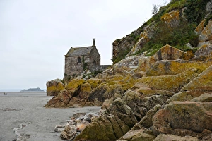
Small Chapel of Mont Saint-Michel of Normany region in FranceMont Saint-Michel is an island commune in Normandy region of Manche department in France
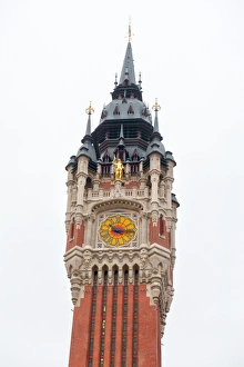
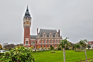
City hill of Calais in the department of Pas-de-Calais in Nord-Pas-de-Calais-Picardie region in Northern part of FranceCalais is a town at department of Pas-de-Calais in Nord-Pas-de-Calais-Picardie region in Northern part of France
Statue of archange Saint Michel at Mont Saint-Michel of Normany region in FranceMont Saint-Michel is an island commune in Normandy region of Manche department in France
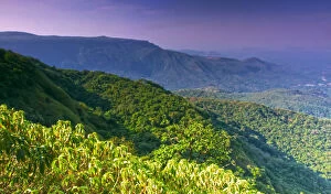
Western Ghats covered in dense forests
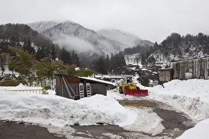
Extreme WeatherShirakawa Village, Ono District, Japan - January 22, 2012: Heavy snowfall area. Snow covered mountain tops hidden in the clouds
View of Blue MountainsNilgiri hills (Blue Mountains) through the haziness
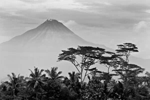
The Beating Heart of JavaGunung or Mount Merapi seen from the world heritage sight of Borobodur in central Java, Indonesia
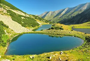
Crystal clear blue lakes in a mountaiPirin mountain national park, UNESCO world heritage site, Europe
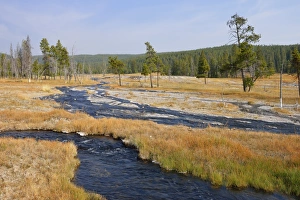
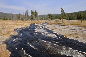
Small stream at Firehole Lake Drive, autumnUNESCO World Heritage Site. Firehole Lake Drive, Yellowstone National Park, Wyoming, USA, North America
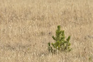
Small coniferous tree in autumn coloured grassYellowstone National Park, Wyoming, USA, North America
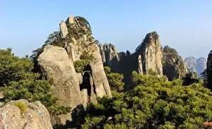
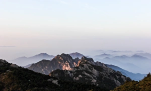
Scenic view of Mount Huangshan (Yellow Mountain or Mt. Huangshan), Anhui Province, ChinaHuangshan ( Yellow Mountains) is a mountain range in southern Anhui province in eastern China.The area is well known for its scenery, sunsets, peculiarly-shaped granite peaks, Huangshan Pine trees
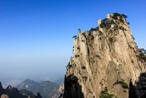
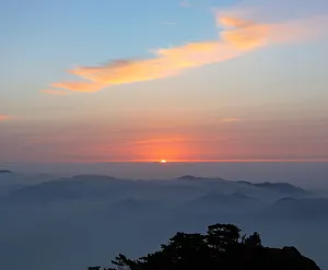
Sunrise above Mount Huangshan (Yellow Mountain or Mt. Huangshan), Anhui Province, China
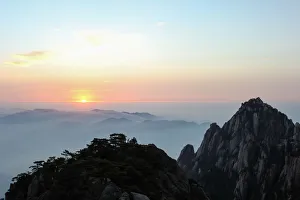
Fog rolling over Mount Huangshan (Yellow Mountain or Mt. Huangshan), Anhui Province, China
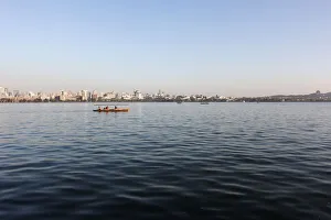
Boat sailing on the West lake, Hangzhou, China
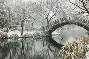
Snowscape of wooden arch bridge over pond in Maojiabu village, Hangzhou, Zhejiang, ChinaMaojiabu village is located in the west of the West Lake.Maojiabu scenic areas rich in architectural forms, mostly built near the water
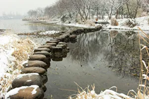
Snowscape of a stone path on the West Lake in Maojiabu village, Hangzhou, Zhejiang, ChinaA stone path on the West Lake in snow, Hangzhou, Zhejiang, Chhina
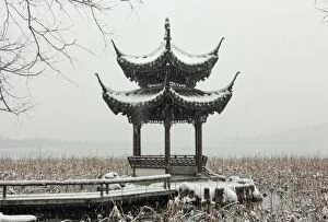
Scenic view of a pavilion by the West Lake in snow, Hangzhou, ChinaScenic view of a pavilion by the West Lake in snow, Hangzhou, Zhejiang, China
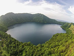
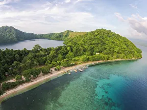
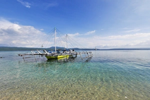
Satonda Island SumbawaSatonda island was formed by volcanic eruption on the sea floor at a depth of 1000 meters, and thrust upwards some millions of years ago
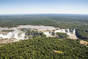
Aerial view of Iguazu Waterfalls, on the border between Argentina and Brazil. And surrounding Iguazu National Park rainforest. UNESCO World Heritage Site
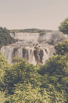
IguaAzu Waterfalls, brazilian sideIguaAzu Waterfalls, view from Brazil. IguaAzu National Park. UNESCO World Heritage Site. Edited in vintage matte tones
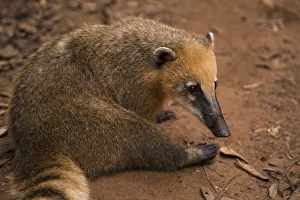
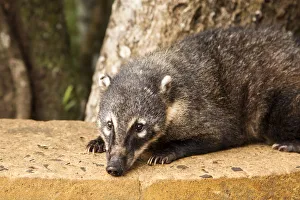
Coati on Iguazu Falls National Park, ArgentinaCoati on Iguazu National Park, Misiones, Argentina. UNESCO World Heritage Site
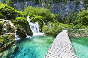
National Park Plitvice Lakes, CroatiaUnesco World Heritage Site, National Park, Plitvice Lakes, Croatia