
Friesland Collection

Background imageFriesland Collection: Northern Friesland (Nordfriesland), and islands, Schleswig-Holstein, Germany, lithograph

Northern Friesland (Nordfriesland), and islands, Schleswig-Holstein, Germany, lithograph, published 1887
North Frisian Islands and Northern Friesland (Nordfriesland), the northernmost district of Germany, part of the state of Schleswig-Holstein. Lithograph, published in 1887

Background imageFriesland Collection: Map of the Netherlands, lithograph, published in 1877

Map of the Netherlands, lithograph, published in 1877
Map of the Netherlands. Lithograph, published in 1877

Background imageFriesland Collection: Map of Schleswig-Holstein, northernmost state of Germany, lithograph, published 1887

Map of Schleswig-Holstein, northernmost state of Germany, lithograph, published 1887
Map of Schleswig-Holstein, northernmost state of Germany. Lithograph, published in 1887

Background imageFriesland Collection: On the Hallig Oland in the North Frisian Wadden Sea, North Sea, Friesland, Germany

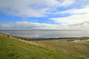
On the Hallig Oland in the North Frisian Wadden Sea, North Sea, Friesland, Germany, photo from 1895, Historic
1900s, 19th-century, 2 people, black, black-and-white, black-white, building, buildings, coast, coastal, coastal area, coastal areas, coastal landscape, coastal region, coastal scene, coastlines

Background imageFriesland Collection: Tidbit, Man in uniform sitting at a table in a barracks room eating a whole herring, Friesland

Tidbit, Man in uniform sitting at a table in a barracks room eating a whole herring, Friesland, Germany, Historic
1900s, 19th-century, 2 people, adults, animal feed, animal feeds, auf, black, black-and-white, black-white, clupeidae, contemporary, depiction, depictions, digital, digitally, dish, dishes, drawing

Background imageFriesland Collection: Taken back by the sea

Taken back by the sea
Old remains of human activity slowly taken back by the Waddensea

Background imageFriesland Collection: Grand Duchy of Oldenburg, litograph, published in 1877

Grand Duchy of Oldenburg, litograph, published in 1877
Ancient map of Grand Duchy of Oldenburg, Germany. Lithograph, published in 1877

Background imageFriesland Collection: Kniepsand sand bank and lighthouse, Amrum, North Frisia, Schleswig-Holstein, Germany, Europe

Kniepsand sand bank and lighthouse, Amrum, North Frisia, Schleswig-Holstein, Germany, Europe

Background imageFriesland Collection: Intertidal mudflats, north beach, Husum, North Friesland, Schleswig-Holstein, Germany, Europe

Intertidal mudflats, north beach, Husum, North Friesland, Schleswig-Holstein, Germany, Europe

Background imageFriesland Collection: Sheep on the Nordstrand dyke of Husum, North Friesland, Schleswig-Holstein, Germany, Europe

Sheep on the Nordstrand dyke of Husum, North Friesland, Schleswig-Holstein, Germany, Europe

Background imageFriesland Collection: Sheep on the fortified beach on the Hamburger Hallig holm, North Friesland, Schleswig-Holstein

Sheep on the fortified beach on the Hamburger Hallig holm, North Friesland, Schleswig-Holstein, Germany, Europe

Background imageFriesland Collection: Common Gull (Larus canus)

Common Gull (Larus canus)

Background imageFriesland Collection: Cart wheel on a clinker brick facade in East Friesland, Lower Saxony, Germany, Europe

Cart wheel on a clinker brick facade in East Friesland, Lower Saxony, Germany, Europe

Background imageFriesland Collection: Old wagon wheel on a facade, brick stone, East Frisia, Lower Saxony, Germany, Europe

Old wagon wheel on a facade, brick stone, East Frisia, Lower Saxony, Germany, Europe

Background imageFriesland Collection: Stilt houses and beach, St Peter-Ording, Schleswig-Holstein, Germany

Stilt houses and beach, St Peter-Ording, Schleswig-Holstein, Germany

Background imageFriesland Collection: Salt meadows, Westerheversand, Westerhever, Eiderstedt, North Frisia, Schleswig-Holstein, Germany

Salt meadows, Westerheversand, Westerhever, Eiderstedt, North Frisia, Schleswig-Holstein, Germany

Background imageFriesland Collection: Bridge and salt meadows, Westerheversand, Westerhever, Eiderstedt, North Frisia

Bridge and salt meadows, Westerheversand, Westerhever, Eiderstedt, North Frisia, Schleswig-Holstein, Germany

Background imageFriesland Collection: Konik horses, Lauwersmeer National Park, Friesland, Netherlands, Europe

Konik horses, Lauwersmeer National Park, Friesland, Netherlands, Europe

Background imageFriesland Collection: List West Lighthouse, Ellenbogen, near List, Sylt, Schleswig-Holstein, Germany

List West Lighthouse, Ellenbogen, near List, Sylt, Schleswig-Holstein, Germany

Background imageFriesland Collection: Rotes Kliff Lighthouse, near Kampen, Sylt, Schleswig-Holstein, Germany

Rotes Kliff Lighthouse, near Kampen, Sylt, Schleswig-Holstein, Germany

Background imageFriesland Collection: West Sylt lighthouse, Sylt, Schleswig-Holstein, Germany

West Sylt lighthouse, Sylt, Schleswig-Holstein, Germany

Background imageFriesland Collection: Remnants of human activity in tidal coastal area at Dutch northcoast

Remnants of human activity in tidal coastal area at Dutch northcoast
Tidal and coastal area at Dutch northcoast with row of wooden poles showing human activity somewhere in the past with the aim to gain land from the sea

Background imageFriesland Collection: Beach, marker posts and a buoy, St Peter-Ording, Schleswig-Holstein, Germany

Beach, marker posts and a buoy, St Peter-Ording, Schleswig-Holstein, Germany

Background imageFriesland Collection: View of the Waddensea from the dyke in Vlieland

View of the Waddensea from the dyke in Vlieland
Vlieland, one of the Frisian islands of the Netherlands. The view towards the Waddensea

Background imageFriesland Collection: Rescue hut on Vlieland (Friesland, Netherlands)

Rescue hut on Vlieland (Friesland, Netherlands)
The western half of the island of Vlieland consists of the deserted sands of the Vliehors. It is nicknamed The Sahara of the north. For the most part military training area

Background imageFriesland Collection: Low tide on the Wadden island Vlieland

Low tide on the Wadden island Vlieland
The Waddensea as seen from Vlieland, one of the Wadden islands in the Netherlands. In 2009 The Wadden sea was added to the Unesco World heritage list

Background imageFriesland Collection: The pier looks like a piece of art on Vlieland

The pier looks like a piece of art on Vlieland
This pier looks like a piece of art on Vlieland, Netherlands. It is the jetty for the small ferry to the other wadden island Texel

Background imageFriesland Collection: Moody Dutch northcoast

Moody Dutch northcoast
Remains of human activity in the mud at the northcoast of the Netherlands during moody and dark circumstances

Background imageFriesland Collection: Reflecting the remants of human activity along the Waddensea in the Netherlands

Reflecting the remants of human activity along the Waddensea in the Netherlands
Reflection of a row of wooden poles during sunrise in a tidal environment along the Dutch northcoast

Background imageFriesland Collection: View over grasses, poles en tidal flats of the Wadden sea at Dutch Northcoast

View over grasses, poles en tidal flats of the Wadden sea at Dutch Northcoast
Endless view over the protected nature reserve of the Wadden sea along the northcoast of the Netherlands. In the foreground remnants of human acitivity can be seen (the row of wooden poles)


All Professionally Made to Order for Quick Shipping