mail_outline sales@mediastorehouse.com
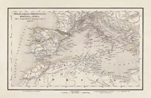
Roman Republic and Carthage during the Second Punic War (218-201-BC)Ancient map of the Roman Republic and Carthage during the Second Punic War (218 to 201 BC). Legend in Latin language. Steel engraving with hand colored borderlines, published in 1861
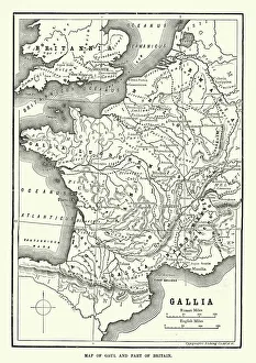
Map of Ancient Gaul (France)Vintage engraving of a Map of Ancient Gaul (France)
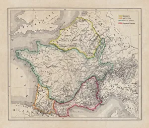
Gaul in the time of Julius Caesar, published in 1867Gaul in the time of Roman politican Gaius Iulius Caesar (100 - 44 BC). Steel engraving with hand-colored borderlines and Latin legend, published in 1867
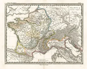
Antique Map of GaulAntique Map from 1862 of Gaul at the time of Julius Caesar. The Roman proconsul and general Julius Caesar pushed his army into Gaul in 58 BC
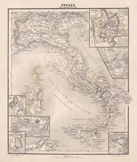
Ancent Italy, c. 450 BC, steel engraving, published in 1861The territory of Italy around 450 BC with separate maps of Rome, Roman Forum, surrounding area of Rome, Syracuse, Carthage and surrounding area of Pompeji and Naples. Legend in Latin language
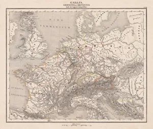
Ancient Europe under Emporer Augstus (63 BC-14 AD), published 1861Ancient map of Gaul, Germania and Britannia during the time of the first Roman Emporer Augstus (63 BC - 14 AD). Legend in Latin language. Steel engraving with colored borderlines, published in 1861
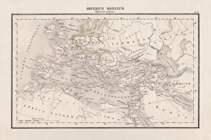
Roman Empire with provinces (115-117 AD), steel engraving, published 1861The Roman Empire and its provinces at the time of its greatest extent under Emperor Trajan in the years 115-117 AD. Legend in Latin language