mail_outline sales@mediastorehouse.com
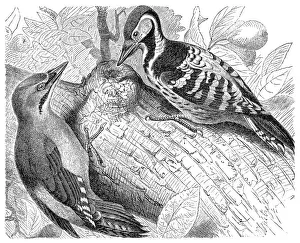
Grey-headed and White-backed WoodpeckerIllustration of a Grey-headed and White-backed Woodpecker
Henry VI, Holy Roman EmperorIllustration of a Henry VI, Holy Roman Emperor
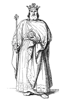
Lothair III, Holy Roman EmperorIllustration of a Lothair III, Holy Roman Emperor
Frederick II, Holy Roman EmperorIllustration of a Frederick II, Holy Roman Emperor
Philip of SwabiaIllustration of a Philip of Swabia
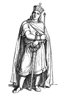
Henry V, Holy Roman EmperorIllustration of a Henry V, Holy Roman Emperor
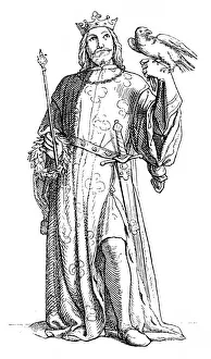
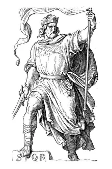
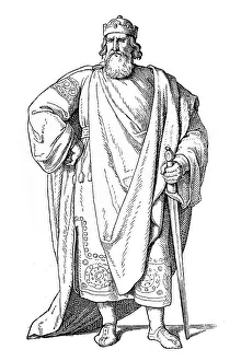
Arnulf of CarinthiaIllustration of a Arnulf of Carinthia
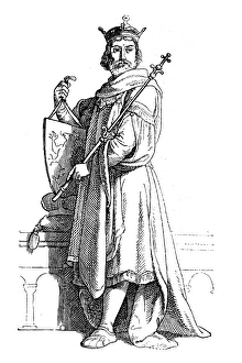
Henry IV, Holy Roman Emperorillustration of a Henry IV, Holy Roman Emperor
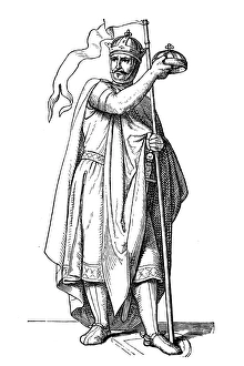
Louis the PiousIllustration of a Louis the Pious
Henry III, Holy Roman Emperorillustration of a Henry III, Holy Roman Emperor
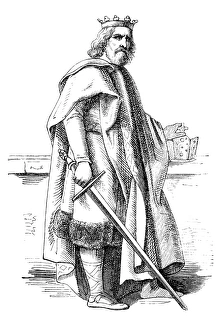
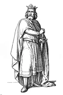
Charles the FatIllustration of a Charles the Fat
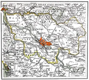
Bremen and BremerhavenIllustration of a Bremen and Bremerhaven
German Reich mapIllustration of a German Reich map
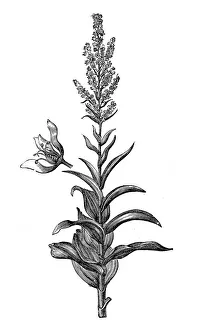
Veratrum album (false helleborine, white hellebore, European white hellebore, or white veratrum)Illustration of a Veratrum album (false helleborine, white hellebore, European white hellebore, or white veratrum)
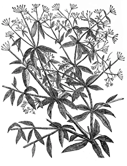
Rubia tinctorum or common madderIllustration of a Rubia tinctorum or common madder
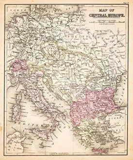
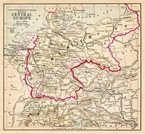
Map of Central Europe 1883Warrens Common School Geography
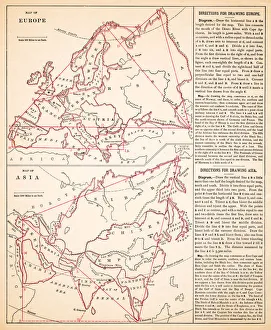
Map of Europe and asia 1883Warrens Common School Geography
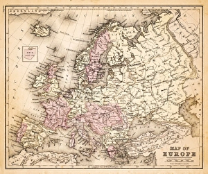
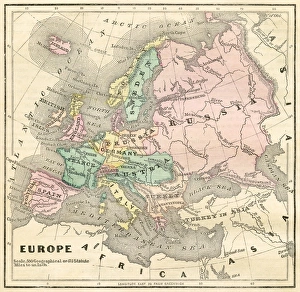
Map of Europe 1883Warrens Common School Geography
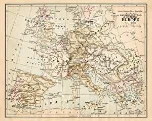
Central Europe map 1881Coltons Common School Geography 1881 New York Sheldon and Co
Europe map 1881Coltons Common School Geography 1881 New York Sheldon and Co
Map of Europe 1856Colton and Fitchs Modern School Geography by George W. Fitch - New York 1856
Portrait of a northern gannet on Helgoland, GermanyPortrait of a northern gannet (morus bassanus or sula bassana) on Helgoland, a small island in the German Bight, North Sea.The first breeding pair of gannets came to this island in 1991
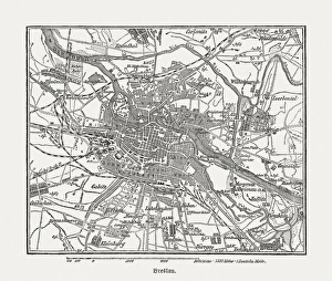
Breslau (Wrocaw, Poland), wood engraving, published in 1882Breslau (formerly German Empire), today Wrocaw, Poland. Wood engraving, published in 1882
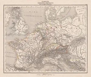
Ancient Europe under Emporer Augstus (63 BC-14 AD), published 1861Ancient map of Gaul, Germania and Britannia during the time of the first Roman Emporer Augstus (63 BC - 14 AD). Legend in Latin language. Steel engraving with colored borderlines, published in 1861
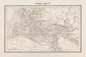
Roman Empire with provinces (115-117 AD), steel engraving, published 1861The Roman Empire and its provinces at the time of its greatest extent under Emperor Trajan in the years 115-117 AD. Legend in Latin language
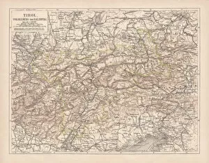
Tirol, Vorarlberg and Salzburg in Austria, lithograph, published in 1878Ancient map of Tirol, Vorarlberg and Salzburg in Austria. Lithograph, published in 1878
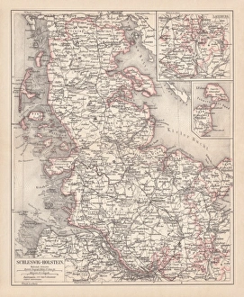
Schleswig-Holstein, lithograph, published in 1878Map of Schleswig-Holstein. Lithograph, published in 1878
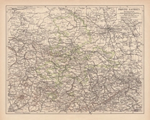
Province of Saxony, lithograph, published in 1878Province of Saxony, former territory of Prussia from 1816 to 1945. Lithograph, published in 1878
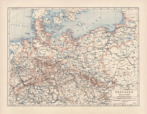
Prussia, lithograph, lithograph, published in 1878The Kingdom of Prussia at its greatest extent, after 1866. Lithograph, published in 1878
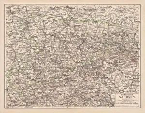
Kingdom of Saxony, lithograph, published in 1878Kingdom of Saxony. Lithograph, published in 1878
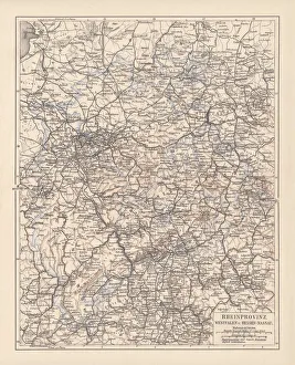
Prussian provinces, lithograph, published in 1878Prussian provinces: Rhineland, Westphalia, and Hesse-Nassau. Lithograph, published in 1878
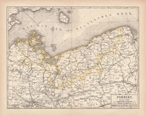
Pomerania, lithograph, lithograph, published in 1878Pomerania, former territory of the German Empire. Lithograph, published in 1878
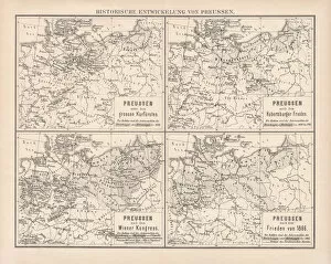
Historical development of Prussia, lithograph, published in 1878Ancient maps of the historical development of Prussia, 17th - 19th century. Lithograph, published in 1878
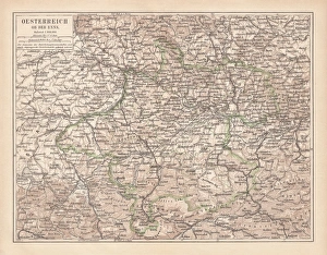
Upper Austria, lithograph, published in 1877Upper Austria (Austria above the Enns, A-sterreich ob der Enns). Lithograph, published in 1877
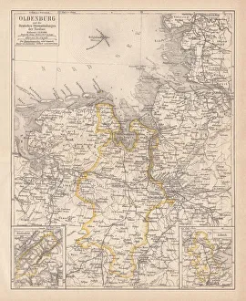
Grand Duchy of Oldenburg, litograph, published in 1877Ancient map of Grand Duchy of Oldenburg, Germany. Lithograph, published in 1877
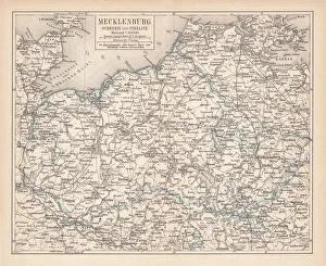
Ancient map of Mecklenburg, lithograph, published in 1877Ancient map of Mecklenburg, Germany. Lithograph, published in 1877
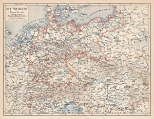
German Empire of 1871-1918, lithograph, published in 1875German Empire within the borders of 1871 - 1918. Lithograph, published in 1875
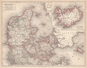
Map of Denmark and Iceland, lithograph, published in 1875Map of Denmark and Iceland. Lithograph, published in 1875
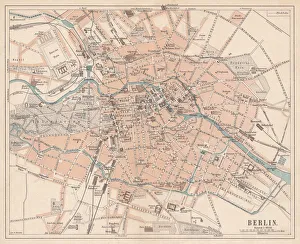
Berlin, city map, lithograph, published in 1874Historic city map of Berlin, Germany. Lithograph, published in 1874
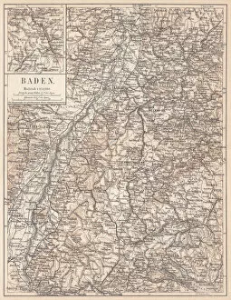
Historical German territory of Baden, lithograph, published in 1874Map of Baden - a historical German territory (today Baden-Wurttemberg). Lithograph, published in 1874
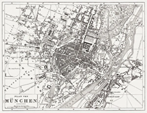
City map of Munich, wood engraving, published in 1854City map of Munich, Germany. Woodcut engraving, published in 1854
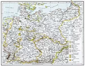
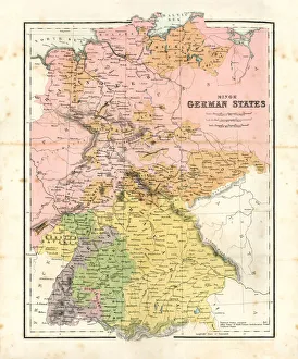
Antique map of Minor German StatesAntique map of the Minor German States from 1864
Antique Germany MapGermany Map, - Antique style. Includes mountains and water bodies. High detail - vector illustration
Berlin Cathedral Church beside Spree RiverTonnaja Travel Photography, 647553104
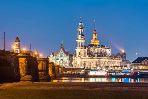
The historical landmark of Dresden, GermanyThe photo include Katholische Hofkirche and Hausmannsturm
Statue of King Johann from Zwinger frameTonnaja Travel Photography, 647553150
Foggy morning with snowy mountain in GermanyThis photo was taken in the morning time near St. Coloman, Germany
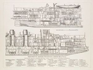
Spanish battleship section 1896Spanish battleship longitudinal section