mail_outline sales@mediastorehouse.com
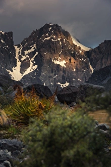
Mount Cook national park, New zealand
Mystery Train25th March 1932: Hikers waiting on Paddington station for a train to take them to a mystery hiking destination. (Photo by Douglas Miller/Topical Press Agency/Getty Images)
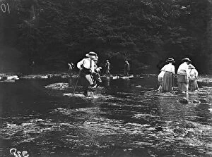
Crossing RiverAugust 1911: After attending a Northern Counties Otter Hounds Fair, a group of people cross a river in the countryside. (Photo by Topical Press Agency/Getty Images)
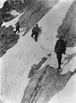
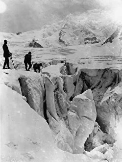
Crevasse CrossersDecember 1910: Three mountaineers crossing a crevsasse on the Pers Glacier in the Alps. (Photo by Topical Press Agency/Getty Images)
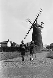
Out Walking29th March 1948: Two young hikers out for a walk near Wray Windmill, Surrey. (Photo by J. A. Hampton/Topical Press Agency/Getty Images)
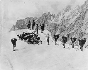
Ski Trekking1923: Cross-country ski trekkers climbing to Faulhorn in Switzerland. (Photo by Topical Press Agency/Getty Images)
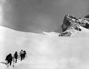
Himalayan TrekMay 1913: Sherpas ascend the Sher-pi-gang glacier in the Himalayas. (Photo by Topical Press Agency/Getty Images)
Crevasse CrossingDecember 1910: Three mountaineers crossing a crevsasse on the Pers Glacier in the Alps. (Photo by Topical Press Agency/Getty Images)
View of dolomites in a clear summer dayShot taken during a hiking tour along Alta Via (Dolomite High Route), a long high level public footpath which runs through the eastern Dolomites in northern Italy
View of Marmolada mountain in ItalyMarmolada is the highest mountain of the Dolomites, northern Italy, with sheer cliffs and a flat glacier on the north side
Typical landscape of Pale di San Martino DolomitesShot taken during a hiking tour in the Dolomites, which since 2009 have been declared a United Nations World Heritage Site for their variety of spectacular vertical forms such as pinnacles
Peaks of DolomitesShot taken at about 2.700 meters above sea level during a hiking tour along Pale di San Martino, a rocky mountain range in the Dolomites, Trentino, northern Italy
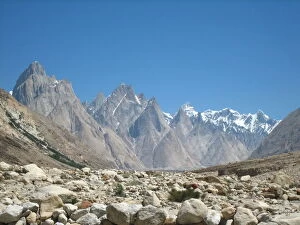
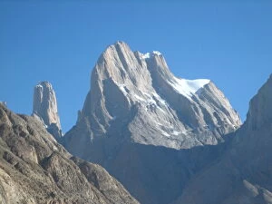
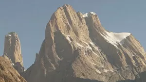
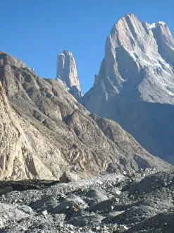
Trango towers in Karakorum rangeThe Trango Towers are a group of granite cliffs located in the northern part of the Baltoro Glacier in Baltistan, a region in northern Pakistan. Part of the Karakoram mountain range
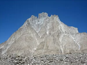
Trango Castle in Karakorum rangeTrango Castle (5, 753 m). The Trango Towers are a group of granite cliffs located in the northern part of the Baltoro Glacier in Baltistan, a region in northern Pakistan
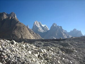
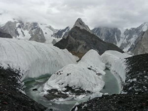
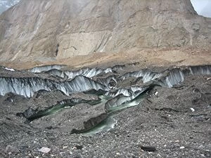
Trango glacier in Karakorum rangeTrango Glacier is a glacier in the Baltoro Muztagh range of the Karakoram in Baltistan, Gilgit-Baltistan, Pakistan. It flows from north to south on the west side of the Trango Towers
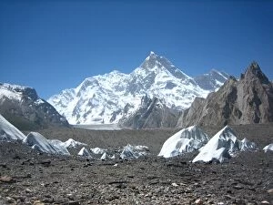
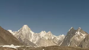
Masherbrum peak from Baltoro glacier in Karakorum rangeMasherbrum (also known as K1) is located in the Ghanche District, Gilgit Baltistan of Pakistan. At 7, 821 metres (25, 659 ft)
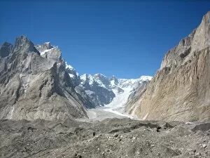
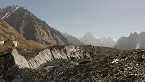
Baltoro glacier with Gasherbrum IV in the background, Karakorum RangeBaltoro Glacier trekking is one of the best treks in the world. The trekking starts from the village of Askole, walking along the Baltoro Glacier to reach Concordia
Gasherbrum IV peak in from Baltoro glacier, in Karakorum rangeGasherbrum IV is the 17th highest mountain on Earth and the 6th highest in Pakistan. It is one of the peaks in the Gasherbrum massif
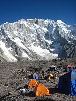
Goro II campsite in Baltoro glacierGoro II, camp on rocks and ice in center of Baltoro glacier. Baltoro Glacier trekking is one of the best treks in the world
Masherbrum peak in Karakorum range from Baltoro glacierMasherbrum (also known as K1) is located in the Ghanche District, Gilgit Baltistan of Pakistan. At 7, 821 metres (25, 659 ft)
Baltoro glacier in Karakorum rangeBaltoro glacier near Concordia camp site in Karakorum range. The Baltoro Glacier, 57 kilometers long, is one of the longest glaciers in the world outside the regions polares.1 is located in
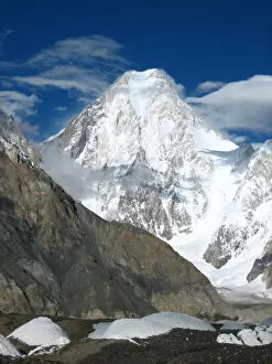
Broad Peak mountain from Concordia camp siteBroad Peak is the 12th highest mountain in the world at 8, 051 metres (26, 414 ft) above sea level. Broad Peak is part of the Gasherbrum massif in Baltistan on the border of Pakistan and China
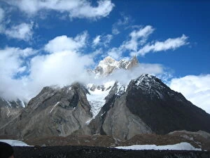
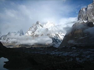
New Cristal Peak and Marble Peak in clouds from Concordia camp site in Karakorum rangeNew Cristal Peak and Marble Peak in clouds from Concordia camp site. Concordia is the name for the confluence of the mighty Baltoro Glacier and the Godwin-Austen Glacier
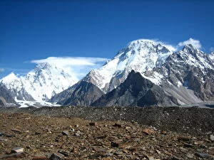
View of K2 and Broad Peak mountains from ConcordiaBroad Peak is the 12th highest mountain in the world at 8, 051 metres (26, 414 ft) above sea level. Broad Peak is part of the Gasherbrum massif in Baltistan on the border of Pakistan and China
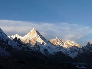
Gasherbrum IV peak in Karakorum rangeGasherbrum IV is the 17th highest mountain on Earth and the 6th highest in Pakistan. It is one of the peaks in the Gasherbrum massif
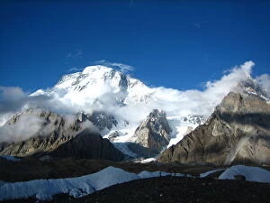
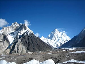
New Cristal Peak, Marble Peak and K2 mountains from Concordia camp siteNew Cristal Peak, Marble Peak (at the left side of the picture) and K2 mountain (in the right center of the picture) from Concordia camp site
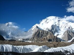
K2 and Broad Peak mountains from Concordia camp site in Karakorum rangeView of K2 (at the left side of the picture) and Broad Peak (at the right side) mountains from Concordia camp site in Karakorum range
Baltoro Glacier in Karakorum rangeThe Baltoro Glacier, 57 kilometers long, is one of the longest glaciers in the world outside the polar regions. It is located in Baltistan, within the territories of northern Pakistan
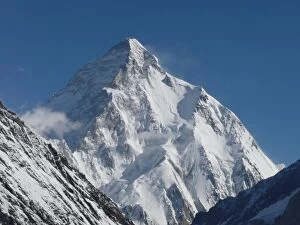
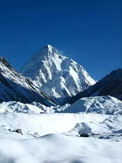
K2 mountain in Karakoram RangeK2 (or Chogori) is the second-highest mountain on Earth (after Mount Everest). With a peak elevation of 8.611 metres (28, 251 ft), K2 is part of the Karakoram range
K2 mountain from Concordia in Karakoram RangeK2 (or Chogori) is the second-highest mountain on Earth (after Mount Everest). With a peak elevation of 8.611 metres (28, 251 ft), K2 is part of the Karakoram range
Trango towers and Thunmo Cathedral under cloudsPicture taken in Urdukas camp site, in the Baltoro trekking, Pakistan. In the background, Thunmo Cathedral (5866 m asl) and Trango towers under clouds on Baltoro Glacier, Northern Areas Pakistan
Landscape near Askole in Karakorum mountain rangeLandscape in Askole mountain village in Karakorum mountain range, Baltistan region, Pakistan. Askole village is the beginning of trekking through the Baltoro Glacier
Mountains and cloudsPirin mountain national park, UNESCO world heritage site, Europe, Bulgaria
Barren moonscape of South Crater on the Tongariro Alpine Crossing in New ZealandThe Tongariro Alpine Crossing, a tramping track in Tongariro National Park, is one of the most popular day hikes in New Zealand
Blue Lake on the Tongariro Alpine Crossing in New ZealandThe Tongariro Alpine Crossing, a tramping track in Tongariro National Park, is one of the most popular day hikes in New Zealand
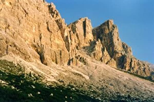
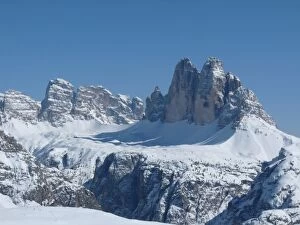
Tre Cime di Lavaredo in winterNorth Face (view from StrudelKopf)
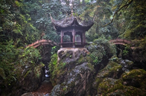
Niuxin PavilionEarly morning at a misty Niuxin Pavilion, close to the Qingyin Pavilion. This pavilion can be seen early on one of the routes up Mount Emei
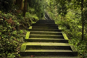
Emei Shan TrailThe many mossy steps that lead up through a lush forest to the summit of Mount Emei
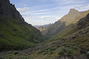
High angle looking down Rockeries valley in the Drakensberg, Kwazulu-Natal, South AfricaRoyal Natal, Drakensberg Ukhahlamba National Park is a UNESCO world heritage site. It is one of the more popular attractions in Kwazulu-Natal. Offering many trails that can be hiked by the adventurous
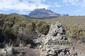
Trekking, sign, route to Kibo Hut, near the Horombo Huts, Mt Mawenzi at back, Marangu Route, Mt. Kilimanjaro, Tanzania, East Africa, Africa
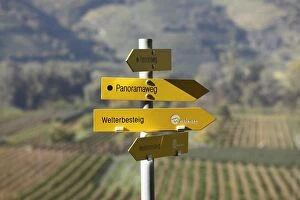
Signpost, hiking trails, Panoramaweg, German for panoramic path and Welterbesteig trail, Rossatz, Wachau valley, Mostviertel region, Lower Austria, Austria, Europe
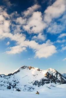
Little hut in winter mountains, Pirin, BulgariaSnowcapped Kamenitza peak 2822m and Tevno ezero shelter at winter, Pirin mountain national park, Europe, Bulgaria
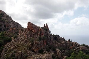
Corsica mountain PianaCalanque de Piana in Corsica island. Pink mountain classifed by UNESCO