mail_outline sales@mediastorehouse.com
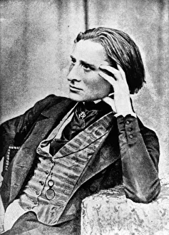
Franz Liszt at 30 Years of AgeHungarian composer Franz Liszt (1811 - 1886) at the age of 30. Original Artwork: Reproduced from a daguerreotype, the first commercially successful photographic process
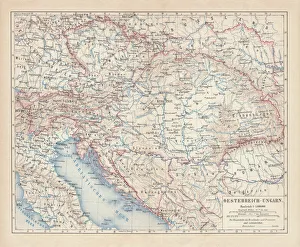
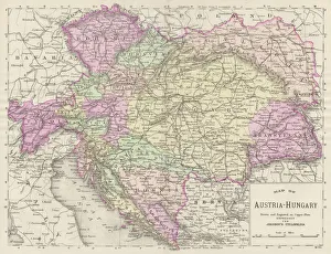
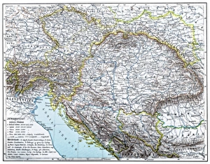
Austro-Hungarian Empire, Habsburg Monarchy, lithograph, published in 1877Ancient map of Austro-Hungarian Empire. Habsburg Monarchy. Lithograph, published in 1877
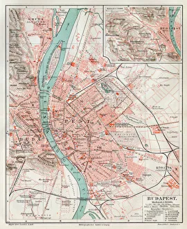
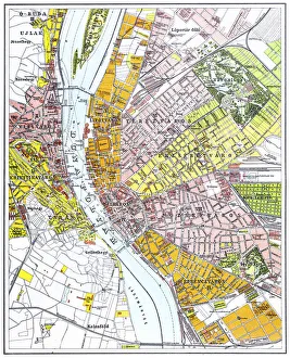
Budapest city map 1895Meyers Konversations-Lexikon. Ein Nachschlagewerk des allgemeinen Wissens, 5th edition 17 volumes Bibliographisches Institut - Leipzig 1895-1897
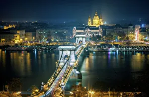
Budapest - Chain Bridge by NightThe Chain Bridge stands out against the night sky in Budapest
Austria Hungary map 1893Johnsonas Universal Cyclopedia - Charles Kendall - New York 1893
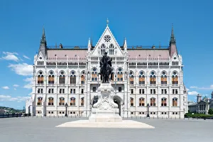
House of Parliament in Budapest, HungaryTonnaja Travel Photography, 617919680
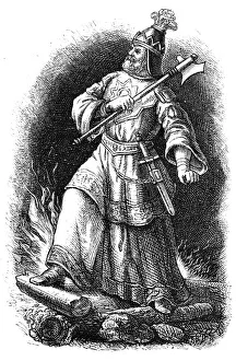
Attila, King of the HunsIllustration of Attila, King of the Huns
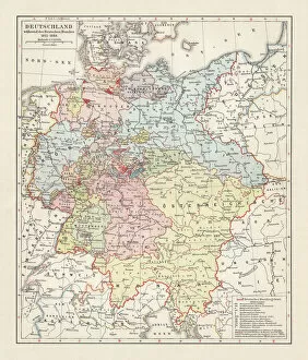
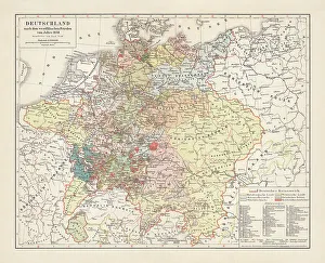
Map of the German Confederation (1815-1866), lithograph, published in 1897Map of the German Confederation between 1815 and 1866. Lithograph, published in 1897
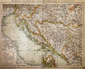
Bosnia, dalmatia, istria, croatia, slavoniaAntique illustration of a Bosnia, dalmatia, istria, croatia, slavonia map
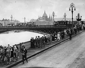
Budapest 1930s City Scenecirca 1930: Pedestrians make their way along the wooden sidewalks and trams cross a river bridge in the bustling city of Budapest, Hungary
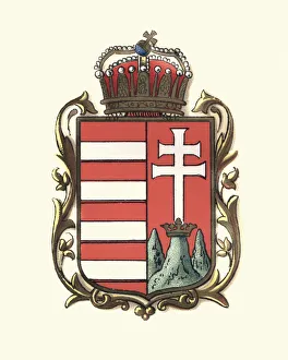
Coat of Arms of Hungary, 1898
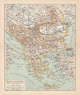
Balkan Peninsula in 1878, lithographAncient map Balkan. The political classification of the Balkan Peninsula after the Treaty of Berlin in 1878. Lithograph, published in 1878
Budapest parliament at Sunrise time, Budapest, Hungary
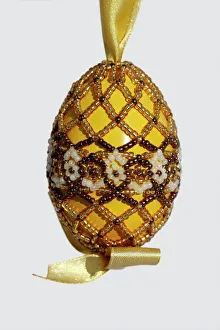
Easter Egg decorated with beads, folklore, traditional Hungarian
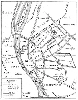
Budapest city mapIllustration of a Budapest city map
Fishermans Bastion and Matthias Church
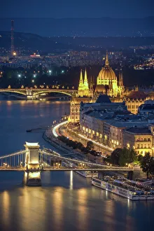
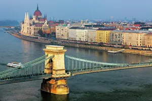
Budapest - Danube ArchitectureWarm sunlight spotlights the Chain Bridge and the Hungarian Parliament Building against a blue sky and Danube River
Illustration of civil and state flag of Hungary, a horizontal tricolor of red, white and green
Hoopoe -Upupa epops-, adult with prey approaching its nest cavity, Kiskunsag National Park, Hungary
European roller -Coracias garrulus- in flight with prey, grass snake -Natrix natrix-, Kiskunsag National Park, Hungary
European roller -Coracias garrulus- departing from its nist cave, Kiskunsag National Park, Hungary
Budapest parliament building, HungaryThe Hungarian Parliament Building from the Danube in Budapest
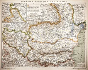
Balkan StatesMap of Rumania, Bulgaria, Serbia, Montenegro
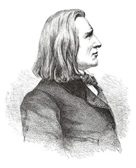
Engraving of composer Franz Liszt from 1882http://farm5.static.flickr.com/4110/4948325162_1323a54a89.jpg
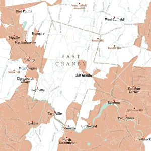
CT Hartford East Granby Vector Road Map. All source data is in the public domain. U.S. Census Bureau Census Tiger. Used Layers: areawater, linearwater, roads, rails, cousub, pointlm, uac10
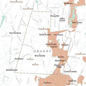
CT Hartford Granby Vector Road Map. All source data is in the public domain. U.S. Census Bureau Census Tiger. Used Layers: areawater, linearwater, roads, rails, cousub, pointlm, uac10
Hungarian parliament building, BudapestThe Hungarian Parliament Building lies in Lajos Kossuth Square, on the bank of the Danube. It is currently the largest building in Hungary and still the tallest building in Budapest
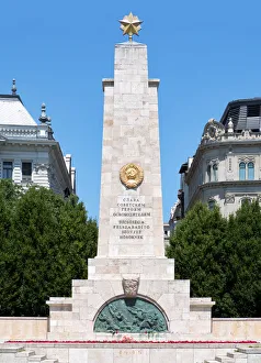
The Soviet War Memorial in Budapest, HungaryWWII memorial to the Soviet Red Army, in Freedom Square, Budapest, Hungary
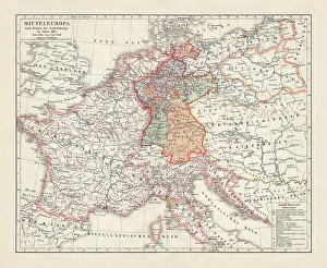
Map of Europe at the Napoleonic Wars of Liberty (1813)Map of Central Europe at the beginning of the Napoleonic Wars of Liberty in 1813. Lithograph, published in 1897
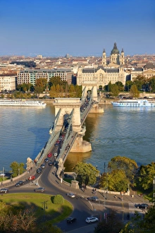
View across the Danube to Pest from the Buda Castle Hill, with the Szechenyi lanchid, or Szechenyi Chain Bridge, Budapest, Hungary
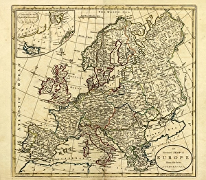
Antique Map of Europe, 1785An accurate map of Europe from the best authorities. London: C. Dilly & G. Robinson: 1785. Original size: 35.7 x 37.4 cm. Coloured, Inset: Spitsbergen, East and West Greenland, and Iceland
Map of Germany, after the Peace of Westphalia in 1648. Lithograph, published in 1897
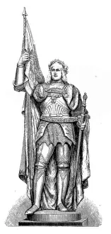
Albert III, Duke of SaxonyIllustration of a Albert III, Duke of Saxony
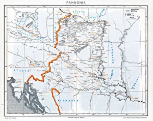
Pannonia is an ancient country of southern Europe that was south and west of the Danube River, in present-day Austria, Hungary, Slovenia, and Croatia
Austro-Hungarian Monarchy map from 1896illustration of a Austro-Hungarian Monarchy map from 1896
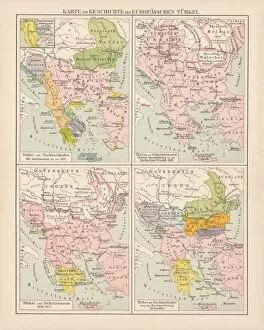
Ottoman Empire, 14th-19th century, lithograph, published in 1878Ancient map of the history of European Turkey, 15th - 19th century. Lithograph, published in 1878
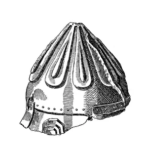
Eger Dobo Istvan helmetAntique illustration of a Eger Dobo Istvan helmet
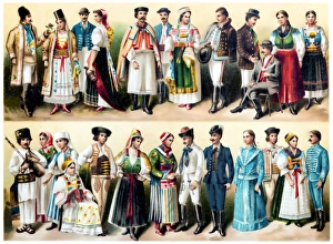
Hungarian national costumesIllustration of a Hungarian national costumes
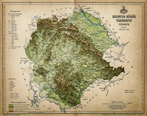
Belovar-koros, Croatio map from 1893Antique illustration of a Belovar-koros, Croatio map from 1893
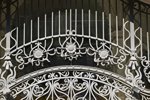
beautiful art deco iron work in budapestbeautiful iron work of a fence in budapest, hungary dating from the early 20th century; art deco style
Water chestnut, water caltrop (Trapa natans), Hortobagy ponds, Hungary, Europe
Hungarian Kuvasz -Canis lupus familiaris- male, guard dog
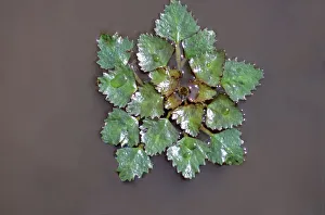
Leaves and thorns of an Acacia -Acacia-, Hungary, Europe
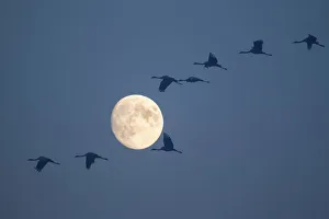
Common Cranes -Grus grus- in flight during a full moon, Hungary
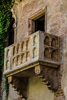
Juliets balcony in Verona
Timeless beautyRetro style dressed woman with cigarette holder
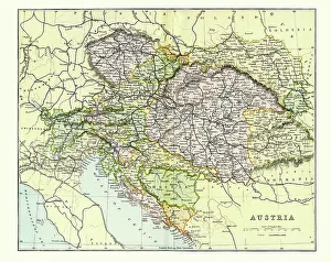
Antique Map of Austria Empire Late 19th CenturyAntique Map of Austria Empire in the Late 19th Century