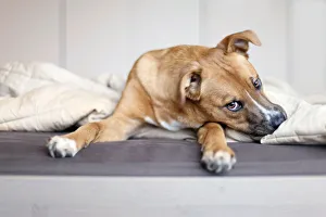
Rescue mutt puppy sitting on bed looking at camera
Bed, Horizontal, Looking At Camera, Indoors, Animal, Animal Body Part, Bedroom, Blanket, Animal Head, USA, Domestic Animals, australian shepherd, rhodesian ridgeback, expressive, emotion, pit bull
architecture, black and white, bridge, building, chicago, chicago river, city, cityscape, day, highrise, horizontal, illinois, no people, outdoors, photography, river, travel, travel destinations
architecture, black and white, building, chicago, city, cityscape, day, fog, highrise, horizontal, illinois, landmark, low angle view, no people, outdoors, photography, travel, travel destinations