mail_outline sales@mediastorehouse.com
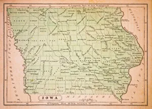
Iowa 1852 Map
Waterloo Iowa US City Street MapVector Illustration of a City Street Map of Waterloo, Iowa, USA. Scale 1:60, 000. All source data is in the public domain. U.S
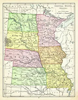
Map of central states USA 1895The Rand-McNally Grammar School Geography 1895 - Chicago & New York
Cedar Rapids Iowa US City Street MapVector Illustration of a City Street Map of Cedar Rapids, Iowa, USA. Scale 1:60, 000. All source data is in the public domain. U.S
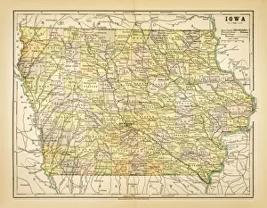
Map of Iowa 1883Map of the state of Iowa
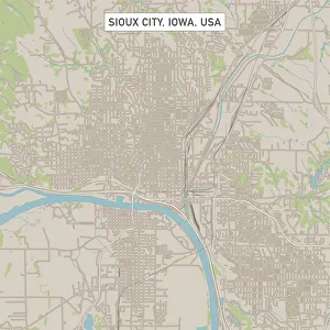
Sioux City Iowa US City Street MapVector Illustration of a City Street Map of Sioux City, Iowa, USA. Scale 1:60, 000. All source data is in the public domain. U.S
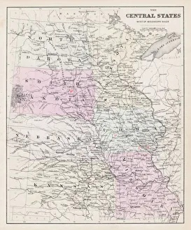
Map of central States USA 1877Warrens Common School Geography 1877
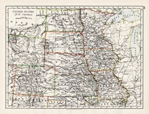
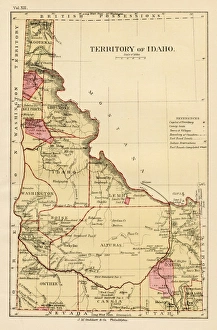
United States NW Central 1897The World-Wide Atlas of Modern Geography, Political and Physical W. & A.K. Johnston - London 1897
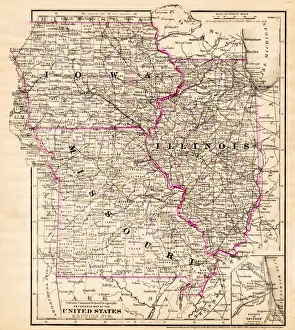
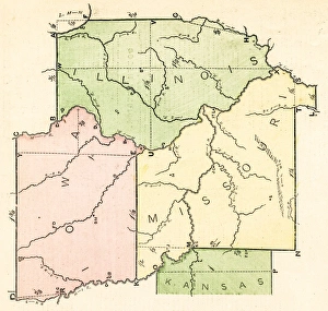
Iowa Missouri Illinois map 1881Coltons Common School Geography 1881 New York Sheldon and Co
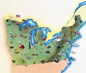
USA, Northern States of America, map with illustrations showing distinguishing features
Salesman At Door Of A House Wife Showing Her A BroUNITED STATES - Circa 1930s: Salesman At Door Of A House Wife Showing Her A Brochure Of His Product He Is Dressed Ia A Suit She Is Wearing A White Apron Over A Dressey Dress. (Photo by H)
United States 1852 Map
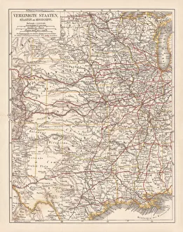
United States of America, States on Mississippi river, lithograph published 1878United States of America, States on the Mississippi river. Lithograph, published in 1878
States USA map 1875The Independent Course Comprehensive Geography by James Monteith, A.S. Barnes & Co, New York & Chicago 1875
Routes of travel in the United States map 1875The Independent Course Comprehensive Geography by James Monteith, A.S. Barnes & Co, New York & Chicago 1875
Iowa USA map 1881Encyclopedia Britannica 9th Edition Vol XII Philadelphia j.M. Stoddart & Co 1881
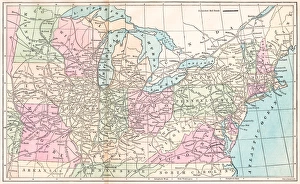
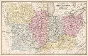
Ohio Indiana Illinois map 1867Mitchellas Modern Atlas - Published by E.H. Butler and Co - Philadelphia 1867
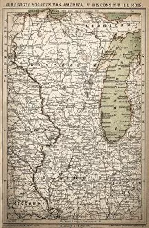
United States of America, Wisconsin, IllinoisAntique illustration of United States of America, Wisconsin, Illinois map
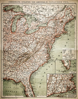
United States of America, eastern partAntique illustration of a United States of America, eastern part
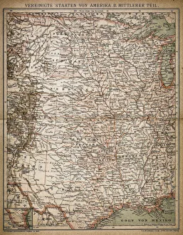
United States of America, Middle sectionAntique illustration of a United States of America, Middle section
United States of America mapAntique illustration of a United States of America map