mail_outline sales@mediastorehouse.com
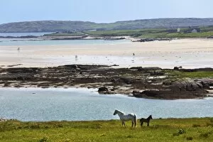
Coast at Claddaghduff with Omey Island, Connemara, County Galway, Republic of Ireland, Europe
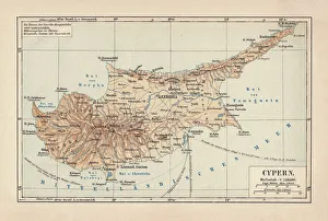
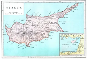
Map of Cyprus, published in 1880Ancient map of Cyprus. Lithograph, published in 1880
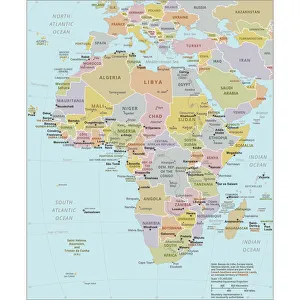
Political Map of AfricaVector Illustration of the policital map of Africa Reference map as created by the US Central Intelligence Agency
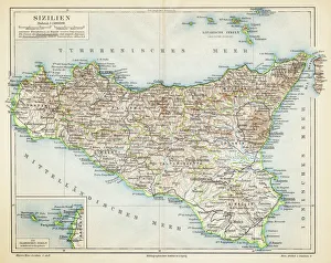
Sicily map 1895Meyers Konversations-Lexikon. Ein Nachschlagewerk des allgemeinen Wissens, 5th edition 17 volumes Bibliographisches Institut - Leipzig 1895-1897
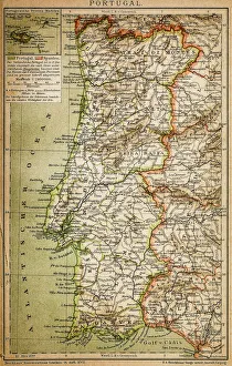
Map of PortugalAntique illustration engraving map og Portugal
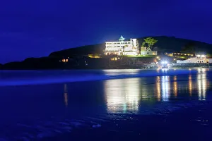
Art Deco Burgh Island HotelBurgh Island is a small tidal island on the coast of South Devon. There are several buildings on the island, the largest being the Art Deco Burgh Island Hotel
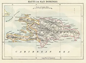
Haiti and Dominican republic map 1883Encyclopedia Britannica 9th Edition New York Samuel L. Hall 1883 Vol XI
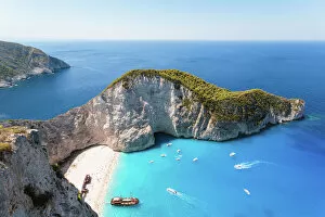
Elevated view of famous shipwreck beach. Zakynthos, Greek Islands, Greece
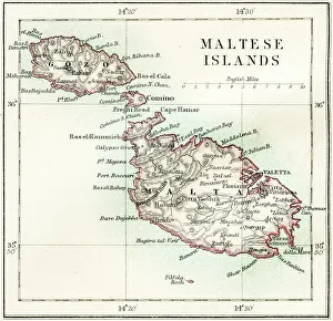
Maltese islands map 1883Encyclopedia Britannica 9th Edition New York Samuel L. Hall 1883 Vol XV
Map of CyprusVintage 19th Century map of Cyprus in the eastern Mediterranean Sea
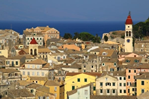
View over the old town of Corfu, GreeceViewof bell-tower, church of Agios Spyridon prominent, Corfu Town, Corfu, Ionian Islands, Greece. The Old Town of Corfu was added to the UNESCO World Heritage List in 2007
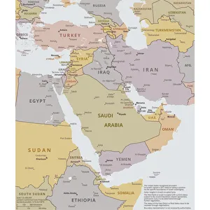
Political map of The Middle EastVector illustration of the policital map of The Middle East Reference map was created by the US Central Intelligence Agency
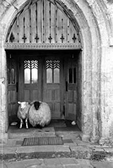
Church Sheep6th August 1955: Sheep huddle in the doorway of the Abbey on the tiny island of Iona, famous for its connection with St Columba who founded a community on Iona after he was expelled from Ireland
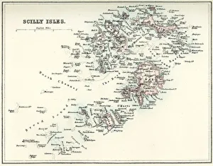
Map of the Scilly IslesVintage map from 1880 of the Scilly Isles an archipelago off the southwestern tip of the Cornish peninsula of Great Britain
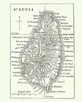
Map of Saint Lucia, 19th CenturyVintage engraving of Map of Saint Lucia, 19th Century
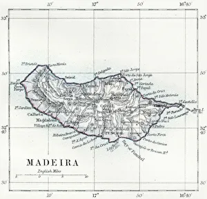
Madeira island map 1883Encyclopedia Britannica 9th Edition New York Samuel L. Hall 1883 Vol XV
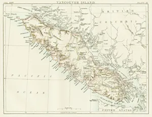
Vancouver island map 1885Encyclopedia Britannica 9th Edition New York Charles Scribners and Sons 1885 Vol XXIV
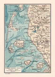
Northern Friesland (Nordfriesland), and islands, Schleswig-Holstein, Germany, lithograph, published 1887North Frisian Islands and Northern Friesland (Nordfriesland), the northernmost district of Germany, part of the state of Schleswig-Holstein. Lithograph, published in 1887
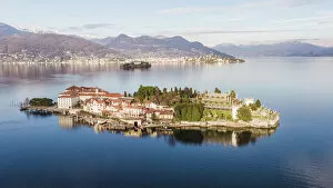
Sunset over Isola Bella, Lake Maggiore, ItalyBorromean islands in the gulf of Pallanza, Lake Maggiore, Piedmont, Italy
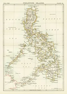
Philippines map 1885Encyclopedia Britannica 9th Edition New York Charles Scribners and Sons 1885 Vol XVIII
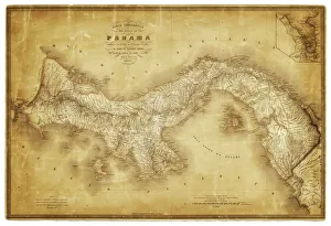
Map of Panama 1864Map of Panama - combined with 2 different texture overlays
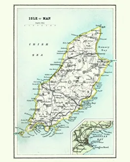
Antique map, Isle of Man 19th CenturyVintage engraving of a Isle of Man 19th Century with detail of Douglas
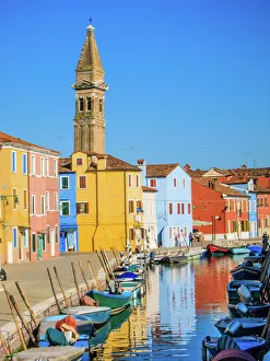
Burano in VeniceThe unbelievably colourful Burano, one of the islands in the Venice lagoon, where every house is painted a bright shade of blue, yellow, pink, purple
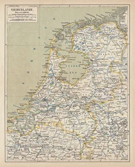
Map of the Netherlands, lithograph, published in 1877Map of the Netherlands. Lithograph, published in 1877
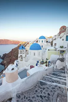
Dawn over famous village of Oia, Santorini, GreeceSunrise over the village of Oia, with famous whitewashed buildings and blue domed churches. Santorini, Mediterranean sea, Greece
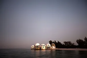
Cape Romano sunken domessunrise over the sunken domes of Cape Romano. Once a vacation residence but two Hurricanes destroyed the island and so these abandoned buildings slowly wandered into the Gulf of Mexico
Sunset at Almyros Beach, near Acharavi, north coast, Corfu Island, Ionian Islands, Greece, Southern Europe, Europe
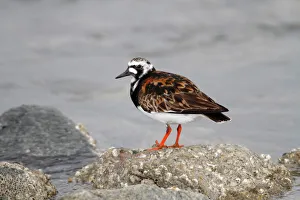
Ruddy Turnstone -Arenaria interpres- in breeding plumage standing on a moss-covered stone on the beach, Neuwerk Island near Cuxhaven, Hamburg Wadden Sea, Germany, Europe
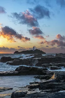
Godrevy Lighthouse, St. Ives Bay, Cornwall, England, Great Britain, Europe
View over ballinskelligs bay to the skellig islandsIveragh peninsula, county kerry, ireland
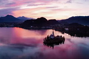
Aerial view of lake Bled at sunrise, SloveniaAerial drone view of Bled lake and island at sunrise, Upper Carniola, Slovenia
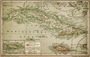
Caribbean mapAntique map of Cuba, Jamaica, Puerto Rico
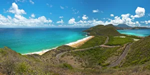
St Kitts - Nevis viewFrom this view you can see North Frigate bay as well as Friars Bay, with the island of Nevis in the distance
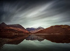
Clouds Over Glencoe Village - Three Sisters - ScotlandGlencoe Village, on the southern bank of the River Coe where it enters Loch Leven in the Lochaber area of the Scottish Highlands
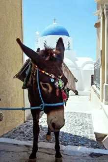
Donkey in front of blue domed church, Santorini
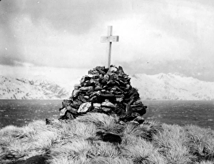
Lonely Monument o Irish explorer Sir Ernest Shackletoncirca 1922: The monument to Irish explorer Sir Ernest Shackleton on the main island of South Georgia. He died of a heart attack and was buried there in 1922, having returned to the spot on the Quest
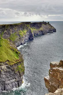
Hags Head, Cliffs of Moher, County Clare, Ireland, Europe
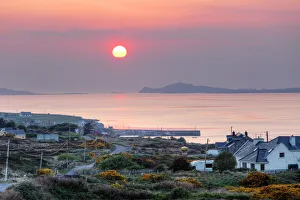
Cleggan at sunset, Connemara, County Galway, Republic of Ireland, Europe
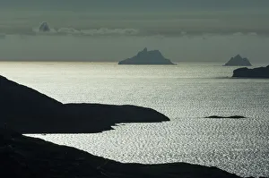
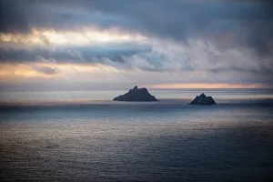
The skellig islands viewed from bolus headIveragh peninsula, county kerry, ireland
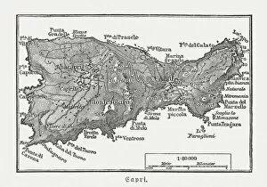
Map of Capri, Italian island, wood engraving published in 1897Map of Capri, Italian island. Wood engraving, published in 1897
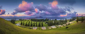
Kingston, Norfolk Island, is a very historic Georgian village and fully restored colonial outpost of the British Empire during the convict transportation era
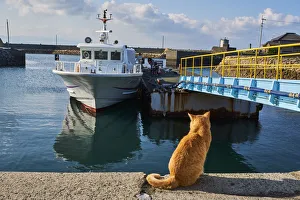
Japan, Cat island, Aoshima islandJapan, Shikoku island, Ehime region, Aoshima island, Cat island
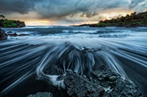
Waianapanapa SunriseThe Road to Hana is an amazing and probably Mauis most popular drive. One of the must stops on the way is the black sand beach. The water is cold, treacherous and shark infested
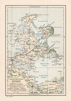
Map of RAOEgen, Baltic Sea, largest island of Germany, lithographMap of RAOEgen - Germanys largest island in the Baltic Sea. Lithograph, published in 1884
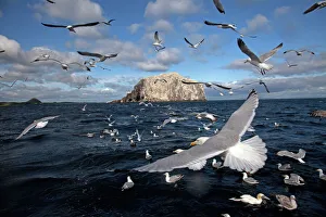
Bass Rock with flock of gannets and seagulls
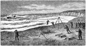
Rescue with the breeches buoyAntique illustration of a Rescue with the breeches buoy
Sunset at Grace Bay, Provienciales, Turks & CaicosA beautiful sunset over Grace Bay, Providenciales, Turks and Caicos coastline at dusk / twilight. Trade-winds & localized cloud cover creating wispy shapes
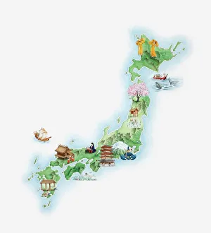
Illustrated map of ancient Japan