mail_outline sales@mediastorehouse.com
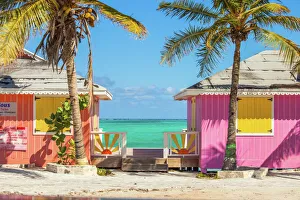
Colorful buildings on the Turks and Caicos islandsLocated in the Blue hills Road neighborhood of Providenciales. Vivid blue of the Caribbean sky and sea with the white sands of Grace bay beach, Turks & Caicos, and bright yellow beach umbrellas
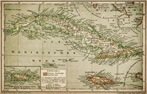
Caribbean mapAntique map of Cuba, Jamaica, Puerto Rico
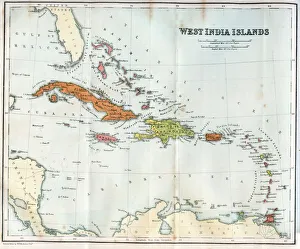
Vintage map of the West India Islands 1860s
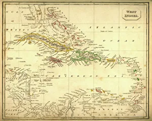
Antquie Map of The West IndiesVintage map of The West Indies from 1837
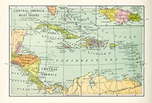
1883 Map Of Central America
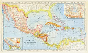
Antique Map of Central America and West IndesVintage map of Central America and West Indes, from 1894
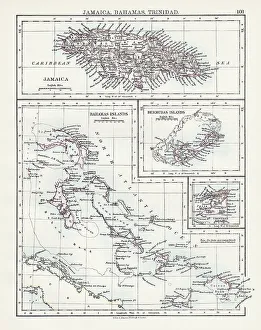
Jamaica Bahamas Trinidad map 1897The World-Wide Atlas of Modern Geography, Political and Physical W. & A.K. Johnston - London 1897
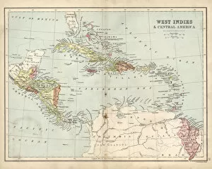
Antique map of West Indies and Central America, 19th Century, 1873
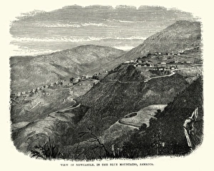
Newcastle, in the Blue Mountains, Jamaica, 19th CenturyVintage engraving of Newcastle, in the Blue Mountains, Jamaica, 19th Century
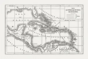
Voyages of Christopher Columbus, wood engraving, published c. 1882Map with the routes of the four voyages of Christopher Columbus in the Caribbean Sea. Wood engraving, published c. 1882
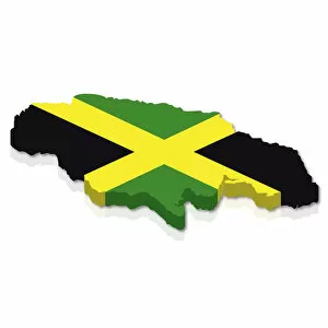
Outline and flag of Jamaica, 3D
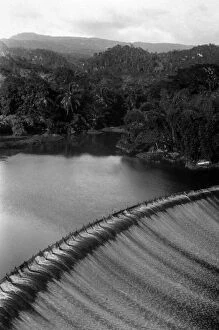
Irrigation Damcirca 1935: The irrigation dam at Bog Walk, Jamaica. (Photo by Topical Press Agency/Getty Images)
Seven Mile Beach, Negril, Jamaica
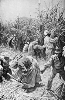
Jamaican Cane CuttersWorkers cutting sugar cane on a plantation in Jamaica, 1897. Illustration by J. Finnemore (Photo by Hulton Archive/Getty Images)