mail_outline sales@mediastorehouse.com
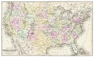
Map of USA 1877Warrens Common School Geography 1877
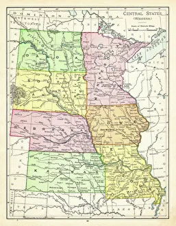
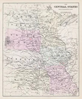
Map of central states USA 1895The Rand-McNally Grammar School Geography 1895 - Chicago & New York
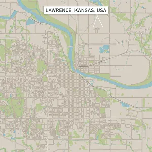
Lawrence Kansas US City Street MapVector Illustration of a City Street Map of Lawrence, Kansas, USA. Scale 1:60, 000. All source data is in the public domain. U.S
Overland Park Kansas US City Street MapVector Illustration of a City Street Map of Overland Park, Kansas, USA. Scale 1:60, 000. All source data is in the public domain. U.S
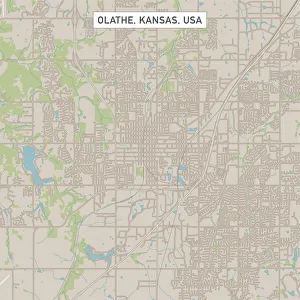
Olathe Kansas US City Street MapVector Illustration of a City Street Map of Olathe, Kansas, USA. Scale 1:60, 000. All source data is in the public domain. U.S
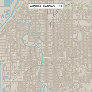
Wichita Kansas US City Street MapVector Illustration of a City Street Map of Wichita, Kansas, USA. Scale 1:60, 000. All source data is in the public domain. U.S
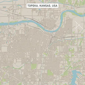
Topeka Kansas US City Street MapVector Illustration of a City Street Map of Topeka, Kansas, USA. Scale 1:60, 000. All source data is in the public domain. U.S
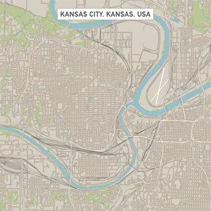
Kansas City Kansas US City Street MapVector Illustration of a City Street Map of Kansas City, Kansas, USA. Scale 1:60, 000. All source data is in the public domain. U.S
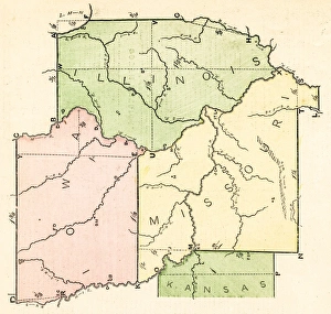
Map of central States USA 1877Warrens Common School Geography 1877
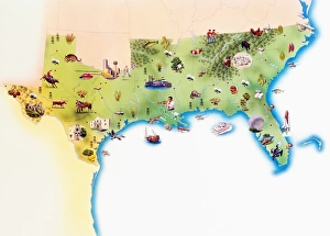
Map of Southern United States of America, with illustrations of distinguishing features and landmarks
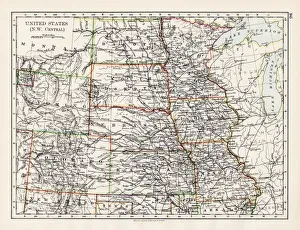
United States NW Central 1897The World-Wide Atlas of Modern Geography, Political and Physical W. & A.K. Johnston - London 1897
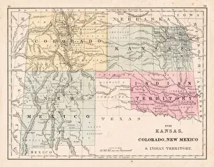
Kansas Colorado New Mexico map 1867Mitchellas Modern Atlas - Published by E.H. Butler and Co - Philadelphia 1867
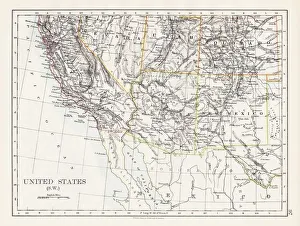
United States South West map 1897The World-Wide Atlas of Modern Geography, Political and Physical W. & A.K. Johnston - London 1897
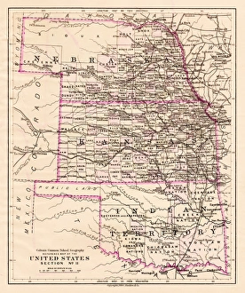
Kansas and Nebraska map 1881Coltons Common School Geography 1881 New York Sheldon and Co
States USA map 1875The Independent Course Comprehensive Geography by James Monteith, A.S. Barnes & Co, New York & Chicago 1875
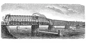
Bridge over Missouri riverAntique illustration of Bridge over Missouri river
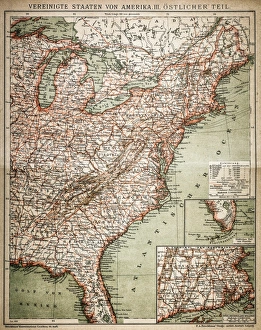
United States of America, eastern partAntique illustration of a United States of America, eastern part
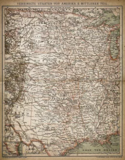
United States of America, Middle sectionAntique illustration of a United States of America, Middle section
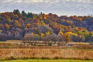
Fall colors in rural WisconsinA hillside in fall colors with a meadow below. Holstein / bovine cows grazing on a rural farm field
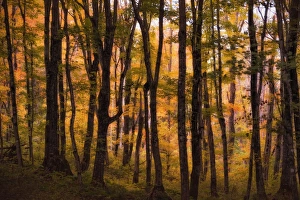
A pathway through Pictured Rocks National Lake Shore near Chapel Falls. Along the way you pass through this enchanting forest
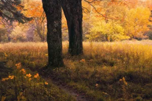
Sable MeadowsA pathway leads from Sable Falls to the Ghost Forest near Lake Superiors coast. Along the way you pass through this enchanting meadow