mail_outline sales@mediastorehouse.com
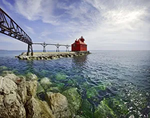
Sturgeon Bay Lighthouse Door County WisconsinUSA Wisconsin Door County Sturgeon Bay North Pierhead Ship Canal Lighthouse. Door County, Wisconsin
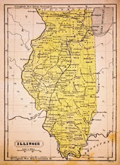
Illinois 1852 Map
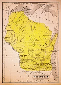
Wisconsin 1852 Map
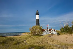
Michigan Lake shore with Big Sable Point Lighthouse, Ludington, Mason County, MichiganBig Sable Point Lighthouse on Lake Michigan, Mason County, Ludington, MI
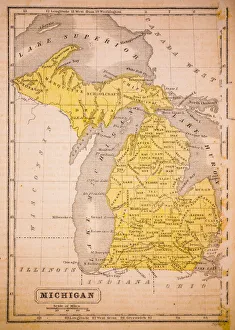
Michigan 1852 Map
Antquie Map of the United StatesVintage map of the United States of America from 1837
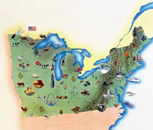
USA, Northern States of America, map with illustrations showing distinguishing features
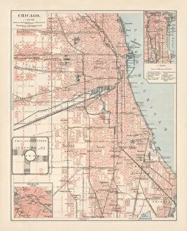
City map of Chicago, Illinois, USA, lithograph, published in 1897City map of Chicago, Illinois, USA. Lithograph, published in 1897
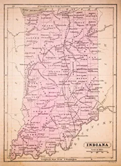
Indiana 1852 Map
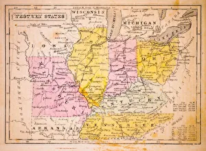
Western States 1852 Map
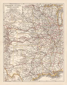
United States of America, States on Mississippi river, lithograph published 1878United States of America, States on the Mississippi river. Lithograph, published in 1878
United States of America, Atlantic coast, lithograph, published in 1878United States of America, Atlantic coast. Lithograph, published in 1878
United States of America mapAntique illustration of a United States of America map
Chicago Illinois Skyline From Lake MichiganUNITED STATES - CIRCA 1950s: Chicago skyline from Lake Michigan. (Photo by H. Armstrong Roberts/Retrofile/Getty Images)