mail_outline sales@mediastorehouse.com
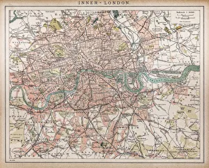
Historic map of London (18th Century)map/plan of the inner city of London from 1898
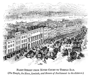
Fleet Street with Temple Bar (Crystal Palace in distance) 1871Fleet Street in the City of London, from Mitre Court to Temple Bar, with The Temple and River Thames. The narrow and traffic-limiting Temple Bar (one of the historic entrances to the City of London)
Tenisons GirlsSome of the twelve girls of Archbishop Tenisons Church of England School, rehearsing Christmas carols in their traditional uniforms, Lambeth, London, 18th November 1929
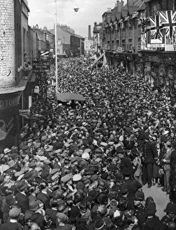
Lambeth Walkerscirca 1924: Crowds in Lambeth to see Lupino Lane doing the Lambeth Walk. He failed to perform because of the size of the crowd. (Photo by Topical Press Agency/Getty Images)
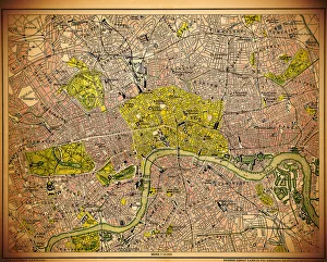
Historic map of LondonAntique illustration map map/plan of the inner city of London from 1898
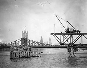
Bridge Constructioncirca 1929: The construction of a new bridge over Londons River Thames, alongside the old Lambeth bridge, which was due for demolition. (Photo by Topical Press Agency/Getty Images)
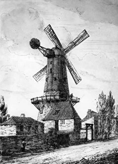
Lambeth Mill1814: The windmill at Lambeth from a colour sketch published in 1814. (Photo by Hulton Archive/Getty Images)