mail_outline sales@mediastorehouse.com
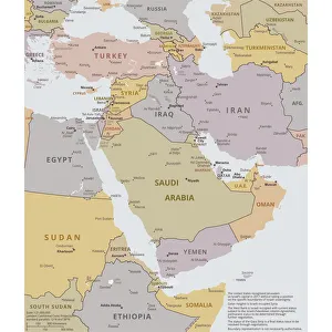
Political map of The Middle EastVector illustration of the policital map of The Middle East Reference map was created by the US Central Intelligence Agency
Excursion boat off the Pigeons Rock, Grotte aux Pigeons, limestone rocks eroded by wind and weather in the Raouche district, Beirut, Lebanon, Middle East, Asia
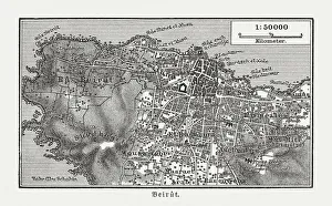
Historic city map of Beirut, Lebanon, wood engraving, published 1897Historic city map of Beirut - capital and largest city of Lebanon. Wood engraving, published in 1897
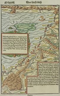
Antique map of holy land including Syria and Lebanon
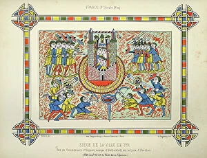
Siege of Tyre, Babylonian army attacking the city, Ancient warfare, from the the Book of Ezekiel, 10th Century ArtVintage illustration of Siege of Tyre, 10th Century Art. Taken from the Commentary of Haymon, Bishop of Halberstadt, on the Book of Ezekiel. (Bibl)
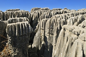
Eroded limestone, karst formation at Qalaat Faqra, Lebanon, Middle East, West Asia
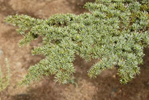
Branch of a Lebanon Cedar (Cedrus libani var brevifolia), needles, Tripylos, Troodos Mountains, Southern Cyprus, Republic of Cyprus, Mediterranean Sea, Europe
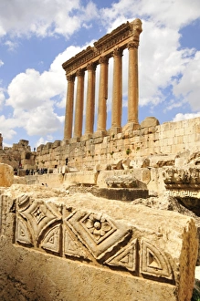
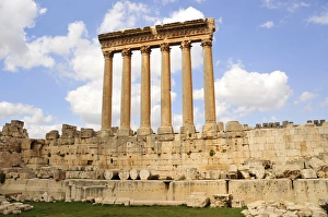
The six remaining columns of the Temple of Jupiter, UNESCO World Heritage Site, Baalbek, Beqaa Valley, Lebanon, Middle East, Orient
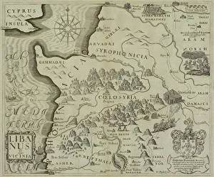
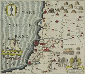
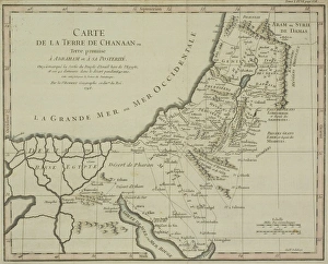
Antique map of the coast of Phoenicia
Antique map of coast of present day Lebanon and Syria
Antique map of holy land with Nile River Delta
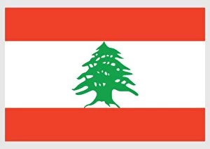
Illustration of flag of Lebanon, white stripe between two horizontal red stripes, with green cedar in center