mail_outline sales@mediastorehouse.com
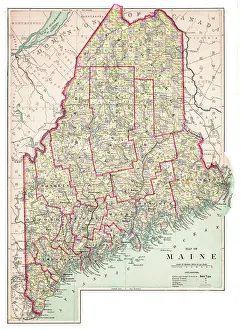
Map of Maine USA 1883Warrens Common School Geography
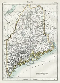
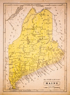
Map of Maine 1883Encyclopedia Britannica 9th Edition New York Samuel L. Hall 1883 Vol XV
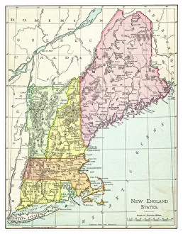
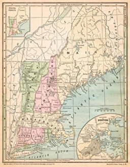
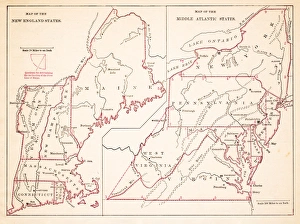
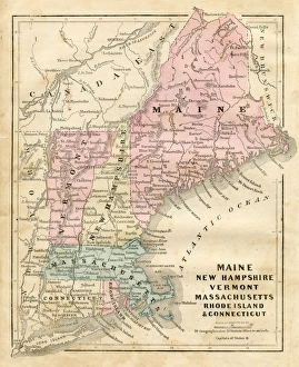
Map of New England states 1895The Rand-McNally Grammar School Geography 1895 - Chicago & New York
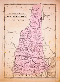
New Hampshire 1852 Map
Map of Northeast United States, published in 1882Map of the Northeast United States of America. Wood engraving, published in 1882
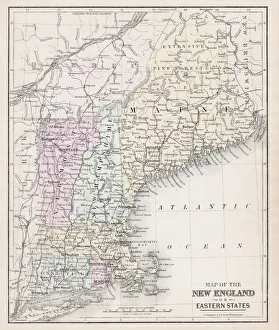
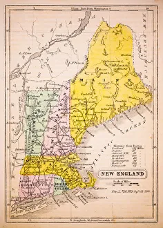
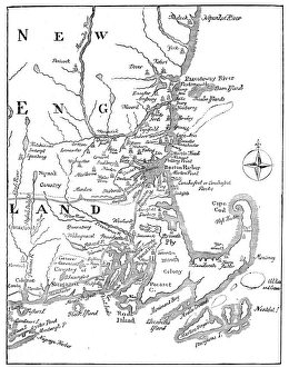
USA New England states map 1875The Independent Course Comprehensive Geography by James Monteith, A.S. Barnes & Co, New York & Chicago 1875
Toddlers In Field Of Daisies. They Wear Fancy Clothes Dress And SuitUNITED STATES - CIRCA 1950s: Toddlers In Field Of Daisies. They Wear Fancy Clothes Dress And Suit. The Girl Holds Daisy Bouquet While The Boy Pulls Daisy Petals For Loves Me Not Game
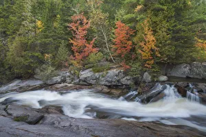
The cascades of Little Niagara Falls with Autumn colors, in Baxter State Park, Maine, USAAlthough small, the cascades of Little Niagara Falls are particularly attractive in the fall, and a popular hiking destination in Baxter State Park, Maine, USA
The low contrast light of an overcast day bring out the vivid autumn colors of maple and birch treesPaper Birch (betula papyrifera) and Sugar Maple (acer saccharum) are common trees in this Maine North Woods location, which is popular with hikers and photographers in the fall season
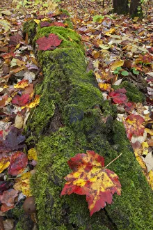
A ground level view of a moss covered log and fallen Sugar Maple leaves (acer saccharum) at SouthbranchLow contrast light on an overcast day, brings out the contrasting colors and textures of moss and fallen maple leaves. Southbranch region of Baxter State Park, Maine, USA
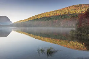
A calm and misty Autumn sunrise in Baxter State Park, Maine, USAThe rich fall colors on Southbranch Mountain are reflected in Southbranch Pond, on a typical still and tranquil fall morning in the North Woods of Maine
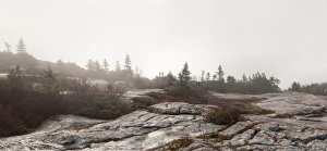
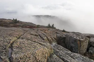
Foggy landscape panoramaFoggy landscape on top of Cadillac Mountain in Acadia National Park in late fall. Wet, lichen covered rocks and red blueberry bushes add color in an otherwise grey misty landscape
Cross section illustration of World War Two British Churchill MK VII tank
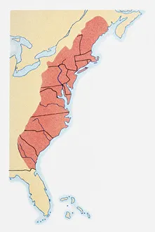
Illustration of states on East Coast of the USA
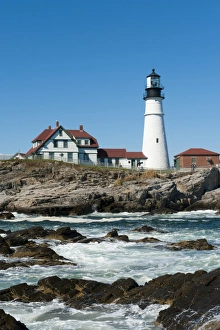
Lighthouse, waves breaking on rocks, Portland Head Light, Cape Elizabeth, Portland, Maine, New England, USA, North America
Flight of puffinAtlantic Puffin- Machias Seal Island
Map of New Hampshire USA 1883Warrens Common School Geography
Map of New England by Explorer John Smith, Circa 1624Beautifully Illustrated Antique Engraved Victorian Illustration of Historical Map of New England from Explorer Captain John Smith, Circa 1624. Source: Original edition from my own archives
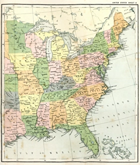
Antquie Map of the United StatesVintage map of the United States of America from 1837
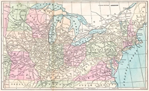
Antique Map of Eastern USAAntique Map from 1867 of Eastern United States of America
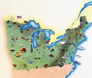
USA, Northern States of America, map with illustrations showing distinguishing features
Borage (Borago officinalis), Flower
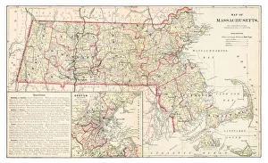
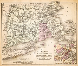
Map of Massachusetts 1877Warrens Common School Geography 1877
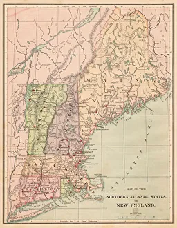
Map of New England 1877Warrens Common School Geography 1877
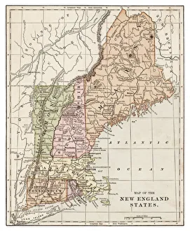
New England States map 1889Indiana Educational Series The Complete Geography - Indianapolis 1889
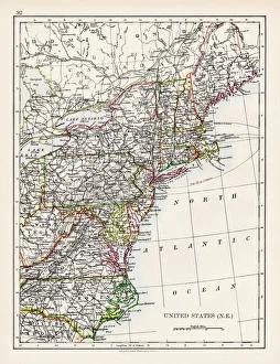
USA Northern Atlantic states 1881Harpers School Geography, New York, Harpers and Brothers, 1881
United States North East map 1897The World-Wide Atlas of Modern Geography, Political and Physical W. & A.K. Johnston - London 1897
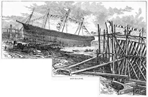
Ship building in Maine USA engraving 1883Warrens Common School Geography
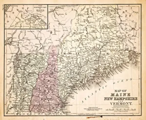
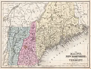
Map of Maine and Vermont1883Warrens Common School Geography
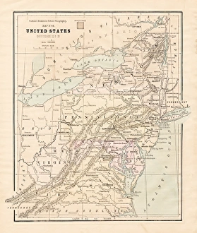
Map of Middle states USA 1883Warrens Common School Geography
New England States USA map 1881Coltons Common School Geography 1881 New York Sheldon and Co
Maine New Hampshire and Vermont 1867Mitchells Modern Atlas - Published by E.H. Buttler & Co - Philadelphia 1867
Maine New Hampshire and Connecticut 1856Colton and Fitchs Modern School Geography by George W. Fitch - New York 1856
Maine 1852 Map
New England 1852 Map
United States 1852 Map
United States of America, Atlantic coast, lithograph, published in 1878United States of America, Atlantic coast. Lithograph, published in 1878
Vintage Map of New England at the beginning of the 18th century
Foggy dayFoggy landscape on top of Cadillac Mountain in Acadia National Park in late fall. Wet, lichen covered rocks and a single dwarfed pine are the only life there in late autumn
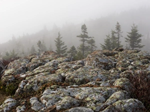
On top of Cadillac MountainFoggy landscape of rolling clouds and fog seen from the top of Cadillac Mountain in Acadia National Park in late fall. Wet
Foggy mountain landscapeFoggy landscape of rolling fog seen on top of Cadillac Mountain in Acadia National Park in late fall. Wet lichen covered rocks in the foreground
Antique carTire and wheel of an antique car. Model T Ford
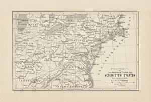
Routes of travel in the United States map 1875The Independent Course Comprehensive Geography by James Monteith, A.S. Barnes & Co, New York & Chicago 1875
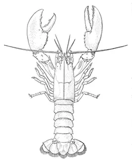
American lobster engraving 1895The American Lobster - A study of their habitats and development - 1895
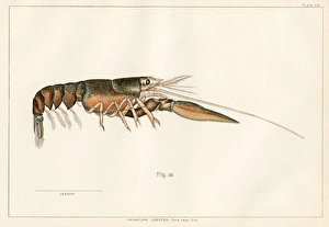
American lobster lithograph 1895The American Lobster - A study of their habitats and development - 1895
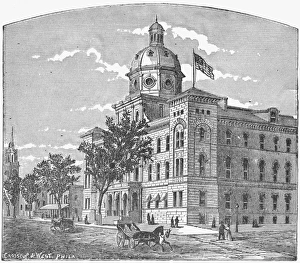
Portland City HallThe old Portland City Hall and Court House, Maine, USA, circa 1875. The building was destroyed by fire in 1908. (Photo by Kean Collection/Hulton Archive/Getty Images)
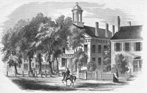
Bangor Court HouseThe Court House in Bangor, Penobscot County, Maine, USA, 1853. Original publication: Gleasons Pictorial Drawing-Room Companion - pub 3rd December 1853
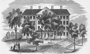
Seminary In BangorThe theological seminary in Bangor, Penobscot County, Maine, USA, 1853. Original publication: Gleasons Pictorial Drawing-Room Companion - pub 3rd December 1853