mail_outline sales@mediastorehouse.com
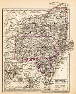
New York Maryland Pennsylvania map 1881Coltons Common School Geography 1881 New York Sheldon and Co
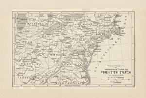
Map of Northeast United States, published in 1882Map of the Northeast United States of America. Wood engraving, published in 1882
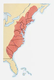
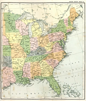
Illustration of states on East Coast of the USA
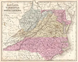
Map of Maryland Virginia North Carolina 1867Mitchells Modern Atlas - Published by E.H. Buttler & Co - Philadelphia 1867
Antique Map of Eastern USAAntique Map from 1867 of Eastern United States of America
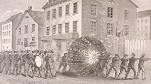
Illustration Of Tippecanoe Procession, MD, 1840Illustration depicting the Tippecanoe procession in support of Whig party presidential candidate William H. Harrison, Baltimore, Maryland, 1840. (Kean Collection/Getty Images)
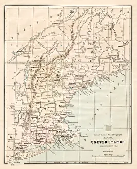
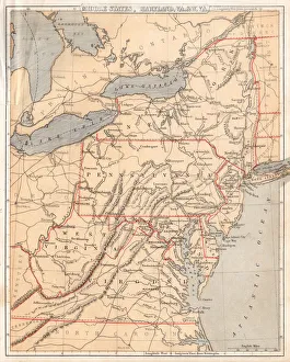
North Eastern States USA map 1881Coltons Common School Geography 1881 New York Sheldon and Co
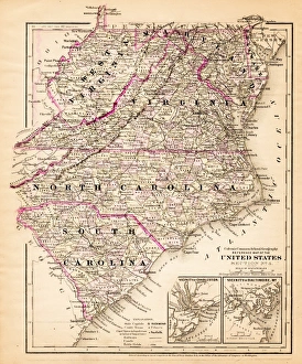
Virginia North Carolina map 1881Coltons Common School Geography 1881 New York Sheldon and Co
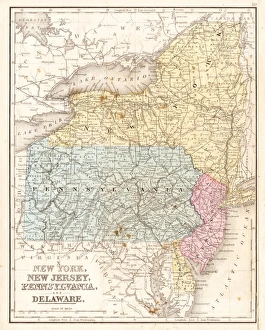
Middle states USA map 1869Cornells Grammars-School Geography - S.S. Cornell - New York D. Appleton and Company 1869
MId-atlantic states usa map 1867Mitchells Modern Atlas - Published by E.H. Buttler & Co - Philadelphia 1867
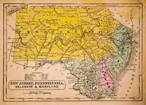
New Jersey, Pennsylvania, Delaware and Maryland 1852 Map
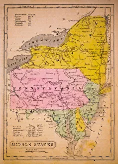
Middle States 1852 Map
Southern States 1852 Map
FreshA bald eagle with a fresh caught fish
Undivided AttentionA bald eagle going down for a catch
Mysterious sunriseA foggy sunrise scene at Conowingo Dam of Abeerdeen sets an eerie mood
Foggy and misty sunriseA foggy sunrise at Conowingo Dam of Darlington
Raccoon, Assateague Island, Marylandoung Raccoon (Procyon lotor) walking in grass