mail_outline sales@mediastorehouse.com
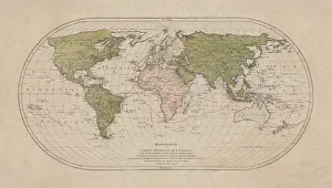
World map by Mathieu Albert Lotter, Augsburg, 1778World map from 1778. Original hand-colored copper engraving by Matthieu Albert Lotter (1741 - 1810, Augsburg) with route of James Cooks First Circumnavigation (1770), through Tahiti
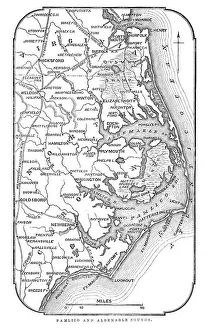
Map of Pamlico and Albemarle SoundsVintage engraving from 1863 of a map of Map of Pamlico and Albemarle Sounds at the time of the American Civil War
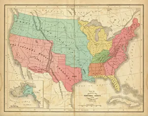
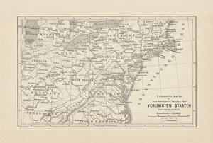
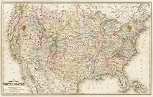
Map of United States 1876Map of United States showing the territorial growth between 1780 and 1876
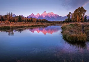
Schwabachers landing - Grand Teton National Park Wyoming USASunrise on the Grand Teton range reflecting in the snake river. Fall colors in Autumn at Grand Teton National Park in Wyoming, United States
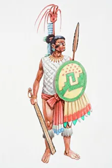
Illustration, Aztec apprentice warrior clad in loincloth carrying a spear-thrower (Atlatl) and oak darts with a stone point
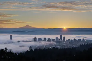
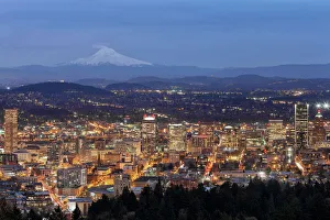
Sunrise over Foggy Portland OregonSunrise over City of Portland Oregon and Mount Hood Covered in Low Fog Banks
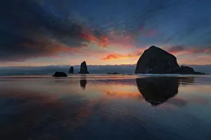
Cannon Beach at SunsetColorful Sunset at Cannon Beach by Haystack Rock at the Oregon Coast during Low Tide
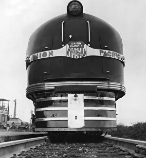
Union Pacific Lococirca 1935: The imposing front view of a Union Pacific railroad engine with an Art Deco style typeface. (Photo by Hulton Archive/Getty Images)
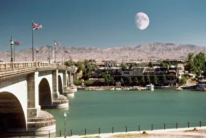
British flags on London Bridge, Lake Havasu, Arizona, USA
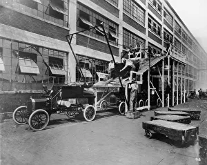
Mass ProductionFull-length image of auto workers lowering the body of a Model T onto its chassis on an assembly line ramp outdoors at the Ford Motor Company, Highland Park, Michigan
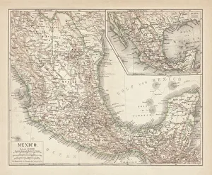
Mexico map 1897The World-Wide Atlas of Modern Geography, Political and Physical W. & A.K. Johnston - London 1897
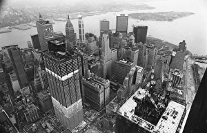
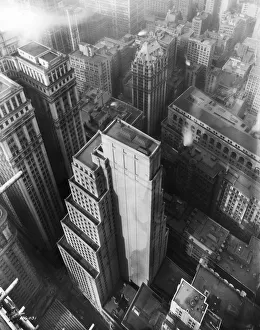
Skyscrapers1971: A birds eye view of the World Trade Center (World Trade Centre) building under construction in New York. The docks can be seen in the background. (Photo by A. Vine/Express/Getty Images)
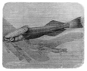
Shark sucker fish, Remora remora (Fork-tailed remora, Echeneis remora)Antique illustration engraving of Shark sucker fish, Remora remora (Fork-tailed remora, Echeneis remora)
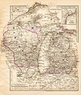
Wisconsin Michigan map 1881Coltons Common School Geography 1881 New York Sheldon and Co
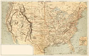
Map of United States 1869Cornells Grammars-School Geography - S.S. Cornell - New York D. Appleton and Company 1869
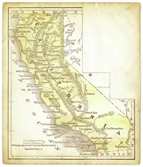
Old map of California 1856Colton and Fitchs Modern School Geography by George W. Fitch - New York 1856
Map of Northeast United States, published in 1882Map of the Northeast United States of America. Wood engraving, published in 1882
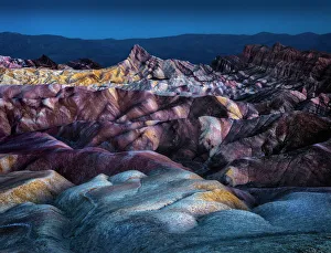
Candy Land MutantNature2015Zabriskie Point with Panamint Range in distance, Mojave Desert. Mutant nature Zabriskie Point is a part of Amargosa Range located east of Death Valley in Death Valley National Park in California
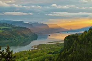
Sunrise at Crown Point in Columbia River GorgeSunrise over Vista House on Crown Point at Columbia River Gorge
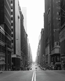
Street in NY city, (B&W)
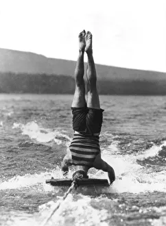
Aquaplaning15th September 1925: One of the most difficult aquaplane stunts, water-surfing upside down, performed by Mr Brooks, at Lake Tahoe, California, where the sport is very popular
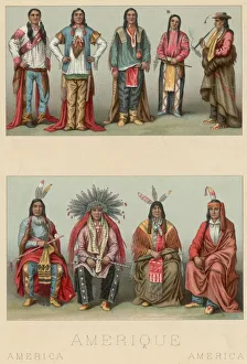
American Chiefscirca 1800: Native American warriors and chieftains with feathered headdresses. Original Artwork: Lithograph by Nordmann and Sahn. (Photo by Hulton Archive/Getty Images)
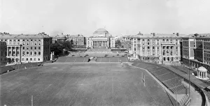
circa 1915: View of the campus of Columbia University, with the football field in the foreground, and the domed library in the distance, Morningside Heights, New York City
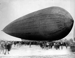
Metal AirshipCrowds gather to view the first all metal dirigible airship. (Photo by Fox Photos/Getty Images)
Franklin D Roosevelt19th January 1938: United States president Franklin Delano Roosevelt (1882 - 1945) addressing a press conference. (Photo by Central Press/Getty Images)
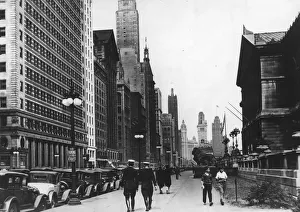
City Lifecirca 1930: Michigan Avenue in Chicago. (Photo by Hulton Archive/Getty Images)
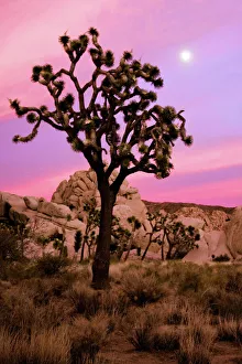
Full moon and a Joshua tree against a pink skyA full moon and a Joshua tree against a pink sky just after sunset. The Real Hidden Valley, Joshua Tree National Park, California
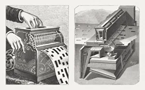
American barrel organ with inside mechanism, wood engravings, published 1888American barrel organ with punched tape technique - Automatic musical instrument from the 19th century. Right side: The inside mechanism. Wood engravings, published in 1888
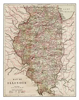
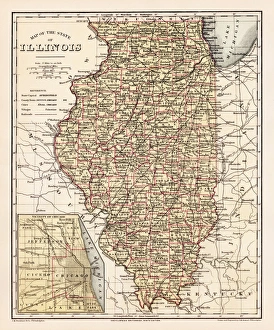
Map of Illinois 1889Indiana Educational Series The Complete Geography - Indianapolis 1889
Map of United States 1867Mitchells Modern Atlas - Published by E.H. Buttler & Co - Philadelphia 1867
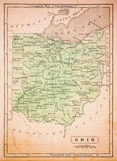
Ohio 1852 Map
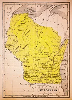
Wisconsin 1852 Map
Mexico, ancient map, lithograph, published in 1877Ancient map of Mexico. Lithograph, published in 1877
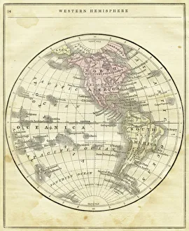
Western Hemisphere map 1856Colton and Fitchs Modern School Geography by George W. Fitch - New York 1856
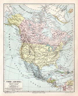
North America political map 1895Meyers Konversations-Lexikon. Ein Nachschlagewerk des allgemeinen Wissens, 5th edition 17 volumes Bibliographisches Institut - Leipzig 1895-1897
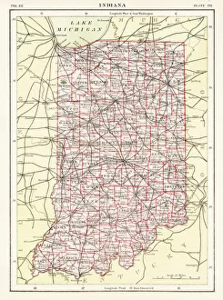
Indiana USA map 1881Encyclopedia Britannica 9th Edition Vol XII Philadelphia j.M. Stoddart & Co 1881
Illinois map 1881Encyclopedia Britannica 9th Edition Vol XII Philadelphia j.M. Stoddart & Co 1881
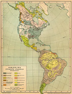
American ethnographic mapIllutration of American ethnographic map
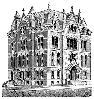
Rush Medical College building in ChicagoAntique illustration of a Rush Medical College building in Chicago
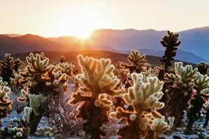
Cholla cactus garden, Joshua Tree National Park, USACholla cactus garden, Joshua Tree National Park, California, USA
Portland Cityscape with Mt Hood at DuskView of Portland Oregon downtown cityscape with Mount Hood from Pittock Mansion Viewpoint at Twilight
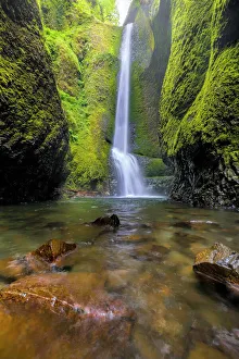
Oneonta FallsTrek along Oneonta Gorge to Lower Oneonta Falls in the Columbia River Gorge
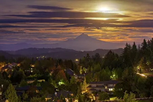
Full moon rising over Mt Hood in Happy Valley OregonHarvest Moon 2016 full moon rising over Mount Hood and Happy Valley Oregon. The Harvest Moon gets its name from folklore. The difference in the Harvest Moon compared to others the location of
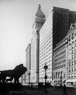
Chicago Buildingscirca 1930: The Railway Exchange on the right and thes W Strauss building on Michigan Avenue looking past one of the lions in front of the Chicago Art Institute
circa 1930: High-angle view of the Chase National Bank building, looking down from the Bank of Manhattan, New York City. (Photo by Edwin Levick/Hulton Archive/Getty Images)
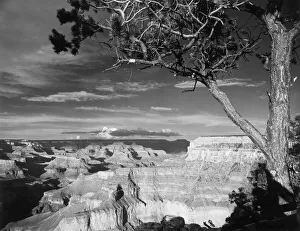
Grand Canyoncirca 1950: A tree overlooking the expanse of the Grand Canyon, Arizona. (Photo by Hulton Archive/Getty Images)
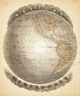
World western hemispheres 1883Warrens Common School Geography