mail_outline sales@mediastorehouse.com
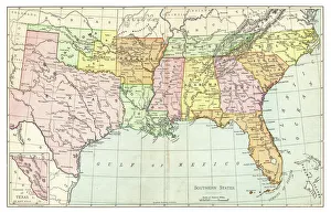
Map of Southern States USA 1895The Rand-McNally Grammar School Geography 1895 - Chicago & New York
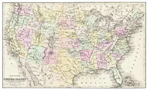
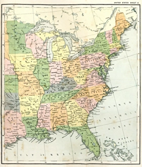
Map of USA 1877Warrens Common School Geography 1877
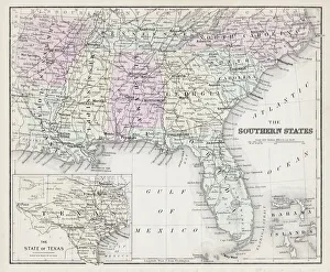
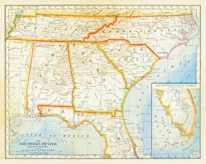
Map of Southern States USA 1877Warrens Common School Geography 1877
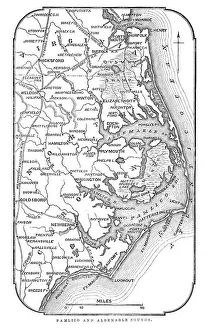
Map of Pamlico and Albemarle SoundsVintage engraving from 1863 of a map of Map of Pamlico and Albemarle Sounds at the time of the American Civil War
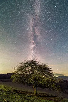
Scenic landscape in autumn from Beacon Heights, Appalachian Mountains, Blue Ridge Parkway, North Carolina, USAThe Blue Ridge Parkway is a National Parkway and All-American Road in the United States, noted for its scenic beauty. The parkway, which is Americas longest linear park
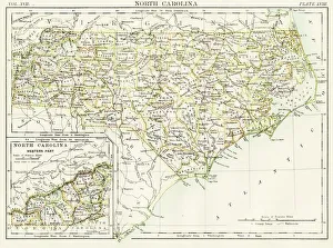
North Carolina map 1884Encyclopedia Britannica 9th Edition New York Charles Scribners and Sonsl 1884 Vol XVII
Map of Northeast United States, published in 1882Map of the Northeast United States of America. Wood engraving, published in 1882
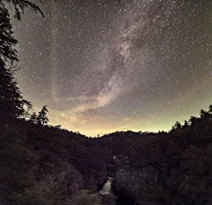
Mountain landscape at sunrise, Great Smoky Mountains National Park, North Carolina, USAGreat Smoky Mountains National Park is a United States National Park and UNESCO World Heritage Site that straddles the ridgeline of the Great Smoky Mountains, part of the Blue Ridge Mountains
Autumn sunset from Clingmans Dome, Appalachian Mountains, Great Smoky Mountains National Park, North Carolina, USAGreat Smoky Mountains National Park is a United States National Park and UNESCO World Heritage Site that straddles the ridgeline of the Great Smoky Mountains, part of the Blue Ridge Mountains
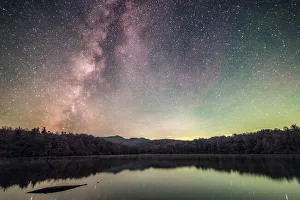
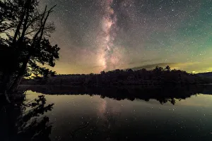
Dreaming of the Blue Ridge Mountains. An image of the Milky Way Galaxy rising above Price Lake located in Blowing Rock, NC
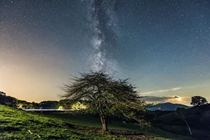
October BluesThe milky way rising above a trail located in the Blue Ridge Mountains with colored leafs all over the ground
Part of hotel buildingNo People, Square Image, Outdoors, Day, Copy Space, Sunlight, Clear Sky, Building Exterior, Architecture, Window, Balcony, Tourism, Travel Destinations, Modern, Hotel, Repetition, Simplicity, Sparse
1883 Southern States Map
Autumn reflections in Bass Lake in Moses H Cone Memorial Park, Blue Ridge Parkway, North Carolina, USAThe Moses H. Cone Memorial Park is a country estate in honour of Moses H. Cone in Blowing Rock, North Carolina. It is on the Blue Ridge Parkway between mileposts 292
Landscape with Cataloochee Creek in Cataloochee Cove, Appalachian Mountains, Great Smoky Mountains National ParkGreat Smoky Mountains National Park is a United States National Park and UNESCO World Heritage Site that straddles the ridgeline of the Great Smoky Mountains, part of the Blue Ridge Mountains
Scenic landscape with foggy mountains from Deep Creek Overlook in autumn, Great Smoky Mountains National ParkGreat Smoky Mountains National Park is a United States National Park and UNESCO World Heritage Site that straddles the ridgeline of the Great Smoky Mountains, part of the Blue Ridge Mountains
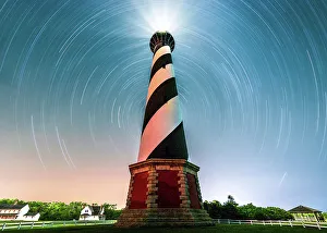
A Portal to Cape Hatteras Light HouseA portal to Cape Hatteras Light House
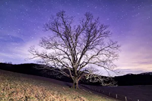
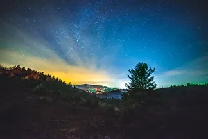
A shooting star heading for the Milky Way overlooking the Blue Ridge Mountains of North Carolina
Reflections of the Universe at Price Lake located off the Blue Ridge Parkway in North Carolina
Cosmic DelightThe Milky Way rising above the Blue Ridge Parkway and light trails from the zooming cars
Midnight Tree HuggerA woman hugging a tree located off the Blue Ridge Parkway in Blowing Rock, NC
A Starry Night at Linville FallsA Starry night at Linville Falls located in the Blue Ridge Mountains of North Carolina
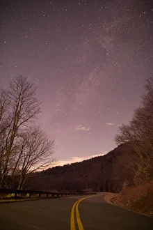
Twisted JourneyThe milky way rising above the Blue Ridge Parkway located in Blowing Rock, NC
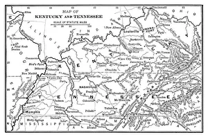
Map of Kentucky and Tennessee - Scanned 1886 Map
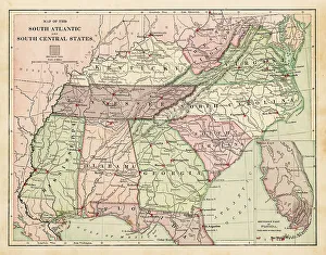
Map of USA Southern states 1869Cornells Grammars-School Geography - S.S. Cornell - New York D. Appleton and Company 1869
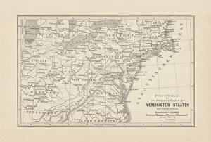
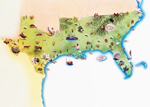
Map of Southern United States of America, with illustrations of distinguishing features and landmarks
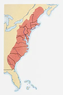
Illustration of states on East Coast of the USA
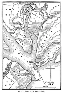
Battle of Port RoyalVintage engraving from 1863 of a map of the Battle of Port Royal which was one of the earliest amphibious operations of the American Civil War
USA Southern states map 1889Indiana Educational Series The Complete Geography - Indianapolis 1889
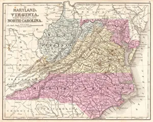
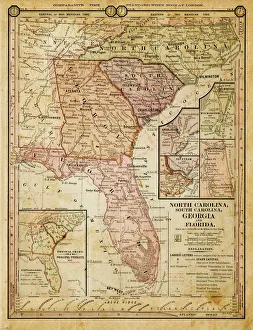
Map of Maryland Virginia North Carolina 1867Mitchells Modern Atlas - Published by E.H. Buttler & Co - Philadelphia 1867
Antquie Map of the United StatesVintage map of the United States of America from 1837
Antique Map of Eastern USAAntique Map from 1867 of Eastern United States of America
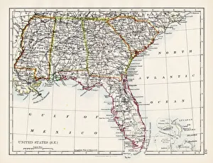
United States South East map 1897The World-Wide Atlas of Modern Geography, Political and Physical W. & A.K. Johnston - London 1897
Map EngravingsFine Art Storehouse Maps: Map Engravings
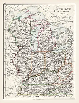
United States North East Central map 1897The World-Wide Atlas of Modern Geography, Political and Physical W. & A.K. Johnston - London 1897
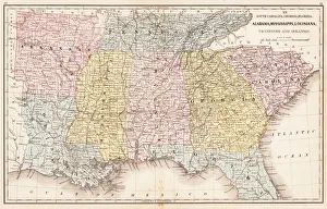
USA Southern States 1867Mitchells Modern Atlas - Published by E.H. Buttler & Co - Philadelphia 1867
Southern States 1852 Map
United States 1852 Map
United States of America, Atlantic coast, lithograph, published in 1878United States of America, Atlantic coast. Lithograph, published in 1878
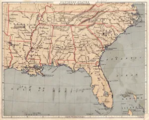
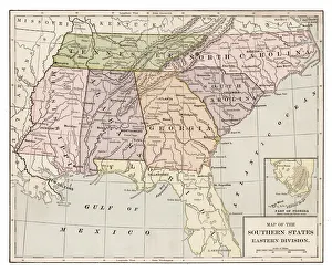
usa - southern states 1884map of north carolina, south carolina, georgia and florida 1884
Sweet NovemberA bizarre sunset at the Lake during November
OrionStars above the Blue Ridge Mountains