mail_outline sales@mediastorehouse.com
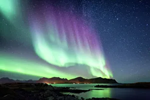
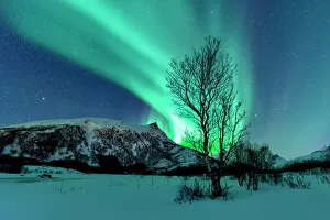
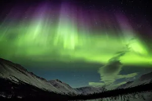
Beautiful Northern Lights aurora borealis borealisgreen Norway natureVery strong Northern Lights. Aurora borealis attract every year many tourists
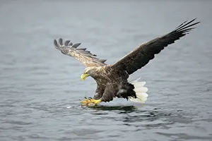
White-tailed Eagle or Sea Eagle -Haliaeetus albicilla- about to grab for a fish, Lauvsnes, Flatanger, Nord-Trondelag, Trondelag, Norway
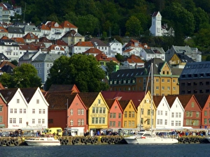
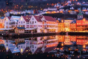
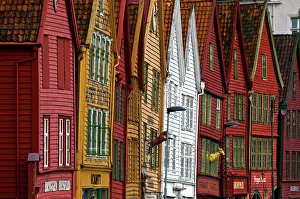
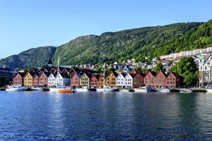
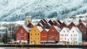
The old centre of Bergen (Bryggen), NorwayThe city of Bergen was founded in 1070. In 1360 a Kontor of the Hanseatic League was established there, and as the town developed into an important trading centre, the wharfs were improved
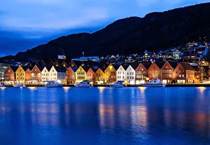
Bergen town centre at dawn, NorwayBergen is a city on Norwayas southwestern coast.The Bryggen district consists of the old wharf and its surrounding commercial buildings, and features vibrantly colored wooden houses
Crooked houses in Bergen, NorwayHistoric shops along Bryggen, centuries old wharf, which now UNESCO World Cultural heritage site in Bergen, Norway
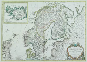
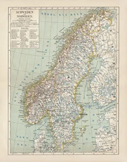
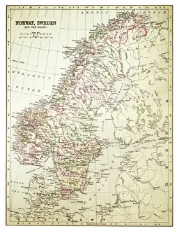
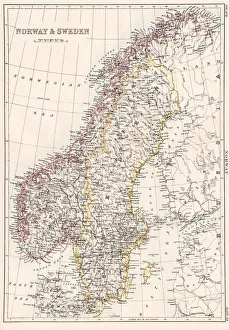
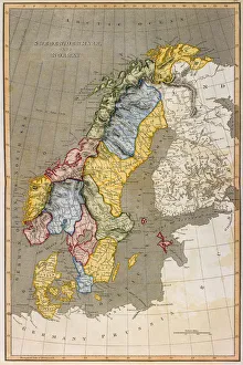
Map of Scandinavia
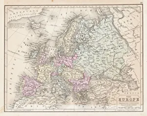
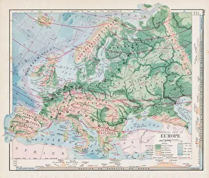
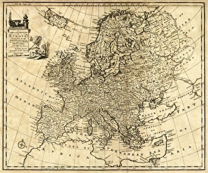
Europe map 1867Mitchellas Modern Atlas - Published by E.H. Butler and Co - Philadelphia 1867
Bryggen at blue hour
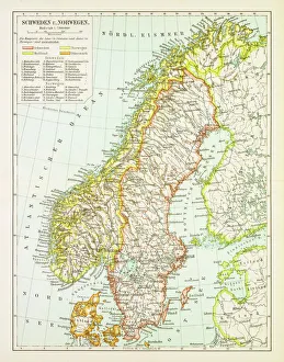
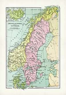
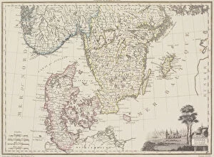
Sweden and Norway, lithograph, published in 1878Ancient map of Sweden and Norway. Lithograph, published in 1878
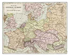
Map of central Europe 1889Indiana Educational Series The Complete Geography - Indianapolis 1889
Map of Sweden and Norway 1897Map of Sweden and Norway
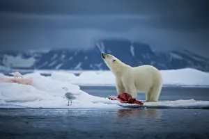
Arctic chillA polar bear looks up towards the sky to smell the air for other approaching bears that would want to take his seal carcass. Taken off the northern coast of the Svalbard Archipelago
Northern Lights over the Lofoten Islands in NorwayNorthern Lights, polar light or Aurora Borealis in the night sky over the Lofoten islands in Northern Norway
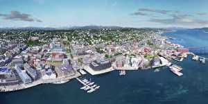
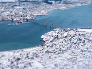
Tromso, NorwayCity of Tromso and Norwegian Sea taken from an aerial point of view
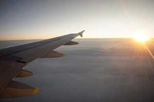
Sunrise from an airplane above the clouds with wing unit, above Norway
Map of Norway and Sweden 1894Map of Norway and Sweden
Bergen old townRegistered as World Heritage by the Unesco
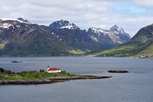
Sildpollnes kirkeSildpollnes Church is located on the Sildpollneset peninsula on the island of AustvAagAŝya. The white wooden church was built in 1891 as a bedehus
Urnes stave church, NorwayUrnes Stave Church (Norwegian: Urnes stavkirke) is a stave church at the Ornes farm, along the Lustrafjord in the municipality of Luster in Sogn og Fjordane county, Norway.In 1979
Norway and Sweden map 1884Encyclopedia Britannica 9th Edition New York Charles Scribners and Sonsl 1884 Vol XVII
Denmark Sweden Norway map 1867Mitchellas Modern Atlas - Published by E.H. Butler and Co - Philadelphia 1867
Antique Map of Sweden, Norway and DenmarkVintage map of Sweden, Norway and Denmark, from 1894
View of TromsoMorning scene of Arctic cathedral in Tromso
Hanseatic houses in Bryggen at winterBryggen, the old Hanseatic wharf of Bergen, which is on the UNESCO list of World Cultural Heritage Sites
Aurora Borealis Northern LightStunning Aurora Borealis captured nearby TromsAŝ in Norway
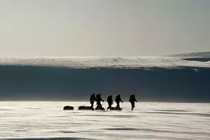
Cross-country skiers with pulkas on a glacier, backlit, Spitsbergen, Svalbard, Norway, Europe
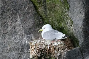
Black-legged kittiwake -Rissa tridactyla- on nest, bird cliffs, Ekkeroy, Varanger, Norway
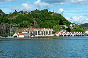
Townscape, Trellevika, Flekkefjord, Norway
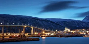
Bridge at tromso with miniature effect
Winter landscape of Tromso
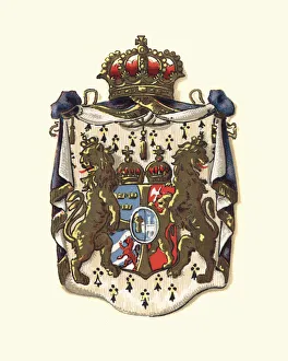
Coat of Arms of Sweden and Norway, 1898
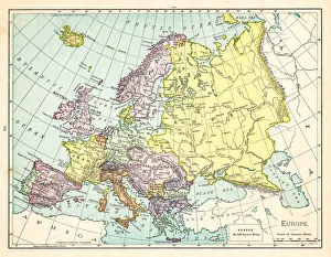
Map of Europe 1895The Rand-McNally Grammar School Geography 1895 - Chicago & New York
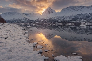
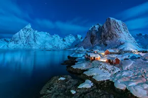
Winter landscape at night in Hamnoy, Lofoten Islands, NorwayLandscape of snowcapped mountains and snow covered village of Hamnoy, Lofoten Islands, Norway
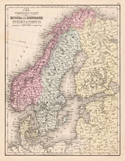
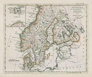
Antique map of Denmark, Norway, Sweden and FinlandWonderful hand coloured antique map, circa 1780 - 1800
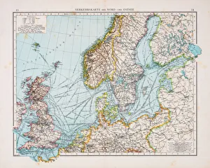
Map of North and East sea 1896Andres Allgemeiner Handatlas - Bielefeld und Leipzig 1896
Map of Europe 1897Natural Elementary Geography by Redway and Hinman - NY/Cincinnati/Chicago 1897
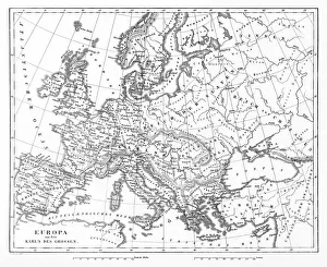
Map of Europe 1877Warrens Common School Geography 1877
Map of Sweden with Denmark and Norway
Antique Map of Europe 1744An engraved map of Europe with ornamental cartouche and relief shown pictorially by Emanuel Bowen 1744, London, Geographer to His Majesty
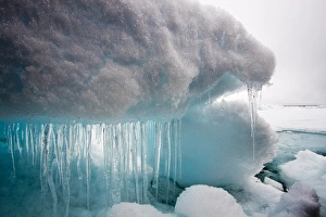
Icicles and Melting Sea Ice, SvalbardNorway, Svalbard, Icicles hang from melting sea ice in fog near PhippsAzAŝya (Phipps Island) amid fog-covered northern islands on summer morning
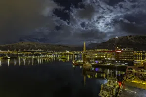
The capital of the ArcticSpectacular view of Tromso Harbor surrounded by mountains, fjords and islands.Visible in the background is the Arctic cathedral, a most famous landmark in Tromso and the Tromso Bridge
Map of Europe 1889Indiana Educational Series The Complete Geography - Indianapolis 1889
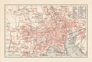
City map of Christiania (now Oslo), Norway, lithograph, published 1897City map of Christiania, now Oslo - capital of Norway. Lithograph, published in 1897
antique, archival, baltic, border, cartography, denmark, document, europe, european, finland, geography, historic, historical, latitude, longitude, map, nobody, north, norway, region, scale
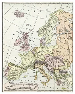
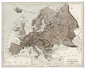
Victorian Map of EuropeEngraved illustrations of Europe in the Time of Charlemagne from Iconographic Encyclopedia of Science, Literature and Art, Published in 1851. Copyright has expired on this artwork. Digitally restored
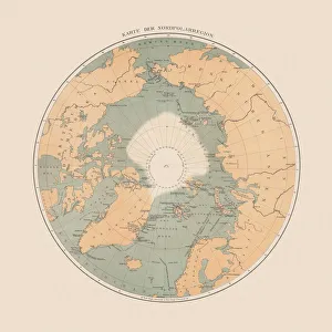
Ancient map of the Arctic Region, lithograph, published in 1883Ancient map of the Arctic Region. Lithograph, published in 1883
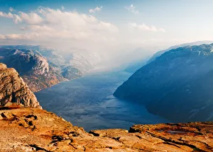
Pulpit RockPulpit rock with cloudy sky and views over Lysefjord in Norway
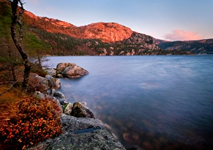
Inspired by NorwayOrange flowers mirror distant cliffs as they glow in last of sunset color over lake at Preikestolen Fjellstue